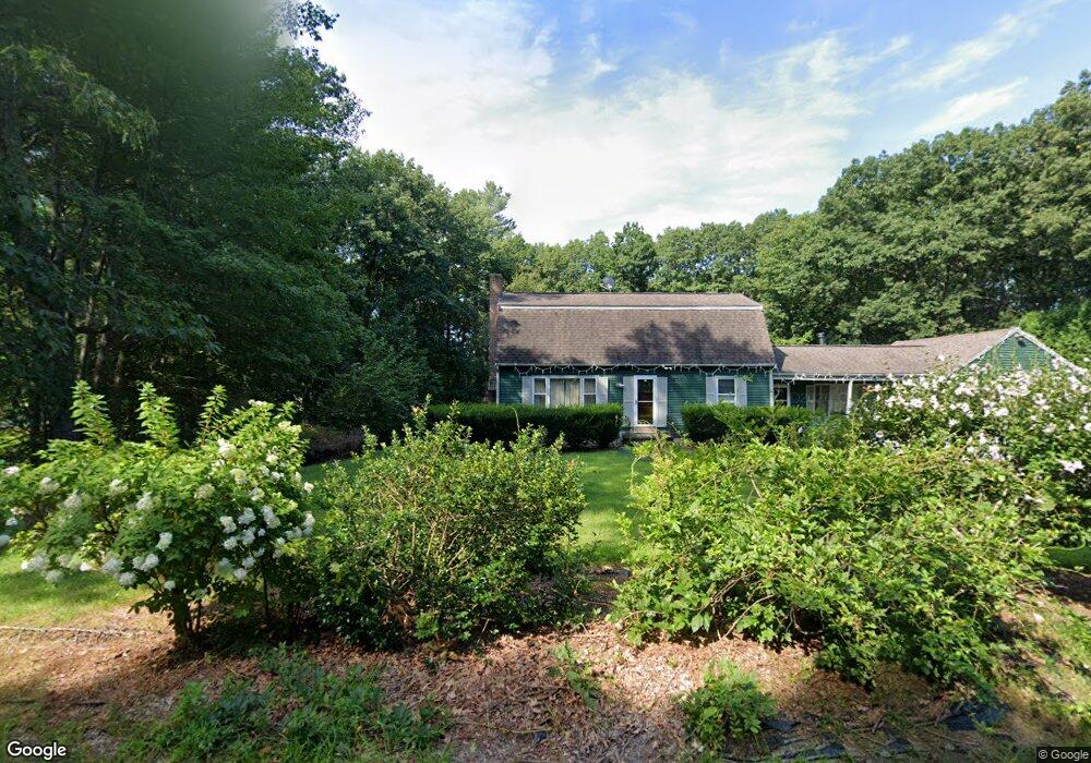
199 High Range Rd Londonderry, NH 03053
Estimated Value: $574,000 - $676,000
4
Beds
2
Baths
2,384
Sq Ft
$268/Sq Ft
Est. Value
About This Home
This home is located at 199 High Range Rd, Londonderry, NH 03053 and is currently estimated at $639,879, approximately $268 per square foot. 199 High Range Rd is a home with nearby schools including North Londonderry Elementary School, Londonderry Middle School, and Londonderry Senior High School.
Ownership History
Date
Name
Owned For
Owner Type
Purchase Details
Closed on
Sep 22, 2025
Sold by
Tannler Jennifer R and Tannler Matthew P
Bought by
Tannler Jennifer R
Current Estimated Value
Home Financials for this Owner
Home Financials are based on the most recent Mortgage that was taken out on this home.
Original Mortgage
$363,000
Outstanding Balance
$362,352
Interest Rate
6.58%
Mortgage Type
New Conventional
Estimated Equity
$277,527
Purchase Details
Closed on
Dec 31, 2024
Sold by
Tannler Matthew P
Bought by
Tannler Matthew P and Tannler Jennifer R
Home Financials for this Owner
Home Financials are based on the most recent Mortgage that was taken out on this home.
Original Mortgage
$355,000
Interest Rate
6.84%
Mortgage Type
New Conventional
Purchase Details
Closed on
Aug 29, 2006
Sold by
Bruckner Robert A and Bruckner Gail W
Bought by
Tannler Matthew P
Home Financials for this Owner
Home Financials are based on the most recent Mortgage that was taken out on this home.
Original Mortgage
$49,400
Interest Rate
6.52%
Mortgage Type
Unknown
Create a Home Valuation Report for This Property
The Home Valuation Report is an in-depth analysis detailing your home's value as well as a comparison with similar homes in the area
Home Values in the Area
Average Home Value in this Area
Purchase History
| Date | Buyer | Sale Price | Title Company |
|---|---|---|---|
| Tannler Jennifer R | -- | -- | |
| Tannler Jennifer R | -- | -- | |
| Tannler Matthew P | -- | None Available | |
| Tannler Matthew P | -- | None Available | |
| Tannler Matthew P | $294,200 | -- | |
| Tannler Matthew P | $294,200 | -- |
Source: Public Records
Mortgage History
| Date | Status | Borrower | Loan Amount |
|---|---|---|---|
| Open | Tannler Jennifer R | $363,000 | |
| Closed | Tannler Jennifer R | $363,000 | |
| Previous Owner | Tannler Matthew P | $355,000 | |
| Previous Owner | Tannler Matthew P | $49,400 | |
| Previous Owner | Tannler Matthew P | $235,293 |
Source: Public Records
Tax History Compared to Growth
Tax History
| Year | Tax Paid | Tax Assessment Tax Assessment Total Assessment is a certain percentage of the fair market value that is determined by local assessors to be the total taxable value of land and additions on the property. | Land | Improvement |
|---|---|---|---|---|
| 2024 | $8,075 | $500,300 | $179,900 | $320,400 |
| 2023 | $7,830 | $500,300 | $179,900 | $320,400 |
| 2022 | $7,261 | $392,900 | $134,900 | $258,000 |
| 2021 | $7,356 | $400,200 | $134,900 | $265,300 |
| 2020 | $7,181 | $357,100 | $113,300 | $243,800 |
| 2019 | $6,924 | $357,100 | $113,300 | $243,800 |
| 2018 | $6,424 | $294,700 | $93,700 | $201,000 |
| 2017 | $6,368 | $294,700 | $93,700 | $201,000 |
| 2016 | $6,336 | $294,700 | $93,700 | $201,000 |
| 2015 | $6,195 | $294,700 | $93,700 | $201,000 |
| 2014 | $6,215 | $294,700 | $93,700 | $201,000 |
| 2011 | -- | $297,900 | $93,700 | $204,200 |
Source: Public Records
Map
Nearby Homes
- 5 Hickory Hill Dr
- 11 Elise Ave Unit Lot 91
- 224 High Range Rd
- 3 Chandler Dr
- 35 Red Deer Rd
- 169 Fieldstone Dr
- 193 Fieldstone Dr
- 193 Fieldstone Dr Unit 193
- 118 Fieldstone Dr Unit 118
- 90 High Range Rd
- 88 High Range Rd
- 6 Wiley Hill Rd
- 12 Wiley Hill Rd
- 57 Hardy Rd
- 214 Winding Pond Rd
- 20 Wedgewood Dr
- 10 Judy Dr
- 267 Winding Pond Rd
- 10 Jason Dr
- 6 Sugar Plum Ln
- 201 High Range Rd
- 197 High Range Rd
- 182 High Range Rd
- 180 High Range Rd
- 203 High Range Rd
- 184 High Range Rd
- 195 High Range Rd
- 8 Poplar Cir
- 6 Poplar Cir
- 205 High Range Rd
- 10 Poplar Cir
- 176 High Range Rd
- 186 High Range Rd
- 9 Poplar Cir
- 193 High Range Rd
- 4 Poplar Cir
- 7 Davis Dr
- 207 High Range Rd
- 4 Mayflower Dr
- 188 High Range Rd