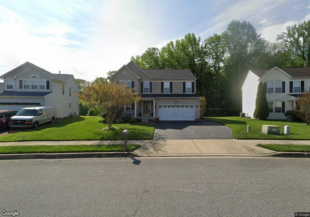
199 Lone Tree Dr Camden, DE 19934
Estimated Value: $408,766 - $454,000
4
Beds
3
Baths
2,552
Sq Ft
$173/Sq Ft
Est. Value
About This Home
This home is located at 199 Lone Tree Dr, Camden, DE 19934 and is currently estimated at $442,192, approximately $173 per square foot. 199 Lone Tree Dr is a home located in Kent County with nearby schools including Nellie Hughes Stokes Elementary School, Fred Fifer Middle School, and Caesar Rodney High School.
Ownership History
Date
Name
Owned For
Owner Type
Purchase Details
Closed on
Oct 31, 2006
Sold by
The Ryland Group Inc
Bought by
Brown Nathan and Brown Cathy
Current Estimated Value
Home Financials for this Owner
Home Financials are based on the most recent Mortgage that was taken out on this home.
Original Mortgage
$160,000
Interest Rate
6.62%
Mortgage Type
Adjustable Rate Mortgage/ARM
Purchase Details
Closed on
Sep 1, 2005
Sold by
Lord Ralph M and Lord Fred C
Bought by
Newells Creek Devlopers Llc
Create a Home Valuation Report for This Property
The Home Valuation Report is an in-depth analysis detailing your home's value as well as a comparison with similar homes in the area
Home Values in the Area
Average Home Value in this Area
Purchase History
| Date | Buyer | Sale Price | Title Company |
|---|---|---|---|
| Brown Nathan | $9,541 | None Available | |
| Newells Creek Devlopers Llc | $21,879 | None Available |
Source: Public Records
Mortgage History
| Date | Status | Borrower | Loan Amount |
|---|---|---|---|
| Previous Owner | Brown Nathan | $160,000 |
Source: Public Records
Tax History
| Year | Tax Paid | Tax Assessment Tax Assessment Total Assessment is a certain percentage of the fair market value that is determined by local assessors to be the total taxable value of land and additions on the property. | Land | Improvement |
|---|---|---|---|---|
| 2025 | $1,310 | $387,200 | $67,700 | $319,500 |
| 2024 | $1,304 | $387,200 | $67,700 | $319,500 |
| 2023 | $1,134 | $53,800 | $3,900 | $49,900 |
| 2022 | $1,307 | $53,800 | $3,900 | $49,900 |
| 2021 | $1,296 | $53,800 | $3,900 | $49,900 |
| 2020 | $1,275 | $53,800 | $3,900 | $49,900 |
| 2019 | $1,225 | $53,800 | $3,900 | $49,900 |
| 2018 | $1,182 | $53,800 | $3,900 | $49,900 |
| 2017 | $1,149 | $53,800 | $0 | $0 |
| 2016 | $1,125 | $53,800 | $0 | $0 |
| 2015 | $944 | $53,800 | $0 | $0 |
| 2014 | $941 | $53,800 | $0 | $0 |
Source: Public Records
Map
Nearby Homes
- 16 Lone Tree Dr
- 31 E Fred Cir
- 45 Capricorn Way
- 96 Lochmeath Way
- 13 Casterline Ct
- 50 Nanticoke Dr
- 256 Headstart Ln
- 143 S Knight Ln Unit 107
- Lot 47 Red Brookfield Dr
- Lot 22 Bee Brookfield Dr
- 74 Nanticoke Dr
- 11 N Kimmer Ln Unit 265
- 43 E Darby Cir
- 870 Brookfield Dr
- Lot 42 Lin Brookfield Dr
- 850 Brookfield Dr
- 1119 Bison Rd
- 1275 Lochmeath Way
- 43 Brookfield Dr
- 45 Brookfield Dr
- 189 Lone Tree Dr
- 209 Lone Tree Dr
- 177 Lone Tree Dr
- 219 Lone Tree Dr
- 229 Lone Tree Dr
- 212 Lone Tree Dr
- 163 Lone Tree Dr
- 174 Lone Tree Dr
- 1 Tidbury Crossing
- 3 Tidbury Crossing
- 235 Lone Tree Dr
- 234 Lone Tree Dr
- 153 Lone Tree Dr
- 158 Lone Tree Dr
- 01 Tidbury Crossing
- 02 Tidbury Crossing
- 04 Tidbury Crossing
- 03 Tidbury Crossing
- 426 Theater Ln
- 250 Lone Tree Dr
Your Personal Tour Guide
Ask me questions while you tour the home.