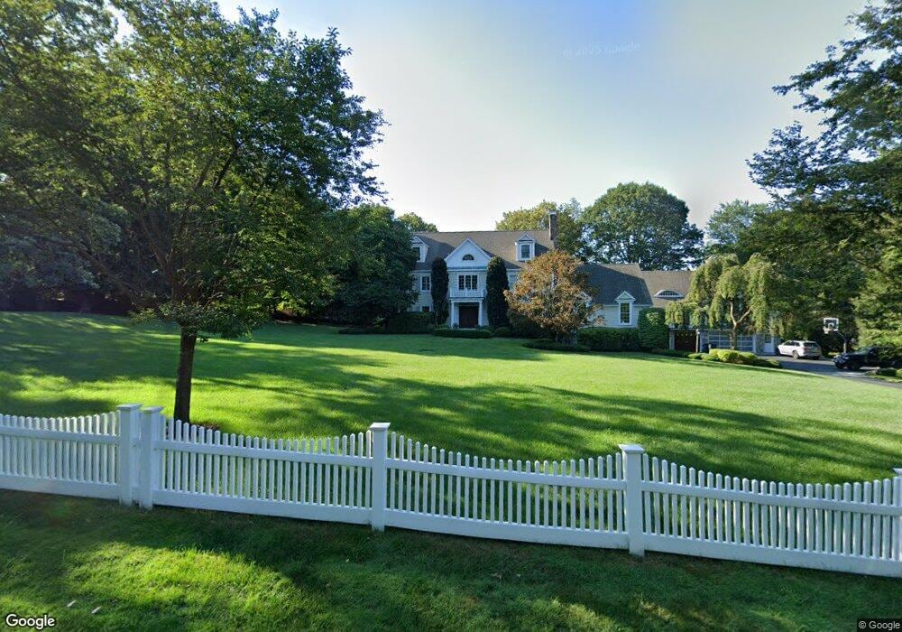
199 Skunk Ln Wilton, CT 06897
Estimated Value: $1,960,000 - $2,184,000
4
Beds
6
Baths
5,476
Sq Ft
$381/Sq Ft
Est. Value
About This Home
This home is located at 199 Skunk Ln, Wilton, CT 06897 and is currently estimated at $2,085,104, approximately $380 per square foot. 199 Skunk Ln is a home located in Fairfield County with nearby schools including Miller-Driscoll School, Cider Mill School, and Middlebrook School.
Ownership History
Date
Name
Owned For
Owner Type
Purchase Details
Closed on
May 16, 2006
Sold by
Longo Joseph and Longo Marie B
Bought by
Hyzy Christopher M and Hyzy Karin A
Current Estimated Value
Home Financials for this Owner
Home Financials are based on the most recent Mortgage that was taken out on this home.
Original Mortgage
$920,000
Outstanding Balance
$337,249
Interest Rate
6%
Estimated Equity
$1,747,855
Purchase Details
Closed on
May 31, 1996
Sold by
Lasker Mark and Lasker Sybil
Bought by
Stanley Walter and Stanley Barbara
Purchase Details
Closed on
Nov 17, 1995
Sold by
Lasker Mark and Lasker Sybil
Bought by
Hughes Daniel
Purchase Details
Closed on
Mar 22, 1993
Sold by
H Back Bldrs
Bought by
Lasker Mark and Lasker Sybil
Create a Home Valuation Report for This Property
The Home Valuation Report is an in-depth analysis detailing your home's value as well as a comparison with similar homes in the area
Home Values in the Area
Average Home Value in this Area
Purchase History
| Date | Buyer | Sale Price | Title Company |
|---|---|---|---|
| Hyzy Christopher M | $1,540,000 | -- | |
| Stanley Walter | $795,000 | -- | |
| Hughes Daniel | $250,000 | -- | |
| Lasker Mark | $687,500 | -- | |
| H Back Bldrs | $112,500 | -- |
Source: Public Records
Mortgage History
| Date | Status | Borrower | Loan Amount |
|---|---|---|---|
| Open | H Back Bldrs | $920,000 | |
| Previous Owner | H Back Bldrs | $1,085,000 | |
| Previous Owner | H Back Bldrs | $590,000 |
Source: Public Records
Tax History
| Year | Tax Paid | Tax Assessment Tax Assessment Total Assessment is a certain percentage of the fair market value that is determined by local assessors to be the total taxable value of land and additions on the property. | Land | Improvement |
|---|---|---|---|---|
| 2025 | $30,572 | $1,252,440 | $306,110 | $946,330 |
| 2024 | $29,983 | $1,252,440 | $306,110 | $946,330 |
| 2023 | $35,780 | $1,033,970 | $292,740 | $741,230 |
| 2022 | $29,189 | $1,033,970 | $292,740 | $741,230 |
| 2021 | $28,817 | $1,033,970 | $292,740 | $741,230 |
| 2020 | $28,393 | $1,033,970 | $292,740 | $741,230 |
| 2019 | $29,510 | $1,033,970 | $292,740 | $741,230 |
| 2018 | $30,225 | $1,072,190 | $308,000 | $764,190 |
| 2017 | $22,854 | $822,990 | $308,000 | $514,990 |
| 2016 | $22,501 | $822,990 | $308,000 | $514,990 |
| 2015 | $22,081 | $822,990 | $308,000 | $514,990 |
| 2014 | $21,691 | $818,230 | $308,000 | $510,230 |
Source: Public Records
Map
Nearby Homes
- 25 Powder Horn Hill Rd
- 41 Calvin Rd
- 76 Sturges Ridge Rd
- 25 Cherry Ln
- 3 Deerfield Rd
- 14 Langner Ln
- 4 Trails End Rd
- 15 River Rd Unit STE 210
- 475 Danbury Rd
- 84 Wilton Crest Rd Unit 84
- 15 Mountain View Dr
- 33 Middlebrook Farm Rd
- 35 Joanne Ln
- 12 Godfrey Rd W
- 30 Lords Hwy
- 126 Heather Ln
- 6 Downe Ln
- 88 Drum Hill Rd
- 93 E Meadow Rd
- 38 Honey Hill Rd
- 30 Friendlee Ln
- 183 Skunk Ln
- 203 Skunk Ln
- 170 Skunk Ln
- 32 Friendlee Ln
- 179 Skunk Ln
- 211 Hurlbutt St
- 26 Friendlee Ln
- 20 Friendlee Ln
- 218 Hurlbutt St
- 160 Skunk Ln
- 38 Friendlee Ln
- 236 Hurlbutt St
- 127 Skunk Ln
- 199 Hurlbutt St
- 200 Hurlbutt St
- 226 Hurlbutt St
- 245 Hurlbutt St
- 92 Buckingham Ridge Rd
- 98 Buckingham Ridge Rd
Your Personal Tour Guide
Ask me questions while you tour the home.