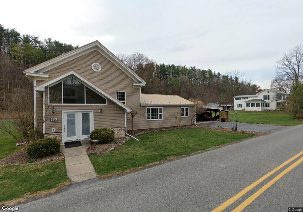
199 Stevenson Rd Port Matilda, PA 16870
Patton NeighborhoodEstimated Value: $440,178 - $528,000
1
Bed
1
Bath
3,192
Sq Ft
$151/Sq Ft
Est. Value
About This Home
This home is located at 199 Stevenson Rd, Port Matilda, PA 16870 and is currently estimated at $481,795, approximately $150 per square foot. 199 Stevenson Rd is a home located in Centre County with nearby schools including Park Forest Elementary School, Park Forest Middle School, and State College Area High School.
Ownership History
Date
Name
Owned For
Owner Type
Purchase Details
Closed on
Feb 14, 2012
Sold by
Stahl James R and Weaver Shannon L
Bought by
Weaver Shannon L
Current Estimated Value
Home Financials for this Owner
Home Financials are based on the most recent Mortgage that was taken out on this home.
Original Mortgage
$188,000
Outstanding Balance
$128,799
Interest Rate
3.89%
Mortgage Type
Credit Line Revolving
Estimated Equity
$352,996
Purchase Details
Closed on
Jul 23, 2003
Bought by
Stahl James R and Stahl Stahl
Create a Home Valuation Report for This Property
The Home Valuation Report is an in-depth analysis detailing your home's value as well as a comparison with similar homes in the area
Home Values in the Area
Average Home Value in this Area
Purchase History
| Date | Buyer | Sale Price | Title Company |
|---|---|---|---|
| Weaver Shannon L | $149,974 | None Available | |
| Stahl James R | $185,000 | -- |
Source: Public Records
Mortgage History
| Date | Status | Borrower | Loan Amount |
|---|---|---|---|
| Open | Weaver Shannon L | $188,000 |
Source: Public Records
Tax History Compared to Growth
Tax History
| Year | Tax Paid | Tax Assessment Tax Assessment Total Assessment is a certain percentage of the fair market value that is determined by local assessors to be the total taxable value of land and additions on the property. | Land | Improvement |
|---|---|---|---|---|
| 2025 | $5,284 | $75,855 | $15,000 | $60,855 |
| 2024 | $4,930 | $75,855 | $15,000 | $60,855 |
| 2023 | $4,930 | $75,855 | $15,000 | $60,855 |
| 2022 | $4,811 | $75,855 | $15,000 | $60,855 |
| 2021 | $4,811 | $75,855 | $15,000 | $60,855 |
| 2020 | $4,811 | $75,855 | $15,000 | $60,855 |
| 2019 | $3,496 | $75,855 | $15,000 | $60,855 |
| 2018 | $4,664 | $75,855 | $15,000 | $60,855 |
| 2017 | $4,613 | $75,855 | $15,000 | $60,855 |
| 2016 | -- | $75,855 | $15,000 | $60,855 |
| 2015 | -- | $75,855 | $15,000 | $60,855 |
| 2014 | -- | $84,255 | $15,000 | $69,255 |
Source: Public Records
Map
Nearby Homes
- 113 Manhasset Dr
- 190 Michael Rd
- 171 Manhasset Dr
- 293 Michael Rd
- 209 Shadow Hawk Ln
- 95 Greenmeadow Ln
- 100 Forest Glen Cir
- 111 Wildernest Ln
- 107 Wildernest Ln
- 234 Amblewood Way Unit 234
- 210 Amblewood Way Unit 210
- 833 Galen Dr
- Lot 2 Julian Pike
- 0 S Eagle Valley Rd
- 291 Oakley Dr
- 257 Oakwood Ave
- 24 Wilts Ln
- 174 Deans Way
- 174 Dean's Way
- 282 Timberton Cir
- 187 Stevenson Rd
- 219 Stevenson Rd
- 212 Stevenson Rd
- 257 Stevenson Rd
- 146 Stevenson Rd
- 150 Kimber Lee Dr
- 177 Stevenson Rd
- Lot 8 Kimber Lee Dr
- 210 Kimber Lee Dr
- 106 Stevenson Rd
- 102 Michael Rd
- 217 Kimber Lee Dr
- 104 Michael Rd
- 106 Michael Rd
- 108 Basin St
- 246 Kimber Lee Dr
- 4414 Buffalo Run Rd
- 212 Michael Rd
- 183 Michael Rd
- ON Stevenson Rd