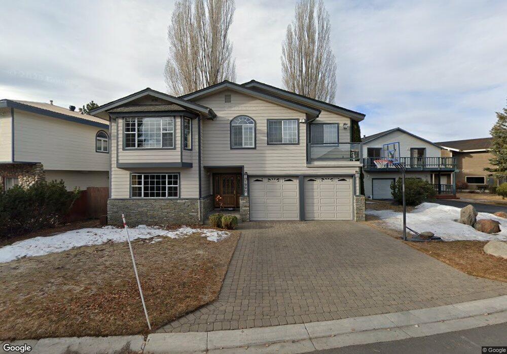
1990 Aloha Dr South Lake Tahoe, CA 96150
Estimated Value: $1,861,659 - $2,073,000
4
Beds
3
Baths
3,239
Sq Ft
$612/Sq Ft
Est. Value
About This Home
This home is located at 1990 Aloha Dr, South Lake Tahoe, CA 96150 and is currently estimated at $1,982,915, approximately $612 per square foot. 1990 Aloha Dr is a home located in El Dorado County with nearby schools including Tahoe Valley Elementary School, South Tahoe Middle School, and South Tahoe High School.
Ownership History
Date
Name
Owned For
Owner Type
Purchase Details
Closed on
Apr 1, 2020
Sold by
Grant Peter W and Grant Vikki D
Bought by
Grant Peter W and Grant Vikki D
Current Estimated Value
Home Financials for this Owner
Home Financials are based on the most recent Mortgage that was taken out on this home.
Original Mortgage
$635,700
Outstanding Balance
$564,212
Interest Rate
3.5%
Mortgage Type
New Conventional
Estimated Equity
$1,418,703
Purchase Details
Closed on
Dec 3, 2015
Sold by
Grant Peter W and Grant Vikki D
Bought by
Grant Family Trust
Home Financials for this Owner
Home Financials are based on the most recent Mortgage that was taken out on this home.
Original Mortgage
$875,000
Interest Rate
3.71%
Mortgage Type
New Conventional
Purchase Details
Closed on
Sep 28, 2011
Sold by
Grant Peter W and Grant Vikki D
Bought by
Grant Peter W and Grant Vikki D
Home Financials for this Owner
Home Financials are based on the most recent Mortgage that was taken out on this home.
Original Mortgage
$330,000
Interest Rate
4.01%
Mortgage Type
New Conventional
Purchase Details
Closed on
Aug 31, 2011
Sold by
Jacikas Arthur E and Jacikas Martha G
Bought by
Jacikas Arthur E and Jacikas Martha G
Home Financials for this Owner
Home Financials are based on the most recent Mortgage that was taken out on this home.
Original Mortgage
$330,000
Interest Rate
4.01%
Mortgage Type
New Conventional
Purchase Details
Closed on
Oct 13, 2010
Sold by
Grant Peter W and Grant Vikki D
Bought by
Grant Peter W and Grant Vikki D
Home Financials for this Owner
Home Financials are based on the most recent Mortgage that was taken out on this home.
Original Mortgage
$346,000
Interest Rate
4.31%
Mortgage Type
New Conventional
Purchase Details
Closed on
Apr 7, 2004
Sold by
Grant Peter W and Grant Vikki D
Bought by
Grant Peter W and Grant Vikki D
Create a Home Valuation Report for This Property
The Home Valuation Report is an in-depth analysis detailing your home's value as well as a comparison with similar homes in the area
Home Values in the Area
Average Home Value in this Area
Purchase History
| Date | Buyer | Sale Price | Title Company |
|---|---|---|---|
| Grant Peter W | -- | Chicago Title Company | |
| Grant Peter W | -- | Chicago Title Company | |
| Grant Family Trust | -- | Ticor Title Tustin | |
| Grant Peter W | -- | Ticor Title | |
| Grant Peter W | -- | North American Title Company | |
| Grant Peter W | -- | North American Title Company | |
| Jacikas Arthur E | -- | None Available | |
| Jacikas Arthur E | $725,000 | Placer Title Company | |
| Grant Peter W | -- | North American Title Co Inc | |
| Grant Peter W | -- | North American Title Co Inc | |
| Grant Peter W | -- | -- |
Source: Public Records
Mortgage History
| Date | Status | Borrower | Loan Amount |
|---|---|---|---|
| Open | Grant Peter W | $635,700 | |
| Closed | Grant Peter W | $875,000 | |
| Closed | Grant Peter W | $330,000 | |
| Previous Owner | Grant Peter W | $346,000 |
Source: Public Records
Tax History Compared to Growth
Tax History
| Year | Tax Paid | Tax Assessment Tax Assessment Total Assessment is a certain percentage of the fair market value that is determined by local assessors to be the total taxable value of land and additions on the property. | Land | Improvement |
|---|---|---|---|---|
| 2025 | $7,393 | $710,250 | $176,813 | $533,437 |
| 2024 | $7,393 | $696,325 | $173,347 | $522,978 |
| 2023 | $7,262 | $682,673 | $169,949 | $512,724 |
| 2022 | $7,189 | $669,288 | $166,617 | $502,671 |
| 2021 | $7,076 | $656,165 | $163,350 | $492,815 |
| 2020 | $6,973 | $649,438 | $161,676 | $487,762 |
| 2019 | $6,938 | $636,705 | $158,506 | $478,199 |
| 2018 | $6,781 | $624,222 | $155,399 | $468,823 |
| 2017 | $6,673 | $611,983 | $152,352 | $459,631 |
| 2016 | $6,535 | $599,984 | $149,365 | $450,619 |
| 2015 | $6,464 | $590,973 | $147,122 | $443,851 |
| 2014 | $6,199 | $579,398 | $144,241 | $435,157 |
Source: Public Records
Map
Nearby Homes
- 2003 Aloha Dr
- 2030 Aloha Dr
- 222 Beach Dr
- 1932 Kokanee Way
- 276 Beach Dr
- 581 Alpine Dr
- 1938 Marconi Way
- 2031 Venice Dr Unit 322
- 2031 Venice Dr Unit 313
- 569 Lucerne Way
- 552 Christie Dr Unit 307
- 552 Christie Dr Unit 303
- 2081 Venice Dr Unit 285
- 2081 Venice Dr Unit 280
- 2071 Venice Dr Unit 294
- 357 Ala Wai Blvd Unit 212
- 2185 Morro Dr
- 439 Ala Wai Blvd Unit 111
- 439 Ala Wai Blvd Unit 106
- 439 Ala Wai Blvd Unit 140