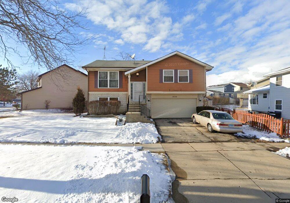
1990 Brookside Ln Unit 4 Hoffman Estates, IL 60169
South Hoffman Estates NeighborhoodEstimated Value: $340,000 - $412,000
3
Beds
2
Baths
1,075
Sq Ft
$341/Sq Ft
Est. Value
About This Home
This home is located at 1990 Brookside Ln Unit 4, Hoffman Estates, IL 60169 and is currently estimated at $366,336, approximately $340 per square foot. 1990 Brookside Ln Unit 4 is a home located in Cook County with nearby schools including Neil Armstrong Elementary School, Dwight D Eisenhower Junior High School, and Hoffman Estates High School.
Ownership History
Date
Name
Owned For
Owner Type
Purchase Details
Closed on
Jul 28, 2011
Sold by
Federal Home Loan Mortgage Corporation
Bought by
Makwana Narendra A
Current Estimated Value
Home Financials for this Owner
Home Financials are based on the most recent Mortgage that was taken out on this home.
Original Mortgage
$114,000
Outstanding Balance
$6,045
Interest Rate
4.58%
Mortgage Type
New Conventional
Estimated Equity
$360,291
Purchase Details
Closed on
Sep 23, 2010
Sold by
Ilyas Ahmadi
Bought by
Federal Home Loan Mortgage Corp
Purchase Details
Closed on
Aug 24, 2004
Sold by
Hee Jo Won Tae and Hee Jo Kyung
Bought by
Ilyas Ahmadi
Home Financials for this Owner
Home Financials are based on the most recent Mortgage that was taken out on this home.
Original Mortgage
$246,050
Interest Rate
7.7%
Mortgage Type
Unknown
Create a Home Valuation Report for This Property
The Home Valuation Report is an in-depth analysis detailing your home's value as well as a comparison with similar homes in the area
Home Values in the Area
Average Home Value in this Area
Purchase History
| Date | Buyer | Sale Price | Title Company |
|---|---|---|---|
| Makwana Narendra A | $153,000 | None Available | |
| Federal Home Loan Mortgage Corp | -- | None Available | |
| Ilyas Ahmadi | $259,000 | Multiple |
Source: Public Records
Mortgage History
| Date | Status | Borrower | Loan Amount |
|---|---|---|---|
| Open | Makwana Narendra A | $114,000 | |
| Previous Owner | Ilyas Ahmadi | $246,050 |
Source: Public Records
Tax History
| Year | Tax Paid | Tax Assessment Tax Assessment Total Assessment is a certain percentage of the fair market value that is determined by local assessors to be the total taxable value of land and additions on the property. | Land | Improvement |
|---|---|---|---|---|
| 2025 | $6,600 | $32,000 | $5,547 | $26,453 |
| 2024 | $6,600 | $24,823 | $5,043 | $19,780 |
| 2023 | $6,637 | $25,769 | $5,043 | $20,726 |
| 2022 | $6,637 | $25,769 | $5,043 | $20,726 |
| 2021 | $5,490 | $19,715 | $7,942 | $11,773 |
| 2020 | $5,436 | $19,715 | $7,942 | $11,773 |
| 2019 | $5,409 | $21,906 | $7,942 | $13,964 |
| 2018 | $5,456 | $20,167 | $6,934 | $13,233 |
| 2017 | $5,378 | $20,167 | $6,934 | $13,233 |
| 2016 | $5,264 | $20,167 | $6,934 | $13,233 |
| 2015 | $5,868 | $20,894 | $6,051 | $14,843 |
| 2014 | $5,782 | $20,894 | $6,051 | $14,843 |
| 2013 | $5,615 | $20,894 | $6,051 | $14,843 |
Source: Public Records
Map
Nearby Homes
- 1880 Bonnie Ln Unit 116
- 1880 Bonnie Ln Unit 112
- 1475 Rebecca Dr Unit 213
- 1500 Robin Cir Unit 314
- 1800 Monterey Ct
- 2222 Seaver Ln
- 1776 Bristol Walk Unit 1776
- 1792 Williamsburg Dr
- 1797 Queensbury Cir Unit 5764
- 1760 Bristol Walk Unit F
- 1769 Sessions Walk Unit C
- 1722 Fayette Walk Unit E
- 1576 Poplar Creek Dr
- 1840 Huntington Blvd Unit BW511
- 1840 Huntington Blvd Unit 203
- 2080 Sutherland Place Unit 1
- 1836 Stockton Dr Unit 3312
- 1975 Windsong Dr Unit 333E1
- 1936 Whitingham Ln Unit 1
- 1450 Meyer Rd
- 2000 Brookside Ln
- 1980 Brookside Ln
- 1525 Brookside Dr
- 1972 Brookside Ln
- 1535 Brookside Dr
- 1975 Brookside Ln
- 1985 Brookside Ln
- 1475 Brookside Dr
- 1995 Brookside Ln
- 1965 Brookside Ln
- 1970 Brookside Ln Unit 4A
- 1549 Brookside Dr
- 1510 Brookside Dr
- 1465 Brookside Dr
- 1530 Brookside Dr
- 1955 Brookside Ln Unit 4
- 1559 Brookside Dr
- 1968 Brookside Ln
- 1964 Brookside Ln
- 1500 Brookside Dr
Your Personal Tour Guide
Ask me questions while you tour the home.