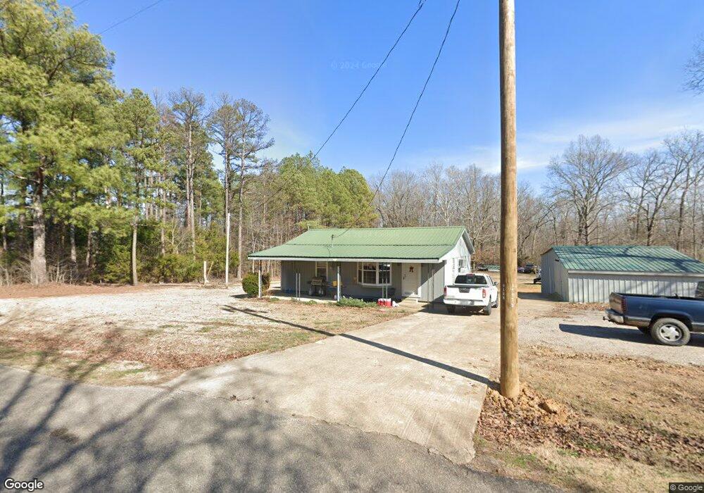
1990 Caney Branch Rd Adamsville, TN 38310
Estimated Value: $64,686 - $211,000
--
Bed
1
Bath
1,512
Sq Ft
$88/Sq Ft
Est. Value
About This Home
This home is located at 1990 Caney Branch Rd, Adamsville, TN 38310 and is currently estimated at $132,672, approximately $87 per square foot. 1990 Caney Branch Rd is a home located in Hardin County with nearby schools including Hardin County High School.
Ownership History
Date
Name
Owned For
Owner Type
Purchase Details
Closed on
Sep 30, 2006
Sold by
Odis Hindman
Bought by
Steven Sanders W
Current Estimated Value
Home Financials for this Owner
Home Financials are based on the most recent Mortgage that was taken out on this home.
Original Mortgage
$23,519
Interest Rate
6.36%
Purchase Details
Closed on
Jun 8, 1989
Bought by
Hindman Odis and Hindman Cindy
Purchase Details
Closed on
Mar 8, 1973
Bought by
Pickens Pickens J and Pickens Bonnie
Create a Home Valuation Report for This Property
The Home Valuation Report is an in-depth analysis detailing your home's value as well as a comparison with similar homes in the area
Home Values in the Area
Average Home Value in this Area
Purchase History
| Date | Buyer | Sale Price | Title Company |
|---|---|---|---|
| Steven Sanders W | $26,000 | -- | |
| Hindman Odis | -- | -- | |
| Pickens Pickens J | -- | -- |
Source: Public Records
Mortgage History
| Date | Status | Borrower | Loan Amount |
|---|---|---|---|
| Closed | Pickens Pickens J | $23,519 |
Source: Public Records
Tax History Compared to Growth
Tax History
| Year | Tax Paid | Tax Assessment Tax Assessment Total Assessment is a certain percentage of the fair market value that is determined by local assessors to be the total taxable value of land and additions on the property. | Land | Improvement |
|---|---|---|---|---|
| 2024 | $210 | $12,000 | $1,500 | $10,500 |
| 2023 | $210 | $12,000 | $1,500 | $10,500 |
| 2022 | $193 | $9,375 | $1,125 | $8,250 |
| 2021 | $193 | $9,375 | $1,125 | $8,250 |
| 2020 | $193 | $9,375 | $1,125 | $8,250 |
| 2019 | $193 | $9,375 | $1,125 | $8,250 |
| 2018 | $187 | $9,375 | $1,125 | $8,250 |
| 2017 | $197 | $9,475 | $1,125 | $8,350 |
| 2016 | $197 | $9,475 | $1,125 | $8,350 |
| 2015 | $172 | $9,475 | $1,125 | $8,350 |
| 2014 | $172 | $9,475 | $1,125 | $8,350 |
Source: Public Records
Map
Nearby Homes
- 200 Grandview Cir
- 3360 Coffee Landing Rd
- 205 Pauline Dr
- 385 Pauline Dr
- 465 Caney Branch Rd
- 90 Columbus Ln
- 874 Old Shiloh Rd
- 705 Twelve Oaks Dr
- 335 Hardy Rd
- 971 Twelve Oaks Dr
- 10 Hardy Rd
- 190 Old Stage Rd
- 345 Shad Ln
- 0 Lynnwood Cove Unit 10194254
- 1515 Riverside Ln
- 606 Duren Dr
- 0 Old Morris Chapel Rd Unit 10201483
- 125 S Palmer St
- 185 Mayfield Ln
- 135 Angotti Rd
- 1455 New Hope Dr
- 1925 Caney Branch Rd
- 1910 Adamsville Shiloh Rd
- 2055 Caney Branch Rd
- 1850 Caney Branch Rd
- 31A31B Caney Branch Rd
- 44A Caney Branch Rd
- 1861 Caney Branch Rd
- 0 Caney Branch Rd Unit 3258954
- 1265 New Hope Dr
- 1265 New Hope Dr
- 1180 New Hope Dr
- 1795 Caney Branch Rd
- 16 Grandview Cir
- 30 Grandview Cir
- 50 Grandview Cir
- 2460 Caney Branch Rd
- 84 Twisted Oaks Ln
- 100 Barrington Cove
- 175 Henson Rd