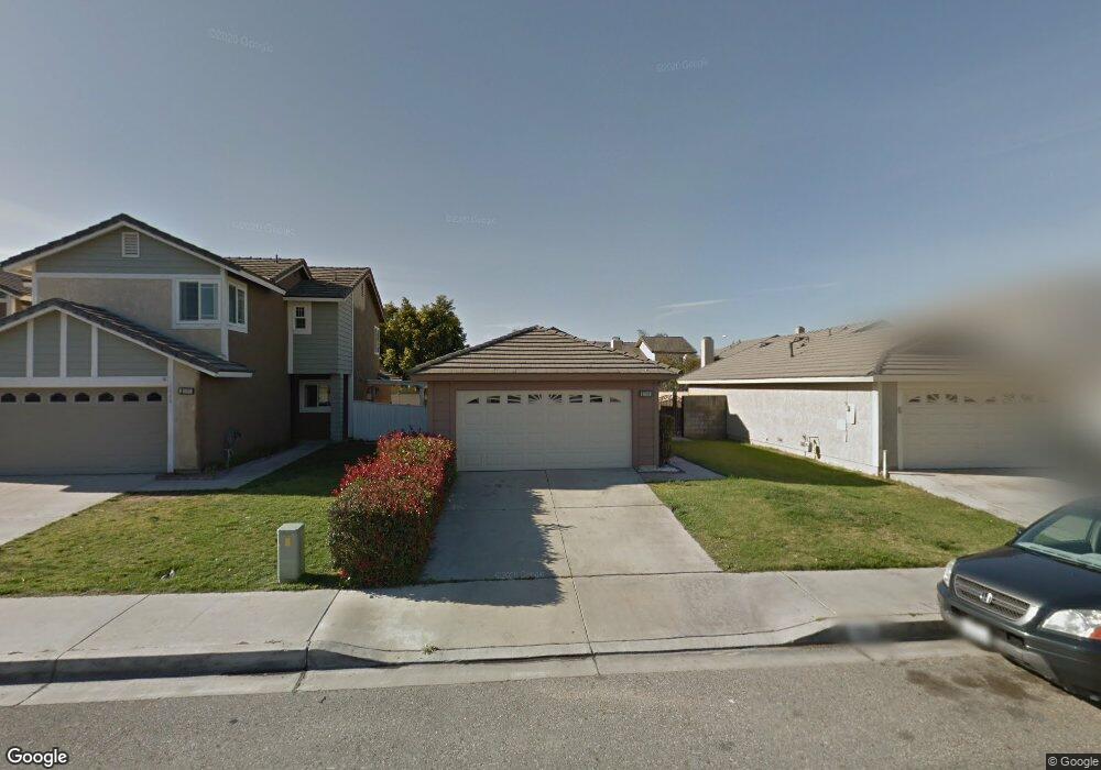
1990 Date Tree Rd Colton, CA 92324
Estimated Value: $476,499 - $508,000
2
Beds
2
Baths
1,032
Sq Ft
$478/Sq Ft
Est. Value
About This Home
This home is located at 1990 Date Tree Rd, Colton, CA 92324 and is currently estimated at $493,625, approximately $478 per square foot. 1990 Date Tree Rd is a home located in San Bernardino County with nearby schools including Georgia Morris Elementary School, William G. Jehue Middle School, and Rialto High School.
Ownership History
Date
Name
Owned For
Owner Type
Purchase Details
Closed on
Feb 26, 1997
Sold by
Va
Bought by
Hill Sheila
Current Estimated Value
Home Financials for this Owner
Home Financials are based on the most recent Mortgage that was taken out on this home.
Original Mortgage
$63,060
Outstanding Balance
$7,756
Interest Rate
7.9%
Mortgage Type
Seller Take Back
Estimated Equity
$485,869
Purchase Details
Closed on
Aug 28, 1996
Sold by
Fleet Mtg Corp
Bought by
Va
Purchase Details
Closed on
Aug 27, 1996
Sold by
Gee Mary K
Bought by
Fleet Mtg Corp
Purchase Details
Closed on
Apr 19, 1994
Sold by
Lee Chi Sang
Bought by
Gee Mary K
Home Financials for this Owner
Home Financials are based on the most recent Mortgage that was taken out on this home.
Original Mortgage
$93,840
Interest Rate
7.79%
Mortgage Type
Assumption
Create a Home Valuation Report for This Property
The Home Valuation Report is an in-depth analysis detailing your home's value as well as a comparison with similar homes in the area
Home Values in the Area
Average Home Value in this Area
Purchase History
| Date | Buyer | Sale Price | Title Company |
|---|---|---|---|
| Hill Sheila | $63,500 | Northern Counties Title | |
| Va | -- | First Southwestern Title Co | |
| Fleet Mtg Corp | $61,545 | First Southwestern Title Co | |
| Gee Mary K | $92,000 | Gateway Title |
Source: Public Records
Mortgage History
| Date | Status | Borrower | Loan Amount |
|---|---|---|---|
| Open | Hill Sheila | $63,060 | |
| Previous Owner | Gee Mary K | $93,840 |
Source: Public Records
Tax History
| Year | Tax Paid | Tax Assessment Tax Assessment Total Assessment is a certain percentage of the fair market value that is determined by local assessors to be the total taxable value of land and additions on the property. | Land | Improvement |
|---|---|---|---|---|
| 2025 | $1,735 | $136,812 | $34,204 | $102,608 |
| 2024 | $1,676 | $134,129 | $33,533 | $100,596 |
| 2023 | $1,779 | $131,499 | $32,875 | $98,624 |
| 2022 | $1,658 | $128,920 | $32,230 | $96,690 |
| 2021 | $1,646 | $126,392 | $31,598 | $94,794 |
| 2020 | $1,655 | $125,096 | $31,274 | $93,822 |
| 2019 | $1,618 | $122,643 | $30,661 | $91,982 |
| 2018 | $1,573 | $120,238 | $30,060 | $90,178 |
| 2017 | $3,146 | $117,881 | $29,471 | $88,410 |
| 2016 | $3,099 | $115,569 | $28,893 | $86,676 |
| 2015 | $3,113 | $113,833 | $28,459 | $85,374 |
| 2014 | $1,460 | $111,604 | $27,902 | $83,702 |
Source: Public Records
Map
Nearby Homes
- 1972 De Anza Dr
- 1065 Martinez Ln
- 1928 Ray Abril Jr Ln
- 340 Lilly St
- 993 S Date Ave
- 1250 Iron Horse Cir
- 825 S Acacia Ave
- 1155 S Riverside Ave Unit 10
- 1155 S Riverside Ave Unit 22
- 1155 S Riverside Ave Unit 7
- 1025 S Riverside Ave Unit 66
- 758 S Acacia Ave
- 365 E Vodden St
- 1166 S Riverside Ave Unit 9
- 722 S Sycamore Ave
- 742 S Magnolia Ave
- 827 S Riverside Ave
- 629 S Sage Ave
- 426 E Orchard St
- 711 N Meridian Ave
- 1988 Date Tree Rd
- 1992 Date Tree Rd
- 1986 Date Tree Rd
- 1994 Date Tree Rd
- 1991 Fig Tree Rd
- 1989 Fig Tree Rd
- 1993 Fig Tree Rd
- 1984 Date Tree Rd
- 1987 Fig Tree Rd
- 1995 Fig Tree Rd
- 1991 Date Tree Rd
- 1997 Fig Tree Rd
- 1982 Date Tree Rd
- 2000 Date Tree Rd
- 1993 Date Tree Rd
- 1985 Fig Tree Rd
- 1989 Date Tree Rd
- 1995 Date Tree Rd
- 1999 Fig Tree Rd
- 1983 Fig Tree Rd
Your Personal Tour Guide
Ask me questions while you tour the home.