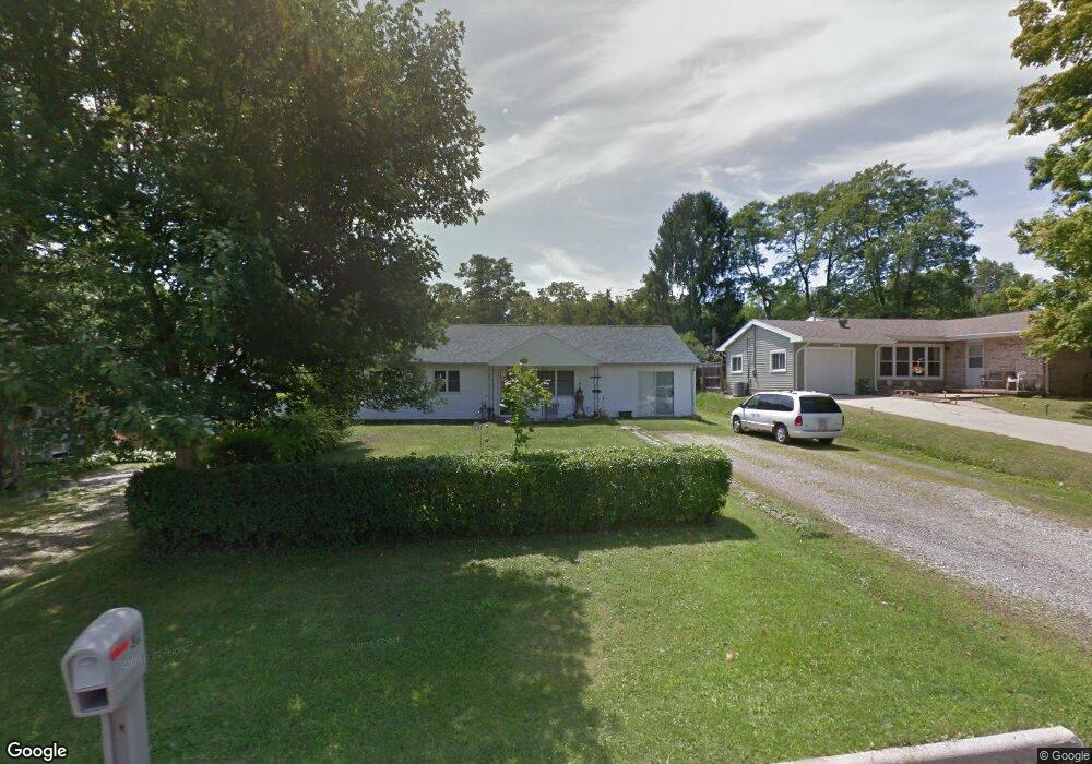
1990 Hout Rd Mansfield, OH 44905
Estimated Value: $105,000 - $196,314
3
Beds
2
Baths
1,248
Sq Ft
$125/Sq Ft
Est. Value
About This Home
This home is located at 1990 Hout Rd, Mansfield, OH 44905 and is currently estimated at $156,079, approximately $125 per square foot. 1990 Hout Rd is a home located in Richland County with nearby schools including Madison High School, St. Mary Catholic School, and Temple-Christian School.
Ownership History
Date
Name
Owned For
Owner Type
Purchase Details
Closed on
Aug 1, 2018
Sold by
Guegold George R and Guegold Dixie E
Bought by
Wurth Joseph M
Current Estimated Value
Home Financials for this Owner
Home Financials are based on the most recent Mortgage that was taken out on this home.
Original Mortgage
$50,000
Interest Rate
4.5%
Mortgage Type
Seller Take Back
Purchase Details
Closed on
Jan 31, 1991
Sold by
Guegold George R
Bought by
Guegold George R
Create a Home Valuation Report for This Property
The Home Valuation Report is an in-depth analysis detailing your home's value as well as a comparison with similar homes in the area
Home Values in the Area
Average Home Value in this Area
Purchase History
| Date | Buyer | Sale Price | Title Company |
|---|---|---|---|
| Wurth Joseph M | $50,000 | None Available | |
| Guegold George R | -- | -- |
Source: Public Records
Mortgage History
| Date | Status | Borrower | Loan Amount |
|---|---|---|---|
| Previous Owner | Wurth Joseph M | $50,000 |
Source: Public Records
Tax History
| Year | Tax Paid | Tax Assessment Tax Assessment Total Assessment is a certain percentage of the fair market value that is determined by local assessors to be the total taxable value of land and additions on the property. | Land | Improvement |
|---|---|---|---|---|
| 2024 | $1,804 | $35,820 | $5,720 | $30,100 |
| 2023 | $1,840 | $35,820 | $5,720 | $30,100 |
| 2022 | $1,622 | $29,010 | $5,160 | $23,850 |
| 2021 | $1,524 | $27,280 | $3,430 | $23,850 |
| 2020 | $1,535 | $27,280 | $3,430 | $23,850 |
| 2019 | $1,415 | $23,430 | $2,910 | $20,520 |
| 2018 | $890 | $23,430 | $2,910 | $20,520 |
| 2017 | $874 | $23,430 | $2,910 | $20,520 |
| 2016 | $867 | $22,970 | $2,770 | $20,200 |
| 2015 | $867 | $22,970 | $2,770 | $20,200 |
| 2014 | $851 | $22,970 | $2,770 | $20,200 |
| 2012 | $779 | $24,180 | $2,910 | $21,270 |
Source: Public Records
Map
Nearby Homes
- 1990 Woodmont Rd
- 690 Ashland Rd
- 811 Mayflower Ave
- 2202 Lakewood Dr
- 1495 Timber Rd
- 1674 Honeysuckle Dr
- 620 Running Brook Way
- 1187 -1189 Fleming Falls Rd
- 683 Coachman Rd
- 474 Biscayne Dr
- 937 Expressview Dr
- 632 Coachman Rd
- 1098 Stewart Rd N
- 1226 Evergreen Ave W
- 602 Champion Rd
- 1217 Evergreen Ave W
- 1359 N Stewart Rd
- 644 Skyline Rd
- 615 Champion Rd
- 646 Fleetwood Rd
Your Personal Tour Guide
Ask me questions while you tour the home.