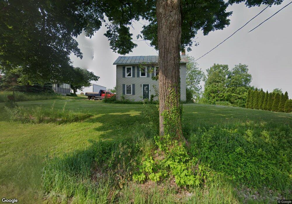
1990 Mansfield Washington Rd Mansfield, OH 44903
Estimated Value: $144,000 - $292,385
4
Beds
1
Bath
1,960
Sq Ft
$120/Sq Ft
Est. Value
About This Home
This home is located at 1990 Mansfield Washington Rd, Mansfield, OH 44903 and is currently estimated at $235,096, approximately $119 per square foot. 1990 Mansfield Washington Rd is a home located in Richland County with nearby schools including St. Peter's Elementary/Montessori School and St. Peter's High School/Junior High.
Ownership History
Date
Name
Owned For
Owner Type
Purchase Details
Closed on
Sep 21, 2007
Sold by
The Huntington National Bank
Bought by
Moon Michael L
Current Estimated Value
Home Financials for this Owner
Home Financials are based on the most recent Mortgage that was taken out on this home.
Original Mortgage
$64,000
Outstanding Balance
$40,707
Interest Rate
6.66%
Mortgage Type
Purchase Money Mortgage
Estimated Equity
$194,389
Purchase Details
Closed on
Jun 26, 2006
Sold by
Hart Deborah A
Bought by
The Huntington National Bank
Create a Home Valuation Report for This Property
The Home Valuation Report is an in-depth analysis detailing your home's value as well as a comparison with similar homes in the area
Home Values in the Area
Average Home Value in this Area
Purchase History
| Date | Buyer | Sale Price | Title Company |
|---|---|---|---|
| Moon Michael L | $80,000 | Attorney | |
| The Huntington National Bank | $56,000 | Ohio Title Corporation |
Source: Public Records
Mortgage History
| Date | Status | Borrower | Loan Amount |
|---|---|---|---|
| Open | Moon Michael L | $64,000 |
Source: Public Records
Tax History Compared to Growth
Tax History
| Year | Tax Paid | Tax Assessment Tax Assessment Total Assessment is a certain percentage of the fair market value that is determined by local assessors to be the total taxable value of land and additions on the property. | Land | Improvement |
|---|---|---|---|---|
| 2024 | $2,296 | $51,950 | $21,300 | $30,650 |
| 2023 | $2,296 | $51,950 | $21,300 | $30,650 |
| 2022 | $1,603 | $32,340 | $17,500 | $14,840 |
| 2021 | $1,626 | $32,340 | $17,500 | $14,840 |
| 2020 | $1,533 | $32,340 | $17,500 | $14,840 |
| 2019 | $1,551 | $29,430 | $14,590 | $14,840 |
| 2018 | $1,537 | $29,430 | $14,590 | $14,840 |
| 2017 | $1,507 | $29,430 | $14,590 | $14,840 |
| 2016 | $1,569 | $29,820 | $14,470 | $15,350 |
| 2015 | $1,569 | $29,820 | $14,470 | $15,350 |
| 2014 | $1,496 | $30,220 | $14,470 | $15,750 |
| 2012 | $647 | $27,810 | $12,060 | $15,750 |
Source: Public Records
Map
Nearby Homes
- 0 Woodville Rd Unit Lot 14952, 14953
- 0 Woodville Rd Unit Lot 14954, 14955
- 0 Woodville Rd Unit Lot 14956, 14957,
- 2061 Washington North Rd
- 1875 Mansfield Lucas Rd
- 1135 E Hanley Rd
- 1599 S Main St
- 1680 S Main St
- 0 Yoha Dr
- 0 Garver Washington Rd S
- 129 Elderberry Dr
- 65 Logan Rd
- 1679 Pulver Rd
- 154 Elderberry Dr
- 148 Elderberry Dr
- 929 Antionette Dr
- 794 Mansfield Washington Rd
- 716 Mansfield Washington Rd
- 104 Elmridge Rd
- 33 Rambleside Dr
- 1995 Mansfield Washington Rd
- 1975 Mansfield Washington Rd
- 00 Mansfield Washington Rd
- 0 Mansfield Washington Rd Unit 502908
- 0 Mansfield Washington Rd Unit 9020261
- 0 Mansfield Washington Rd Unit 9023704
- 0 Mansfield Washington Rd Unit 9033690
- 0 Mansfield Washington Rd Unit 9037288
- 0 Mansfield Washington Rd Unit 2937096
- 0 Mansfield Washington Rd Unit 218039629
- 0 Mansfield Washington Rd Unit 4047450
- 1903 Mansfield Washington Rd
- 2092 Mansfield Washington Rd
- 2065 Mansfield Washington Rd
- 2095 Mansfield Washington Rd
- 817 Taylor Rd
- 1843 Mansfield Washington Rd
- 1865 Mansfield Washington Rd
- 827 Taylor Rd
- 1840 Mansfield Washington Rd