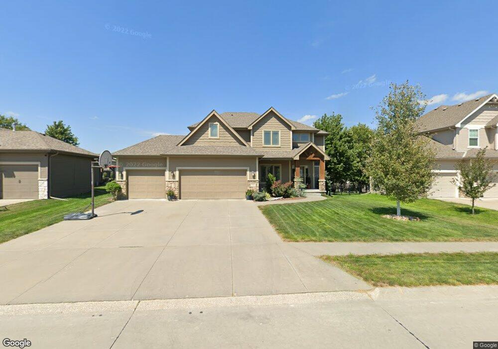
19904 Maple St Gretna, NE 68028
Estimated Value: $503,000 - $563,000
4
Beds
3
Baths
2,291
Sq Ft
$230/Sq Ft
Est. Value
About This Home
This home is located at 19904 Maple St, Gretna, NE 68028 and is currently estimated at $526,133, approximately $229 per square foot. 19904 Maple St is a home with nearby schools including Squire John Thomas Elementary School, Gretna Middle School, and Gretna High School.
Ownership History
Date
Name
Owned For
Owner Type
Purchase Details
Closed on
May 27, 2011
Sold by
Marasco Homes Inc
Bought by
Makovicka Jeffrey S and Makovicka Tracy A
Current Estimated Value
Home Financials for this Owner
Home Financials are based on the most recent Mortgage that was taken out on this home.
Original Mortgage
$232,000
Outstanding Balance
$161,577
Interest Rate
4.85%
Estimated Equity
$364,556
Purchase Details
Closed on
Dec 23, 2010
Sold by
Mccune Development L L C
Bought by
Marasco Homes Inc
Home Financials for this Owner
Home Financials are based on the most recent Mortgage that was taken out on this home.
Original Mortgage
$2,000,000
Interest Rate
4.41%
Mortgage Type
Small Business Administration
Create a Home Valuation Report for This Property
The Home Valuation Report is an in-depth analysis detailing your home's value as well as a comparison with similar homes in the area
Home Values in the Area
Average Home Value in this Area
Purchase History
| Date | Buyer | Sale Price | Title Company |
|---|---|---|---|
| Makovicka Jeffrey S | $292,000 | Pre | |
| Marasco Homes Inc | $32,000 | Pre |
Source: Public Records
Mortgage History
| Date | Status | Borrower | Loan Amount |
|---|---|---|---|
| Open | Makovicka Jeffrey S | $232,000 | |
| Previous Owner | Marasco Homes Inc | $2,000,000 |
Source: Public Records
Tax History Compared to Growth
Tax History
| Year | Tax Paid | Tax Assessment Tax Assessment Total Assessment is a certain percentage of the fair market value that is determined by local assessors to be the total taxable value of land and additions on the property. | Land | Improvement |
|---|---|---|---|---|
| 2025 | $8,228 | $461,653 | $73,000 | $388,653 |
| 2024 | $8,252 | $454,992 | $67,000 | $387,992 |
| 2023 | $8,252 | $383,906 | $47,000 | $336,906 |
| 2022 | $7,878 | $345,239 | $42,000 | $303,239 |
| 2021 | $5,869 | $320,361 | $37,000 | $283,361 |
| 2020 | $8,253 | $314,871 | $37,000 | $277,871 |
| 2019 | $8,439 | $310,753 | $35,000 | $275,753 |
| 2018 | $8,492 | $308,426 | $35,000 | $273,426 |
| 2017 | $8,501 | $308,230 | $35,000 | $273,230 |
| 2016 | $8,095 | $294,652 | $35,000 | $259,652 |
| 2015 | $7,877 | $288,331 | $32,000 | $256,331 |
| 2014 | $7,876 | $290,175 | $32,000 | $258,175 |
| 2012 | -- | $279,295 | $32,000 | $247,295 |
Source: Public Records
Map
Nearby Homes
- 19819 Sherwood Cir
- 19905 Maple St
- 19910 Oak St
- 434 Devonshire Dr
- 11719 S 203rd St
- 22111 Hackberry Dr
- 206 E Westplains Rd
- 20717 Frances St
- 11606 S 191st Ave
- 11512 S 191st Ave
- 11280 S 200th Ave
- 11647 Willow Park Dr
- 19120 Murray Trail
- 21716 Glenmore Dr
- 21711 Glenmore Dr
- 21707 Glenmore Dr
- 19122 Fir St
- 19109 Murray Trail
- 11535 S 191st St
- 19016 Hazelnut Dr
- 19908 Maple St
- 19820 Maple St
- 19912 Maple St
- 19816 Maple St
- 19903 Sherwood Cir
- 19901 Maple St
- 19907 Sherwood Cir
- 19909 Maple St
- 19815 Maple St
- 19911 Sherwood Cir
- 19916 Maple St
- 19814 Maple St
- 19815 Sherwood Cir
- 19811 Maple St
- 19913 Maple St
- 19915 Sherwood Cir
- 19906 Ash St
- 19810 Maple St
- 19902 Ash St
- 19910 Ash St