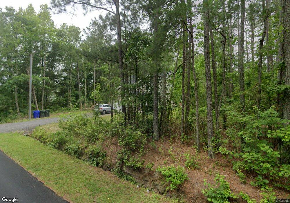
1991 Airport Rd Suffolk, VA 23434
Holy Neck NeighborhoodEstimated Value: $423,000 - $452,000
4
Beds
3
Baths
2,000
Sq Ft
$218/Sq Ft
Est. Value
About This Home
This home is located at 1991 Airport Rd, Suffolk, VA 23434 and is currently estimated at $436,966, approximately $218 per square foot. 1991 Airport Rd is a home located in Suffolk City with nearby schools including Booker T. Washington Elementary School, John F. Kennedy Middle School, and Lakeland High School.
Ownership History
Date
Name
Owned For
Owner Type
Purchase Details
Closed on
Mar 17, 2022
Sold by
Poje Grant A and Tyler Michelle
Bought by
Poje Grant A
Current Estimated Value
Purchase Details
Closed on
Jun 24, 2021
Sold by
Daniels Construction Corp
Bought by
Poje Grant A and Vacha Michelle
Home Financials for this Owner
Home Financials are based on the most recent Mortgage that was taken out on this home.
Original Mortgage
$362,496
Interest Rate
2.88%
Mortgage Type
VA
Purchase Details
Closed on
Sep 29, 2020
Sold by
The Estate Of Floyd Carl Heart
Bought by
Daniels Construction Corp
Home Financials for this Owner
Home Financials are based on the most recent Mortgage that was taken out on this home.
Original Mortgage
$180,000
Interest Rate
2.9%
Mortgage Type
New Conventional
Create a Home Valuation Report for This Property
The Home Valuation Report is an in-depth analysis detailing your home's value as well as a comparison with similar homes in the area
Home Values in the Area
Average Home Value in this Area
Purchase History
| Date | Buyer | Sale Price | Title Company |
|---|---|---|---|
| Poje Grant A | -- | Holland David S | |
| Poje Grant A | $349,900 | Priority Title & Escrow | |
| Daniels Construction Corp | $5,500 | Attorney |
Source: Public Records
Mortgage History
| Date | Status | Borrower | Loan Amount |
|---|---|---|---|
| Previous Owner | Poje Grant A | $362,496 | |
| Previous Owner | Daniels Construction Corp | $180,000 |
Source: Public Records
Tax History Compared to Growth
Tax History
| Year | Tax Paid | Tax Assessment Tax Assessment Total Assessment is a certain percentage of the fair market value that is determined by local assessors to be the total taxable value of land and additions on the property. | Land | Improvement |
|---|---|---|---|---|
| 2024 | $4,957 | $403,100 | $76,800 | $326,300 |
| 2023 | $4,706 | $374,900 | $76,800 | $298,100 |
| 2022 | $3,528 | $323,700 | $76,800 | $246,900 |
| 2021 | $1,839 | $165,700 | $76,800 | $88,900 |
| 2020 | $46 | $4,100 | $4,100 | $0 |
| 2019 | $46 | $4,100 | $4,100 | $0 |
| 2018 | $45 | $4,100 | $4,100 | $0 |
| 2017 | $44 | $4,100 | $4,100 | $0 |
| 2016 | $44 | $4,100 | $4,100 | $0 |
| 2015 | $20 | $4,100 | $4,100 | $0 |
| 2014 | $20 | $4,100 | $4,100 | $0 |
Source: Public Records
Map
Nearby Homes
- 2349 Skeetertown Rd
- 1678 Whaleyville Blvd
- 1913 Whaleyville Blvd
- 1+ Ac Hosier Rd
- 1900 Hosier Rd
- 98 AC Whaleyville Blvd
- 2395 Copeland Rd
- 3003 Whaleyville Blvd
- 2389 Copeland Rd
- 2933 Carolina Rd
- 2308 Hosier Rd
- 3085 Carolina Rd
- 3 ac Carolina Rd
- 1925 Copeland Rd
- 4006 Whaleyville Blvd
- 121 Meadows Landing Ln
- 1346 Lawson Cir
- 15 Acres Cypress Chapel Rd
- 45.5 Acres Cypress Chapel Rd
- .200 Ac Hosier Rd
- 2001 Airport Rd
- 2009 Airport Rd
- 1913 Airport Rd
- 1951 Airport Rd
- 2015 Airport Rd
- 2012 Airport Rd
- 2110 Skeetertown Rd
- 2018 Airport Rd
- 1909 Airport Rd
- 2019 Airport Rd
- 1905 Airport Rd
- 1900 Airport Rd
- 2013 Airport Rd
- 2137 Skeetertown Rd
- 1901 Airport Rd
- 1968 Carolina Rd
- 1964 Carolina Rd
- 1972 Carolina Rd
- 2.03 Airport Rd
- 12+ AC Airport Rd
