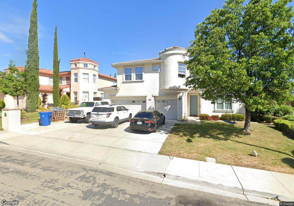
1991 Colosseum Way Antioch, CA 94531
Lone Tree Valley NeighborhoodEstimated Value: $784,000 - $818,584
4
Beds
3
Baths
3,270
Sq Ft
$245/Sq Ft
Est. Value
About This Home
This home is located at 1991 Colosseum Way, Antioch, CA 94531 and is currently estimated at $800,646, approximately $244 per square foot. 1991 Colosseum Way is a home located in Contra Costa County with nearby schools including Lone Tree Elementary School, Dallas Ranch Middle School, and Deer Valley High School.
Ownership History
Date
Name
Owned For
Owner Type
Purchase Details
Closed on
Apr 24, 2003
Sold by
Black Diamond Knolls Ltd
Bought by
Pang Yong Jing and Cao Yuning
Current Estimated Value
Home Financials for this Owner
Home Financials are based on the most recent Mortgage that was taken out on this home.
Original Mortgage
$35,000
Interest Rate
5.84%
Mortgage Type
Purchase Money Mortgage
Purchase Details
Closed on
Oct 16, 2002
Sold by
South Terra Corp
Bought by
Black Diamond Knolls Ltd
Purchase Details
Closed on
Mar 18, 1998
Sold by
City Of Richmond Redevelopment Agency
Bought by
State Of California
Create a Home Valuation Report for This Property
The Home Valuation Report is an in-depth analysis detailing your home's value as well as a comparison with similar homes in the area
Home Values in the Area
Average Home Value in this Area
Purchase History
| Date | Buyer | Sale Price | Title Company |
|---|---|---|---|
| Pang Yong Jing | $431,000 | Old Republic Title | |
| Black Diamond Knolls Ltd | -- | Old Republic Title Company | |
| State Of California | -- | -- |
Source: Public Records
Mortgage History
| Date | Status | Borrower | Loan Amount |
|---|---|---|---|
| Closed | Pang Yong Jing | $35,000 |
Source: Public Records
Tax History Compared to Growth
Tax History
| Year | Tax Paid | Tax Assessment Tax Assessment Total Assessment is a certain percentage of the fair market value that is determined by local assessors to be the total taxable value of land and additions on the property. | Land | Improvement |
|---|---|---|---|---|
| 2025 | $7,790 | $683,008 | $152,063 | $530,945 |
| 2024 | $7,517 | $669,617 | $149,082 | $520,535 |
| 2023 | $7,517 | $656,488 | $146,159 | $510,329 |
| 2022 | $7,399 | $643,617 | $143,294 | $500,323 |
| 2021 | $7,184 | $630,998 | $140,485 | $490,513 |
| 2019 | $7,041 | $612,284 | $136,319 | $475,965 |
| 2018 | $6,613 | $584,000 | $130,022 | $453,978 |
| 2017 | $6,276 | $552,000 | $122,898 | $429,102 |
| 2016 | $5,615 | $490,000 | $109,094 | $380,906 |
| 2015 | $5,757 | $468,500 | $104,308 | $364,192 |
| 2014 | $7,169 | $499,500 | $111,210 | $388,290 |
Source: Public Records
Map
Nearby Homes
- 1964 Finger Peak Way
- 2401 Silveria Way
- 4604 Coal Hill Place
- 5488 Southwood Ct
- 1333 Mokelumne Dr
- 1879 Mount Conness Way
- 2344 Forty Niner Ct
- 5448 Southwood Way
- 5243 Delta View Way
- 2498 Taylor Way
- 2510 Vallecito Way
- 1928 Badger Pass Way
- 2721 Vallejo Ct
- 1256 Mokelumne Ct
- 2201 Mark Twain Dr
- 1157 Rockspring Way
- 1525 Barkley Mountain Way
- Residence 2 Plan at Deer Valley
- Residence 6 Plan at Deer Valley
- Residence 4 Plan at Deer Valley
- 1987 Colosseum Way
- 1995 Colosseum Way
- 1992 Mokelumne Dr
- 1988 Mokelumne Dr
- 1988 Mokeumne Dr
- 1983 Colosseum Way
- 1996 Mokelumne Dr
- 2000 Mount Wilson Ct
- 1691 Observation Way
- 1687 Observation Way
- 1984 Mokelumne Dr
- 1949 Colosseum Way
- 1979 Colosseum Way
- 2000 Mokelumne Dr
- 1980 Mokelumne Dr
- 1998 Mount Wilson Ct
- 1945 Colosseum Way
- 1980 Mount Wilson Ct
- 1975 Colosseum Way
- 1976 Mokelumne Dr