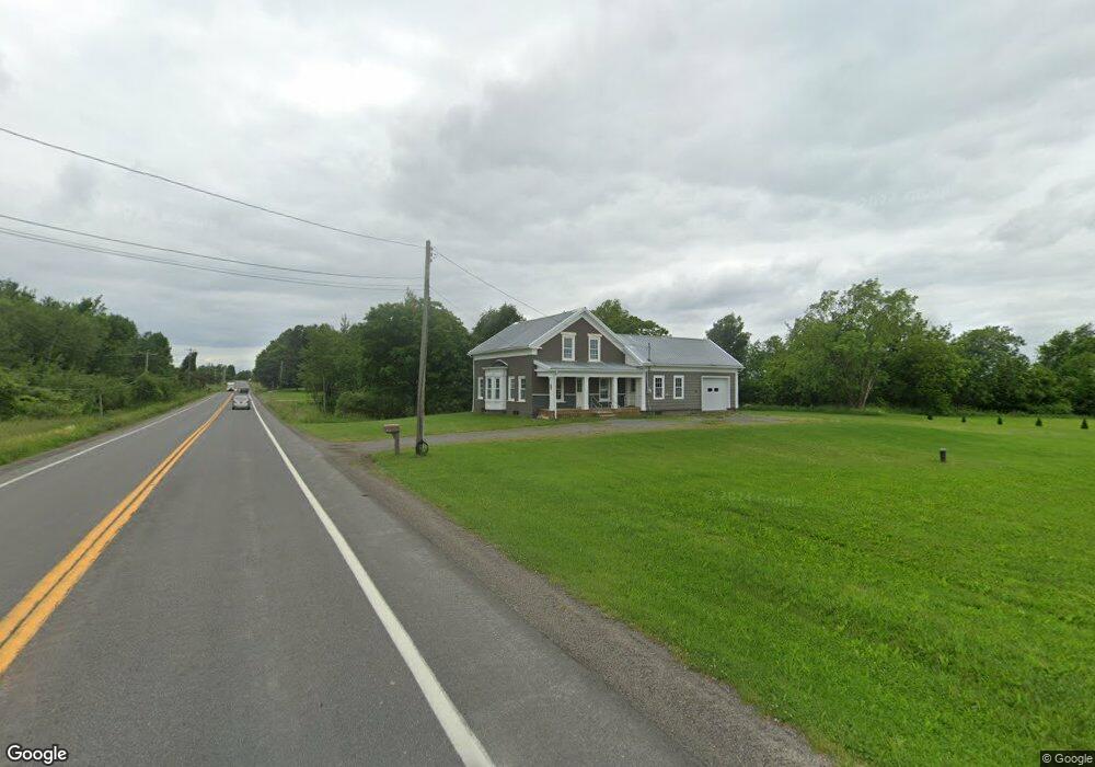
1991 State Route 11b North Bangor, NY 12966
Estimated Value: $108,000 - $140,000
4
Beds
2
Baths
1,661
Sq Ft
$76/Sq Ft
Est. Value
About This Home
This home is located at 1991 State Route 11b, North Bangor, NY 12966 and is currently estimated at $126,211, approximately $75 per square foot. 1991 State Route 11b is a home located in Franklin County with nearby schools including Brushton-Moira Elementary School and Brushton-Moira High School.
Ownership History
Date
Name
Owned For
Owner Type
Purchase Details
Closed on
Oct 30, 2019
Sold by
Hsbc Bank Usa Na
Bought by
Zimmerman Elon
Current Estimated Value
Purchase Details
Closed on
Nov 5, 2015
Sold by
Maher James
Bought by
Hsbc Bank Usa
Purchase Details
Closed on
Jun 9, 2008
Sold by
Woods Maurice
Bought by
Martin Jason
Home Financials for this Owner
Home Financials are based on the most recent Mortgage that was taken out on this home.
Original Mortgage
$80,563
Interest Rate
6.17%
Mortgage Type
Purchase Money Mortgage
Purchase Details
Closed on
Dec 18, 2006
Sold by
Sears Elva
Bought by
Woods Maurice
Create a Home Valuation Report for This Property
The Home Valuation Report is an in-depth analysis detailing your home's value as well as a comparison with similar homes in the area
Home Values in the Area
Average Home Value in this Area
Purchase History
| Date | Buyer | Sale Price | Title Company |
|---|---|---|---|
| Zimmerman Elon | $9,000 | Chicago Title | |
| Hsbc Bank Usa | -- | -- | |
| Martin Jason | $81,700 | -- | |
| Woods Maurice | $33,500 | Jonathan Miller |
Source: Public Records
Mortgage History
| Date | Status | Borrower | Loan Amount |
|---|---|---|---|
| Previous Owner | Martin Jason | $80,563 |
Source: Public Records
Tax History Compared to Growth
Tax History
| Year | Tax Paid | Tax Assessment Tax Assessment Total Assessment is a certain percentage of the fair market value that is determined by local assessors to be the total taxable value of land and additions on the property. | Land | Improvement |
|---|---|---|---|---|
| 2024 | $1,931 | $57,500 | $16,000 | $41,500 |
| 2023 | $1,951 | $57,500 | $16,000 | $41,500 |
| 2022 | $1,346 | $57,500 | $16,000 | $41,500 |
| 2021 | $410 | $12,000 | $10,000 | $2,000 |
| 2020 | $1,097 | $12,000 | $10,000 | $2,000 |
| 2019 | $2,067 | $65,800 | $16,000 | $49,800 |
| 2018 | $1,969 | $65,800 | $16,000 | $49,800 |
| 2017 | $1,921 | $65,800 | $16,000 | $49,800 |
| 2016 | $1,882 | $65,800 | $16,000 | $49,800 |
| 2015 | -- | $65,800 | $16,000 | $49,800 |
| 2014 | -- | $65,800 | $16,000 | $49,800 |
Source: Public Records
Map
Nearby Homes
- 0 Cox Rd Unit 204813
- 40 Mccarthy Rd
- 1822 State Route 11
- 20 Mill St
- 390 Co Rt 12
- 1336 State Route 11b
- 0 Wagner Rd Unit 203197
- 725 S Woods Rd
- 752 S Woods Rd
- 2422 U S 11
- 1107 County Rt 53
- 87 Van Dusen Dr
- 706 County Route 7
- 32 Grove St
- 202 County Route 8
- 192 Wiley Rd
- 662 Baker Rd
- 916 County Route 8
- 75 Cr Rt 3
- 1434 County Route 22
- 1991 New York 11b
- 1979 State Route 11b
- 1967 State Route 11b
- 2014 State Route 11b
- 1966 State Route 11b
- 2051 State Route 11b
- 2056 State Route 11b
- 1997 State Route 11b
- 1917 State Route 11b
- 2065 State Route 11b
- 1914 State Route 11b
- 2070 State Route 11b
- 1909 State Route 11b
- 2073 State Route 11b
- 1899 State Route 11b
- 33 Gallop Rd
- 2089 State Route 11b
- 45 Gallop Rd
- 2095 State Route 11b
- 1883 State Route 11b