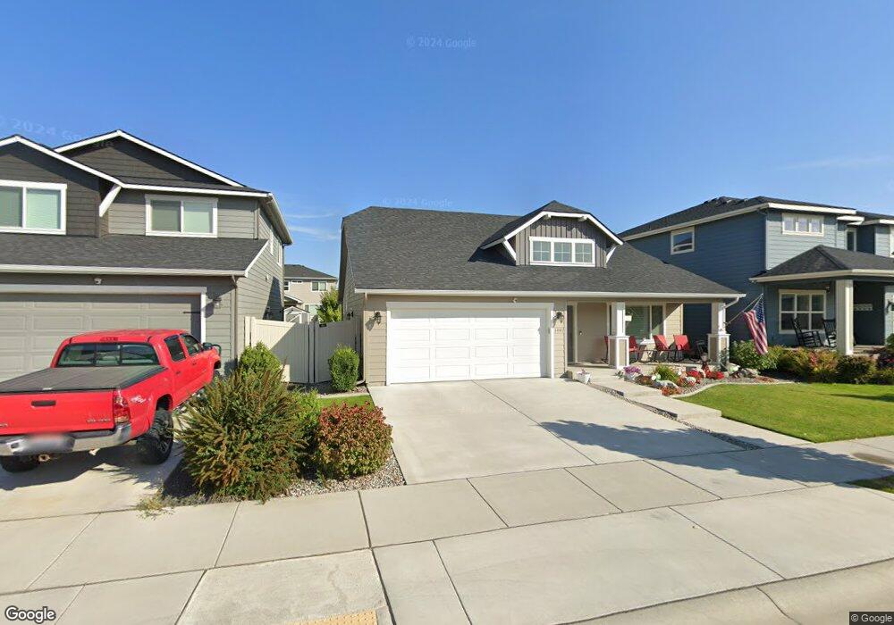
1991 W Alsea Loop Post Falls, ID 83854
West Prairie NeighborhoodEstimated Value: $451,879 - $486,000
3
Beds
2
Baths
1,438
Sq Ft
$327/Sq Ft
Est. Value
About This Home
This home is located at 1991 W Alsea Loop, Post Falls, ID 83854 and is currently estimated at $470,220, approximately $326 per square foot. 1991 W Alsea Loop is a home located in Kootenai County with nearby schools including West Ridge Elementary School, River City Middle School, and Post Falls High School.
Ownership History
Date
Name
Owned For
Owner Type
Purchase Details
Closed on
Jul 1, 2019
Sold by
Sorbonne Homes Llc
Bought by
Martin Sandra L
Current Estimated Value
Home Financials for this Owner
Home Financials are based on the most recent Mortgage that was taken out on this home.
Original Mortgage
$115,635
Outstanding Balance
$101,465
Interest Rate
4%
Mortgage Type
New Conventional
Estimated Equity
$368,755
Purchase Details
Closed on
Jun 28, 2019
Sold by
Lopez Albert and Martin Sandra L
Bought by
Martin Sandra L
Home Financials for this Owner
Home Financials are based on the most recent Mortgage that was taken out on this home.
Original Mortgage
$115,635
Outstanding Balance
$101,465
Interest Rate
4%
Mortgage Type
New Conventional
Estimated Equity
$368,755
Create a Home Valuation Report for This Property
The Home Valuation Report is an in-depth analysis detailing your home's value as well as a comparison with similar homes in the area
Home Values in the Area
Average Home Value in this Area
Purchase History
| Date | Buyer | Sale Price | Title Company |
|---|---|---|---|
| Martin Sandra L | -- | Pioneer Title Kootenai Cnty | |
| Martin Sandra L | -- | Pioneer Title Kootenai Cnty |
Source: Public Records
Mortgage History
| Date | Status | Borrower | Loan Amount |
|---|---|---|---|
| Open | Martin Sandra L | $115,635 |
Source: Public Records
Tax History
| Year | Tax Paid | Tax Assessment Tax Assessment Total Assessment is a certain percentage of the fair market value that is determined by local assessors to be the total taxable value of land and additions on the property. | Land | Improvement |
|---|---|---|---|---|
| 2025 | $1,721 | $442,450 | $155,000 | $287,450 |
| 2024 | $1,714 | $430,670 | $155,000 | $275,670 |
| 2023 | $1,714 | $442,534 | $120,000 | $322,534 |
| 2022 | $2,087 | $460,101 | $110,000 | $350,101 |
| 2021 | $1,748 | $294,530 | $90,000 | $204,530 |
| 2020 | $1,925 | $266,190 | $75,000 | $191,190 |
| 2019 | $860 | $249,340 | $70,000 | $179,340 |
| 2018 | $945 | $70,000 | $70,000 | $0 |
Source: Public Records
Map
Nearby Homes
- 2084 W Platte Ct
- 2120 W Platte Ct
- 2097 W Platte Ct
- 2115 W Platte Ct
- 2133 W Platte Ct
- 2021 N Skagit Dr
- 1999 N Skagit Dr
- 2045 N Skagit Dr
- 1478 N Wollaston Dr
- 1436 N Minam Loop
- 1531 N Wilhelm Way
- 1688 Umpqua Ct
- 2118 N Teanaway
- 1087 N Lean St
- 2661 N Distant Star Rd
- 2243 W Gueneveres
- 2042 W Gueneveres Way
- 957 N Maranatha Dr Unit 10
- 2225 N Methow Ct
- 1345 N Kaniksu St
- 1991 W Alsea Ave
- 1949 Alsea
- 2007 W Alsea Ave
- 2007 W Alsea Ave
- 1975 W Alsea Loop
- 1949 W Alsea Ave
- 2021 W Alsea Ave
- 2021 W Alsea Ave
- 2008 W Malad Ave
- 1943 W Alsea Ave
- 1974 W Malad Ave
- 2037 W Alsea Ave
- 1992 W Malad Ave
- 1974 W Malad Ave
- 1943 W Alsea Loop
- 2008 W Malad Ave
- 2037 W Alsea Ave
- 2004 W Alsea Ave
- 2004 W Alsea Ave
- 1956 W Malad Ave
Your Personal Tour Guide
Ask me questions while you tour the home.