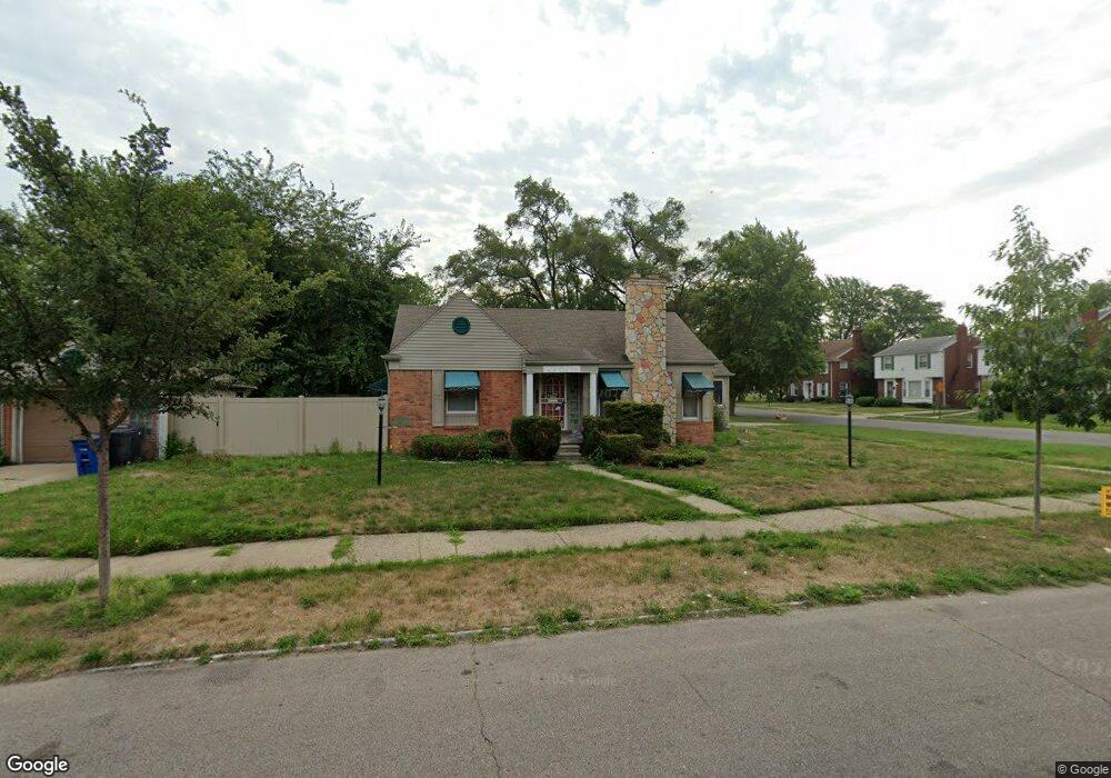
19910 Appoline St Detroit, MI 48235
Blackstone Park NeighborhoodEstimated Value: $91,014 - $119,000
--
Bed
1
Bath
933
Sq Ft
$111/Sq Ft
Est. Value
About This Home
This home is located at 19910 Appoline St, Detroit, MI 48235 and is currently estimated at $103,504, approximately $110 per square foot. 19910 Appoline St is a home located in Wayne County with nearby schools including Vernor Elementary School, Charles L. Spain Elementary-Middle School, and Edward 'Duke' Ellington Conservatory of Music and Art.
Ownership History
Date
Name
Owned For
Owner Type
Purchase Details
Closed on
Aug 3, 2011
Sold by
Lambert Julius B and Lambert Erma
Bought by
Us Bank National Association Nd
Current Estimated Value
Purchase Details
Closed on
Apr 28, 2003
Sold by
Lambert Julius B
Bought by
Lambert Julius B
Home Financials for this Owner
Home Financials are based on the most recent Mortgage that was taken out on this home.
Original Mortgage
$98,345
Interest Rate
9.25%
Mortgage Type
Purchase Money Mortgage
Create a Home Valuation Report for This Property
The Home Valuation Report is an in-depth analysis detailing your home's value as well as a comparison with similar homes in the area
Home Values in the Area
Average Home Value in this Area
Purchase History
| Date | Buyer | Sale Price | Title Company |
|---|---|---|---|
| Us Bank National Association Nd | $17,000 | None Available | |
| Lambert Julius B | -- | -- |
Source: Public Records
Mortgage History
| Date | Status | Borrower | Loan Amount |
|---|---|---|---|
| Previous Owner | Lambert Julius B | $98,345 |
Source: Public Records
Tax History Compared to Growth
Tax History
| Year | Tax Paid | Tax Assessment Tax Assessment Total Assessment is a certain percentage of the fair market value that is determined by local assessors to be the total taxable value of land and additions on the property. | Land | Improvement |
|---|---|---|---|---|
| 2025 | $1,146 | $43,200 | $0 | $0 |
| 2024 | $1,146 | $37,600 | $0 | $0 |
| 2023 | $1,111 | $30,800 | $0 | $0 |
| 2022 | $1,214 | $26,300 | $0 | $0 |
| 2021 | $1,184 | $21,200 | $0 | $0 |
| 2020 | $1,172 | $19,400 | $0 | $0 |
| 2019 | $1,154 | $14,700 | $0 | $0 |
| 2018 | $987 | $12,700 | $0 | $0 |
| 2017 | $241 | $13,100 | $0 | $0 |
| 2016 | $1,132 | $14,800 | $0 | $0 |
| 2015 | $1,480 | $14,800 | $0 | $0 |
| 2013 | $2,016 | $21,726 | $0 | $0 |
| 2010 | -- | $31,852 | $1,355 | $30,497 |
Source: Public Records
Map
Nearby Homes
- 12819 Pembroke Ave
- 19934 Manor St
- 19943 Monte Vista St
- 20123 Appoline St
- 20141 Appoline St
- 19483 Meyers Rd
- 20048 Monte Vista St
- 19719 Ward St
- 20202 Appoline St
- 20178 Manor St
- 20022 Pinehurst St
- 20129 Ward St
- 20108 Cheyenne St
- 20184 Ward St
- 20203 Monte Vista St
- 20167 Ward St
- 19474 Cheyenne St
- 20186 Monte Vista St
- 19744 Littlefield St
- 20403 Manor St
- 12724 Pembroke Ave
- 19930 Appoline St
- 19938 Appoline St
- 19938 Appoline St
- 19909 Meyers Rd
- 19919 Meyers Rd
- 19905 Meyers Rd
- 19925 Meyers Rd
- 19931 Meyers Rd
- 19929 Appoline St
- 19946 Appoline St
- 12820 Pembroke Ave
- 19937 Meyers Rd
- 19937 Appoline St
- 12741 Pembroke Ave
- 12735 Pembroke Ave
- 19945 Meyers Rd
- 12727 Pembroke Ave
- 12830 Pembroke Ave
- 12719 Pembroke Ave