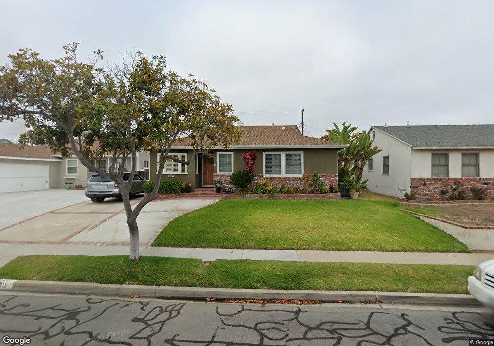
19911 Ingrum Way Torrance, CA 90503
West Torrance NeighborhoodEstimated Value: $1,067,000 - $1,480,000
3
Beds
2
Baths
1,701
Sq Ft
$768/Sq Ft
Est. Value
About This Home
This home is located at 19911 Ingrum Way, Torrance, CA 90503 and is currently estimated at $1,306,576, approximately $768 per square foot. 19911 Ingrum Way is a home located in Los Angeles County with nearby schools including Towers Elementary School, Bert M. Lynn Middle School, and West High School.
Ownership History
Date
Name
Owned For
Owner Type
Purchase Details
Closed on
May 10, 2025
Sold by
Knobbe Family Revocable Trust and Knobbe Roger R
Bought by
Knobbe Family Revocable Trust and Knobbe
Current Estimated Value
Home Financials for this Owner
Home Financials are based on the most recent Mortgage that was taken out on this home.
Original Mortgage
$399,975
Outstanding Balance
$397,105
Interest Rate
6.64%
Mortgage Type
Credit Line Revolving
Estimated Equity
$909,471
Purchase Details
Closed on
Jan 3, 2020
Sold by
Knobbe Roger R and Knobbe Donna M
Bought by
Knobbe Roger R and Knobbe Donna M
Purchase Details
Closed on
Jun 24, 1997
Sold by
Fallah Afshin
Bought by
Knobbe Roger and Knobbe Donna
Home Financials for this Owner
Home Financials are based on the most recent Mortgage that was taken out on this home.
Original Mortgage
$209,600
Interest Rate
7.7%
Create a Home Valuation Report for This Property
The Home Valuation Report is an in-depth analysis detailing your home's value as well as a comparison with similar homes in the area
Home Values in the Area
Average Home Value in this Area
Purchase History
| Date | Buyer | Sale Price | Title Company |
|---|---|---|---|
| Knobbe Family Revocable Trust | -- | Atlas Title | |
| Knobbe Roger R | -- | None Available | |
| Knobbe Roger | $262,000 | Commonwealth Land Title |
Source: Public Records
Mortgage History
| Date | Status | Borrower | Loan Amount |
|---|---|---|---|
| Open | Knobbe Family Revocable Trust | $399,975 | |
| Previous Owner | Knobbe Roger | $209,600 |
Source: Public Records
Tax History
| Year | Tax Paid | Tax Assessment Tax Assessment Total Assessment is a certain percentage of the fair market value that is determined by local assessors to be the total taxable value of land and additions on the property. | Land | Improvement |
|---|---|---|---|---|
| 2025 | $5,482 | $470,521 | $334,671 | $135,850 |
| 2024 | $5,482 | $461,296 | $328,109 | $133,187 |
| 2023 | $5,383 | $452,252 | $321,676 | $130,576 |
| 2022 | $5,310 | $443,385 | $315,369 | $128,016 |
| 2021 | $5,207 | $434,692 | $309,186 | $125,506 |
| 2019 | $5,057 | $421,801 | $300,016 | $121,785 |
| 2018 | $4,865 | $413,532 | $294,134 | $119,398 |
| 2016 | $4,639 | $397,475 | $282,713 | $114,762 |
| 2015 | $4,538 | $391,506 | $278,467 | $113,039 |
| 2014 | $4,423 | $383,838 | $273,013 | $110,825 |
Source: Public Records
Map
Nearby Homes
- 4914 Halison St
- 20331 Anza Ave Unit 10
- 20021 Saltee Ave
- 4489 Spencer St Unit 224
- 4428 Spencer St
- 4102 Spencer St
- 4278 Spencer St
- 20520 Earl St Unit 14
- 20610 Mansel Ave
- 2722 Spreckels Ln
- 20462 Roslin Ave
- 20652 Vista Dr
- 606 Phelan Ln
- 2345 W 190th St Unit 77
- 2345 190th St Unit 63
- 3522 Del Amo Blvd
- 3723 Emerald St Unit B
- 5540 Norton St
- 18528 Kingsdale Ave
- 634 Meyer Ln Unit D
- 4806 Halison St
- 19923 Ingrum Way
- 19910 Bellemare Ave
- 19916 Bellemare Ave
- 19904 Bellemare Ave
- 19922 Bellemare Ave
- 19910 Ingrum Way
- 19929 Ingrum Way
- 19916 Ingrum Way
- 19904 Ingrum Way
- 19922 Ingrum Way
- 19928 Bellemare Ave
- 19924 Bellemare Ave
- 4807 Halison St
- 4811 Halison St
- 4803 Halison St
- 20005 Ingrum Way
- 19928 Ingrum Way
- 4815 Halison St
- 4735 Halison St