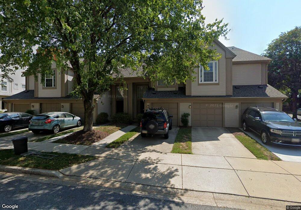
19918 Dunstable Cir Germantown, MD 20876
Estimated Value: $347,000 - $354,623
2
Beds
3
Baths
1,392
Sq Ft
$252/Sq Ft
Est. Value
About This Home
This home is located at 19918 Dunstable Cir, Germantown, MD 20876 and is currently estimated at $350,406, approximately $251 per square foot. 19918 Dunstable Cir is a home located in Montgomery County with nearby schools including South Lake Elementary School, Neelsville Middle, and Watkins Mill High School.
Ownership History
Date
Name
Owned For
Owner Type
Purchase Details
Closed on
Jan 6, 2009
Sold by
Malkin Kelly A
Bought by
Lehner Donald W
Current Estimated Value
Home Financials for this Owner
Home Financials are based on the most recent Mortgage that was taken out on this home.
Original Mortgage
$196,000
Outstanding Balance
$132,285
Interest Rate
6.49%
Mortgage Type
Purchase Money Mortgage
Estimated Equity
$218,121
Purchase Details
Closed on
Dec 1, 2008
Sold by
Malkin Kelly A
Bought by
Lehner Donald W
Home Financials for this Owner
Home Financials are based on the most recent Mortgage that was taken out on this home.
Original Mortgage
$196,000
Outstanding Balance
$132,285
Interest Rate
6.49%
Mortgage Type
Purchase Money Mortgage
Estimated Equity
$218,121
Purchase Details
Closed on
Sep 26, 2003
Sold by
Johnston David H
Bought by
Malkin Kelly A
Purchase Details
Closed on
Dec 12, 2001
Sold by
Deangelo Joseph M
Bought by
Johnston David H
Create a Home Valuation Report for This Property
The Home Valuation Report is an in-depth analysis detailing your home's value as well as a comparison with similar homes in the area
Home Values in the Area
Average Home Value in this Area
Purchase History
| Date | Buyer | Sale Price | Title Company |
|---|---|---|---|
| Lehner Donald W | $245,000 | -- | |
| Lehner Donald W | $245,000 | -- | |
| Malkin Kelly A | $206,100 | -- | |
| Malkin Kelly A | $206,100 | -- | |
| Johnston David H | $134,900 | -- |
Source: Public Records
Mortgage History
| Date | Status | Borrower | Loan Amount |
|---|---|---|---|
| Open | Lehner Donald W | $196,000 | |
| Closed | Lehner Donald W | $196,000 |
Source: Public Records
Tax History
| Year | Tax Paid | Tax Assessment Tax Assessment Total Assessment is a certain percentage of the fair market value that is determined by local assessors to be the total taxable value of land and additions on the property. | Land | Improvement |
|---|---|---|---|---|
| 2025 | $3,276 | $283,333 | -- | -- |
| 2024 | $3,276 | $251,667 | $0 | $0 |
| 2023 | $3,583 | $220,000 | $66,000 | $154,000 |
| 2022 | $1,746 | $216,667 | $0 | $0 |
| 2021 | $1,961 | $213,333 | $0 | $0 |
| 2020 | $3,802 | $210,000 | $63,000 | $147,000 |
| 2019 | $3,704 | $206,667 | $0 | $0 |
| 2018 | $1,811 | $203,333 | $0 | $0 |
| 2017 | $1,861 | $200,000 | $0 | $0 |
| 2016 | $2,314 | $200,000 | $0 | $0 |
| 2015 | $2,314 | $200,000 | $0 | $0 |
| 2014 | $2,314 | $200,000 | $0 | $0 |
Source: Public Records
Map
Nearby Homes
- 19932 Dunstable Cir
- 19917 Gateshead Cir
- 11103 Knights Ct
- 19970 Appledowre Cir
- 11441 Ledbury Way
- 11309 Halethorpe Terrace
- 20203 Red Buckeye Ct
- 11462 Fruitwood Way
- 1 Appledowre Ct
- 20172 Locustdale Dr
- 20113 Locustdale Dr
- 11427 Hawks Ridge Terrace
- 11406 Locustdale Terrace
- 19234 Golden Meadow Dr
- 22 Cross Laurel Ct
- 11304 Bent Creek Terrace
- 11409 Berland Place
- 19621 Gunners Branch Rd Unit L
- 19625 Gunners Branch Rd Unit 932
- 19625 Gunners Branch Rd Unit F
- 19920 Dunstable Cir
- 19922 Dunstable Cir
- 19914 Dunstable Cir
- 19912 Dunstable Cir
- 19928 Dunstable Cir
- 19924 Dunstable Cir
- 19926 Dunstable Cir
- 19908 Dunstable Cir
- 19906 Dunstable Cir
- 19910 Dunstable Cir
- 19911 Dunstable Cir
- 19907 Dunstable Cir
- 19909 Dunstable Cir
- 19934 Dunstable Cir
- 19930 Dunstable Cir
- 19905 Dunstable Cir
- 19903 Dunstable Cir
- 19901 Dunstable Cir
- 19938 Dunstable Cir Unit 225
- 19940 Dunstable Cir
Your Personal Tour Guide
Ask me questions while you tour the home.