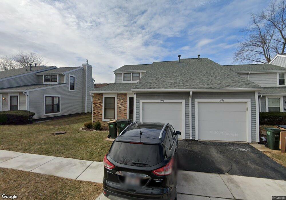
1992 Georgetown Ln Hoffman Estates, IL 60169
South Hoffman Estates NeighborhoodEstimated Value: $256,000 - $298,000
3
Beds
1
Bath
1,384
Sq Ft
$204/Sq Ft
Est. Value
About This Home
This home is located at 1992 Georgetown Ln, Hoffman Estates, IL 60169 and is currently estimated at $281,782, approximately $203 per square foot. 1992 Georgetown Ln is a home located in Cook County with nearby schools including John Muir Literacy Academy, Dwight D Eisenhower Junior High School, and Hoffman Estates High School.
Ownership History
Date
Name
Owned For
Owner Type
Purchase Details
Closed on
Sep 27, 2018
Sold by
Perrone Jeffrey W
Bought by
Perrone Jeffrey W and The Jeffrey W Perrone Revocable Trust
Current Estimated Value
Create a Home Valuation Report for This Property
The Home Valuation Report is an in-depth analysis detailing your home's value as well as a comparison with similar homes in the area
Home Values in the Area
Average Home Value in this Area
Purchase History
| Date | Buyer | Sale Price | Title Company |
|---|---|---|---|
| Perrone Jeffrey W | -- | None Available |
Source: Public Records
Tax History
| Year | Tax Paid | Tax Assessment Tax Assessment Total Assessment is a certain percentage of the fair market value that is determined by local assessors to be the total taxable value of land and additions on the property. | Land | Improvement |
|---|---|---|---|---|
| 2025 | $4,506 | $24,000 | $3,868 | $20,132 |
| 2024 | $4,506 | $18,000 | $3,000 | $15,000 |
| 2023 | $4,330 | $18,000 | $3,000 | $15,000 |
| 2022 | $4,330 | $18,000 | $3,000 | $15,000 |
| 2021 | $3,774 | $14,594 | $3,046 | $11,548 |
| 2020 | $3,760 | $14,594 | $3,046 | $11,548 |
| 2019 | $3,744 | $16,216 | $3,046 | $13,170 |
| 2018 | $3,778 | $15,022 | $2,659 | $12,363 |
| 2017 | $3,730 | $15,022 | $2,659 | $12,363 |
| 2016 | $3,731 | $15,022 | $2,659 | $12,363 |
| 2015 | $3,473 | $13,437 | $2,320 | $11,117 |
| 2014 | $3,429 | $13,437 | $2,320 | $11,117 |
| 2013 | $3,323 | $13,437 | $2,320 | $11,117 |
Source: Public Records
Map
Nearby Homes
- 2051 Kettering Rd Unit 2
- 2021 Kensington Ln Unit 3004
- 2027 Kensington Ln Unit 3001
- 2025 Kensington Ln Unit 3002
- 2023 Kensington Ln Unit 3003
- 2080 Sutherland Place Unit 1
- 1965 Blackberry Ln Unit 101
- 1836 Stockton Dr Unit 3312
- 1933 Williamsburg Dr Unit 1
- 2267 Briar Ct Unit 65
- 1792 Williamsburg Dr
- 1840 Huntington Blvd Unit BW511
- 1659 Islandview Ct
- 1975 Kenilworth Cir Unit B
- 1930 Kenilworth Cir Unit E
- 1722 Fayette Walk Unit E
- 1724 Fayette Walk Unit J
- 1769 Sessions Walk Unit C
- 1712 Fayette Walk Unit D
- 1776 Bristol Walk Unit 1776
- 1994 Georgetown Ln Unit 4
- 1994 Georgetown Ln Unit 1994
- 1990 Georgetown Ln Unit 4
- 1996 Georgetown Ln
- 1988 Georgetown Ln
- 1998 Georgetown Ln
- 1993 Oxford Ln Unit 2
- 1991 Oxford Ln Unit 2
- 1986 Georgetown Ln
- 1995 Oxford Ln Unit 2
- 1989 Oxford Ln Unit 2
- 1997 Oxford Ln Unit 2
- 1987 Oxford Ln Unit 2
- 1999 Oxford Ln Unit 2
- 1984 Georgetown Ln
- 1984 Georgetown Ln Unit 461
- 1993 Georgetown Ln
- 1991 Georgetown Ln
- 1997 Georgetown Ln Unit 4
- 1995 Georgetown Ln
Your Personal Tour Guide
Ask me questions while you tour the home.