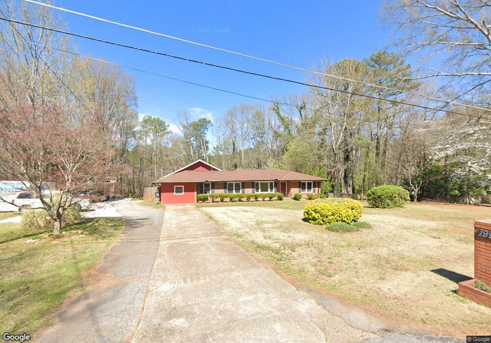
1992 Mcduffie Rd Austell, GA 30106
Estimated Value: $311,340 - $390,000
5
Beds
3
Baths
3,862
Sq Ft
$91/Sq Ft
Est. Value
About This Home
This home is located at 1992 Mcduffie Rd, Austell, GA 30106 and is currently estimated at $350,835, approximately $90 per square foot. 1992 Mcduffie Rd is a home located in Cobb County with nearby schools including Deerwood Elementary School, Clarkdale Elementary School, and Garrett Middle School.
Ownership History
Date
Name
Owned For
Owner Type
Purchase Details
Closed on
Mar 9, 2022
Sold by
Hill Timothy D
Bought by
Hill Timothy D and Hill Cosetta Williams
Current Estimated Value
Home Financials for this Owner
Home Financials are based on the most recent Mortgage that was taken out on this home.
Original Mortgage
$270,000
Outstanding Balance
$216,102
Interest Rate
3.01%
Mortgage Type
New Conventional
Estimated Equity
$134,733
Purchase Details
Closed on
Dec 28, 2000
Sold by
Brown Mitzi and Brown Michael B
Bought by
Hill Timothy D
Home Financials for this Owner
Home Financials are based on the most recent Mortgage that was taken out on this home.
Original Mortgage
$161,500
Interest Rate
7.44%
Mortgage Type
New Conventional
Purchase Details
Closed on
Aug 26, 1994
Sold by
Martin Billy D
Bought by
Brown Mitzi M Michael B
Home Financials for this Owner
Home Financials are based on the most recent Mortgage that was taken out on this home.
Original Mortgage
$93,100
Interest Rate
8.44%
Create a Home Valuation Report for This Property
The Home Valuation Report is an in-depth analysis detailing your home's value as well as a comparison with similar homes in the area
Home Values in the Area
Average Home Value in this Area
Purchase History
| Date | Buyer | Sale Price | Title Company |
|---|---|---|---|
| Hill Timothy D | -- | New Title Company Name | |
| Hill Timothy D | $162,500 | -- | |
| Brown Mitzi M Michael B | $98,000 | -- |
Source: Public Records
Mortgage History
| Date | Status | Borrower | Loan Amount |
|---|---|---|---|
| Open | Hill Timothy D | $270,000 | |
| Previous Owner | Hill Timothy D | $161,500 | |
| Previous Owner | Brown Mitzi M Michael B | $93,100 |
Source: Public Records
Tax History Compared to Growth
Tax History
| Year | Tax Paid | Tax Assessment Tax Assessment Total Assessment is a certain percentage of the fair market value that is determined by local assessors to be the total taxable value of land and additions on the property. | Land | Improvement |
|---|---|---|---|---|
| 2025 | $1,792 | $204,500 | $27,300 | $177,200 |
| 2024 | $868 | $157,020 | $27,300 | $129,720 |
| 2023 | $0 | $99,044 | $15,960 | $83,084 |
| 2022 | $0 | $99,044 | $15,960 | $83,084 |
| 2021 | $2,445 | $99,044 | $15,960 | $83,084 |
| 2020 | $1,943 | $76,116 | $14,700 | $61,416 |
| 2019 | $1,943 | $76,116 | $14,700 | $61,416 |
| 2018 | $1,833 | $71,096 | $14,000 | $57,096 |
| 2017 | $1,747 | $71,096 | $14,000 | $57,096 |
| 2016 | $1,748 | $71,096 | $14,000 | $57,096 |
| 2015 | $1,060 | $44,816 | $12,800 | $32,016 |
| 2014 | $1,069 | $44,816 | $0 | $0 |
Source: Public Records
Map
Nearby Homes
- 2016 Mcduffie Rd
- 1976 Mcduffie Rd
- 2024 Mcduffie Rd
- 1968 Mcduffie Rd
- 2005 Mcduffie Rd
- 2015 Mcduffie Rd
- 2023 Mcduffie Rd
- 2023 Mcduffie Rd Unit 27
- 2032 Mcduffie Rd
- 1960 Mcduffie Rd
- 1981 Mcduffie Rd
- 2035 Mcduffie Rd Unit 26
- 2035 Mcduffie Rd
- 2042 Mcduffie Rd
- 1954 Mcduffie Rd
- 2053 Mcduffie Rd
- 2052 Mcduffie Rd
- 4639 Rodney Place Unit 7
- 1944 Mcduffie Rd