1992 R Ave Wilsey, KS 66873
Estimated payment $1,142/month
About This Lot
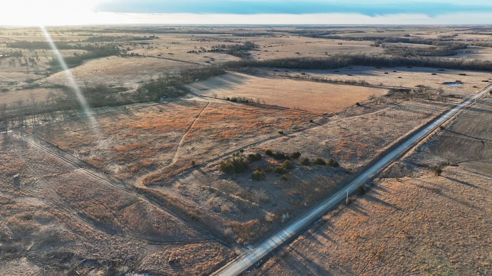
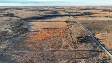
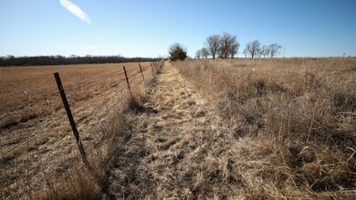
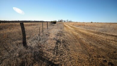
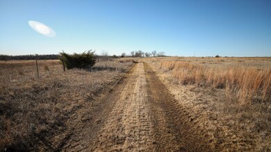
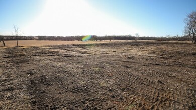
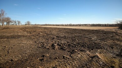
This 37 +/- acre property is located in central Morris County, Kansas. The property sets up perfectly to build your dream home and still have plenty of room to raise some livestock! The property has 20 +/- native grass pasture acres and 15 +/- native grass hay meadow acres. The native warm-season grass is primarily mixed with big bluestem, little bluestem, Indiangrass, and switchgrass. The property has above-average fencing, with some cross-fencing. The remaining 2 +/- acres have mature shade trees, two water wells with an insulated well house, and an electric meter onsite, creating the perfect future building site. The property is located on a well-maintained year-round gravel road with fiber optic cable at the road. Mineral rights are intact and will be transferred to the buyer at closing. There are no active leases or tenants' rights in place. This property is a must-see to truly appreciate the views and everything it has to offer! Contact Trent Siegle at (620) 767-2926 for additional information, disclosures, or to schedule a showing.
Property Features
-20 +/- acres native grass pasture
-15 +/- acres native grass hay meadow
-2 +/- acre building site
-Big bluestem, little bluestem, Indiangrass, and switchgrass
-Above-average barbed-wire fencing
-Primarily Irwin silty clay loam soils
-36 +/- feet of elevation change
-Whitetail deer and upland bird hunting
-Well-maintained year-round gravel road
-Electric meter and water well (2) on site
-Insulated well house with pressure tank
-Fiber optic cable at the road
-Mineral rights intact and transfer
-No active leases or tenants’ rights are in place
-2024 taxes: $714.80
-5 miles from Wilsey, KS
-14 miles from Council Grove, KS

Property Details
Property Type
- Land
Lot Details
- Current uses include hunting/fishing
Map
Home Values in the Area
Average Home Value in this Area
Tax History
| Year | Tax Paid | Tax Assessment Tax Assessment Total Assessment is a certain percentage of the fair market value that is determined by local assessors to be the total taxable value of land and additions on the property. | Land | Improvement |
|---|---|---|---|---|
| 2024 | -- | $10,855 | $2,097 | $8,758 |
| 2023 | -- | $10,380 | $2,011 | $8,369 |
| 2022 | -- | $9,848 | $1,713 | $8,135 |
| 2021 | -- | $9,455 | $1,591 | $7,864 |
| 2020 | $2,363 | $9,463 | $1,250 | $8,213 |
| 2019 | -- | -- | $2,194 | $7,884 |
| 2018 | -- | -- | $1,086 | $7,879 |
| 2017 | -- | -- | $1,026 | $8,533 |
| 2016 | -- | -- | $954 | $8,540 |
| 2015 | -- | -- | $1,212 | $8,414 |
| 2014 | -- | -- | $3,216 | $8,406 |
Property History
| Date | Event | Price | Change | Sq Ft Price |
|---|---|---|---|---|
| 07/19/2025 07/19/25 | For Sale | $169,970 | -2.6% | -- |
| 06/03/2025 06/03/25 | Price Changed | $174,565 | -5.4% | -- |
| 04/21/2025 04/21/25 | Price Changed | $184,565 | -2.7% | -- |
| 03/15/2025 03/15/25 | For Sale | $189,738 | +41.0% | -- |
| 11/20/2024 11/20/24 | Sold | -- | -- | -- |
| 07/09/2024 07/09/24 | Pending | -- | -- | -- |
| 07/08/2024 07/08/24 | For Sale | $134,520 | -- | -- |
Purchase History
| Date | Type | Sale Price | Title Company |
|---|---|---|---|
| Deed | $17,000 | -- |
- 0000 R Ave
- 0 Route 1 Unit SUN232925
- 209 N First St
- 1218 S 2600 Rd
- 124 Cottonwood Cove Unit G-5
- 350 Lake Rd Unit E-27
- 100 Limestone Bluff Unit J-23
- 821 E Stockholm St
- 314 E Stover St
- 136 Highview Point Unit IT-1
- 140 Highview Point Unit I-T0
- 104 E Shore Dr Unit R-20
- 1067 U S 56
- 1067 Us Highway 56
- 1581 F Ave
- 513 Country Ln
- 0 Country Ln Unit 22409750
- 923 T Ave
- 204 Sunset Dr
- 216 Sunset Dr