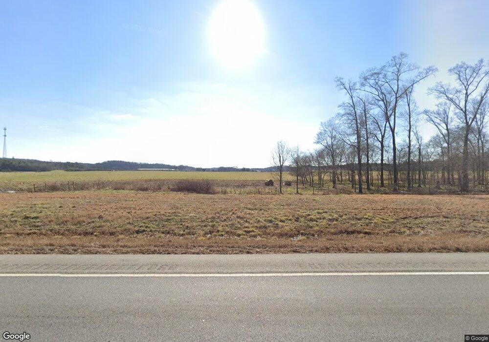
1992 Rome Rd SW Calhoun, GA 30701
Estimated Value: $328,000 - $2,133,990
3
Beds
2
Baths
2,036
Sq Ft
$535/Sq Ft
Est. Value
About This Home
This home is located at 1992 Rome Rd SW, Calhoun, GA 30701 and is currently estimated at $1,088,330, approximately $534 per square foot. 1992 Rome Rd SW is a home located in Gordon County with nearby schools including Swain Elementary School, Ashworth Middle School, and Gordon Central High School.
Ownership History
Date
Name
Owned For
Owner Type
Purchase Details
Closed on
May 1, 2025
Sold by
Bgr06 Llc
Bought by
Nwgp1006 Llc
Current Estimated Value
Purchase Details
Closed on
Dec 19, 2024
Sold by
Barrett C W
Bought by
Bgr06 Llc
Purchase Details
Closed on
Oct 25, 2024
Sold by
Barrett Charles Wayne
Bought by
Flipper Mcdaniel & Associates Inc
Create a Home Valuation Report for This Property
The Home Valuation Report is an in-depth analysis detailing your home's value as well as a comparison with similar homes in the area
Home Values in the Area
Average Home Value in this Area
Purchase History
| Date | Buyer | Sale Price | Title Company |
|---|---|---|---|
| Nwgp1006 Llc | -- | -- | |
| Nwgp1006 Llc | -- | -- | |
| Bgr06 Llc | $3,100,000 | -- | |
| Flipper Mcdaniel & Associates Inc | -- | -- | |
| Dempsey Auction Co | -- | -- | |
| Landlord Inc | -- | -- | |
| Dempsey Auction Co | -- | -- |
Source: Public Records
Tax History Compared to Growth
Tax History
| Year | Tax Paid | Tax Assessment Tax Assessment Total Assessment is a certain percentage of the fair market value that is determined by local assessors to be the total taxable value of land and additions on the property. | Land | Improvement |
|---|---|---|---|---|
| 2024 | $1,183 | $331,824 | $285,840 | $45,984 |
| 2023 | $1,059 | $328,824 | $285,840 | $42,984 |
| 2022 | $990 | $325,944 | $285,840 | $40,104 |
| 2021 | $847 | $317,904 | $285,840 | $32,064 |
| 2020 | $844 | $318,544 | $285,840 | $32,704 |
| 2019 | $830 | $322,944 | $290,240 | $32,704 |
| 2018 | $7,779 | $337,984 | $307,080 | $30,904 |
| 2017 | $699 | $335,984 | $307,080 | $28,904 |
| 2016 | $687 | $335,984 | $307,080 | $28,904 |
| 2015 | $651 | $336,664 | $308,400 | $28,264 |
| 2014 | $634 | $335,939 | $308,429 | $27,510 |
Source: Public Records
Map
Nearby Homes
- 1943 Rome Rd SW
- 301 Switch Rd SW
- 0 Reeves Station Rd SW Unit 10548197
- 0 Reeves Station Rd SW Unit 7601645
- 187 Cantrell Dr SW
- 0 Highway 53 Spur SW Unit 7529096
- 261 Liberty Ln SW
- 3293 Rome Rd SW
- 159 Moores Ferry Rd SW
- 221 Hardin Rd SW
- 121 Foxhall Dr SW
- 110 Darby Rd SW
- 176 Village Way SW
- 130 Brookstone Dr SW
- The Braselton II Plan at Fair Oak
- The Reynolds Plan at Fair Oak
- The Buford II Plan at Fair Oak
- The Lawson Plan at Fair Oak
- The Caldwell Plan at Fair Oak
- The Benson II Plan at Fair Oak
- 1973 Rome Rd SW
- 2009 Rome Rd SW
- 2031 Rome Rd SW
- 444 Switch Connector Rd SW
- 382 Switch Connector Rd SW
- 444 Switch Conn Rd SW
- 3488 Rome Rd SW
- 2073 Rome Rd SW
- 485 Switch Rd SW
- 485 Switch Connector Rd SW
- 475 Switch Rd SW
- 427 Switch Connector Rd SW
- 409 Switch Connector Rd SW
- 409 Switch Rd SW
- 125 Switch Rd SW
- 324 Switch Connector Rd SW
- 100 Switch Rd SW
- 347 Switch Connector Rd SW
- 128 Andrea Dr
- 122 Switch Rd SW
