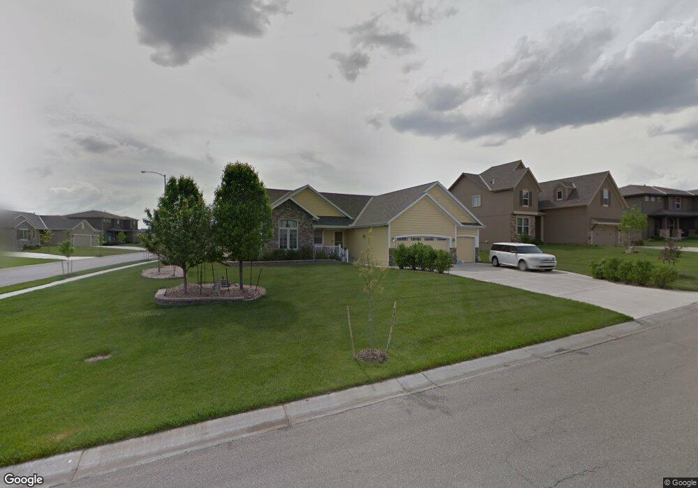
19926 Balsam St Spring Hill, KS 66083
Estimated Value: $447,368 - $509,000
3
Beds
3
Baths
1,599
Sq Ft
$301/Sq Ft
Est. Value
About This Home
This home is located at 19926 Balsam St, Spring Hill, KS 66083 and is currently estimated at $481,592, approximately $301 per square foot. 19926 Balsam St is a home located in Johnson County with nearby schools including Wolf Creek Elementary School, Spring Hill Middle School, and Spring Hill High School.
Ownership History
Date
Name
Owned For
Owner Type
Purchase Details
Closed on
Feb 1, 2010
Sold by
Dusselier & Mark Homes Inc
Bought by
Lytle Alan D and Lytle Carol R
Current Estimated Value
Home Financials for this Owner
Home Financials are based on the most recent Mortgage that was taken out on this home.
Original Mortgage
$189,375
Outstanding Balance
$5,761
Interest Rate
5.16%
Mortgage Type
New Conventional
Estimated Equity
$475,831
Create a Home Valuation Report for This Property
The Home Valuation Report is an in-depth analysis detailing your home's value as well as a comparison with similar homes in the area
Home Values in the Area
Average Home Value in this Area
Purchase History
| Date | Buyer | Sale Price | Title Company |
|---|---|---|---|
| Lytle Alan D | -- | First American Title Ins Co | |
| Dusselier & Marks Homes Inc | -- | First American Title Ins Co |
Source: Public Records
Mortgage History
| Date | Status | Borrower | Loan Amount |
|---|---|---|---|
| Open | Dusselier & Marks Homes Inc | $189,375 |
Source: Public Records
Tax History Compared to Growth
Tax History
| Year | Tax Paid | Tax Assessment Tax Assessment Total Assessment is a certain percentage of the fair market value that is determined by local assessors to be the total taxable value of land and additions on the property. | Land | Improvement |
|---|---|---|---|---|
| 2024 | $6,670 | $47,334 | $11,302 | $36,032 |
| 2023 | $5,993 | $42,366 | $9,830 | $32,536 |
| 2022 | $5,664 | $39,721 | $8,541 | $31,180 |
| 2021 | $5,419 | $36,984 | $8,137 | $28,847 |
| 2020 | $5,475 | $36,098 | $8,137 | $27,961 |
| 2019 | $5,155 | $33,959 | $7,401 | $26,558 |
| 2018 | $5,248 | $35,673 | $7,403 | $28,270 |
| 2017 | $4,916 | $33,085 | $6,166 | $26,919 |
| 2016 | $4,604 | $30,843 | $5,615 | $25,228 |
| 2015 | $4,463 | $29,866 | $5,611 | $24,255 |
| 2013 | -- | $28,486 | $5,611 | $22,875 |
Source: Public Records
Map
Nearby Homes
- 19308 W 200th St
- 19435 W 200th Terrace
- The Providence Plan at Boulder Springs
- The Martinique Plan at Boulder Springs
- The Antigua Plan at Boulder Springs
- The St Marten II Plan at Boulder Springs
- The St Marten Plan at Boulder Springs
- The Heritage Plan at Boulder Springs
- The Montego Plan at Boulder Springs
- The St Croix Plan at Boulder Springs
- 19620 W 201st St
- Chatham Plan at Woodland Crossing
- 19621 W 201st St
- Holcombe Plan at Woodland Crossing
- Bellamy Plan at Woodland Crossing
- Newcastle Plan at Woodland Crossing
- Harmony Plan at Woodland Crossing
- 19631 W 201st St
- 19485 W 202nd St
- 20174 Cornice St
- 19920 Balsam St
- 19925 Barker St
- 19407 W 199th Terrace
- 19914 Balsam St
- 19413 W 199th Terrace
- 19401 W 199th Terrace
- 19927 Balsam St
- 19921 Balsam St
- 19919 Barker St
- 19419 W 199th Terrace
- 19915 Balsam St
- 19321 W 199th Terrace
- 19913 Barker St
- 19908 Balsam St
- 19315 W 199th Terrace
- 19425 W 199th Terrace
- 19414 W 200th St
- 19408 W 200th St
- 19909 Balsam St
- 19420 W 200th St