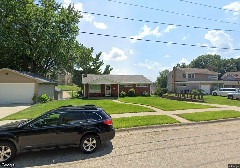
1994 Simpson St Dubuque, IA 52003
Estimated Value: $176,000 - $260,000
3
Beds
3
Baths
1,092
Sq Ft
$209/Sq Ft
Est. Value
About This Home
This home is located at 1994 Simpson St, Dubuque, IA 52003 and is currently estimated at $228,583, approximately $209 per square foot. 1994 Simpson St is a home located in Dubuque County with nearby schools including Bryant Elementary School, George Washington Middle School, and Dubuque Senior High School.
Ownership History
Date
Name
Owned For
Owner Type
Purchase Details
Closed on
May 10, 2024
Sold by
Scheppele Helen Joan and Scheppele Helen Joan
Bought by
Kramer Nolan R
Current Estimated Value
Home Financials for this Owner
Home Financials are based on the most recent Mortgage that was taken out on this home.
Original Mortgage
$134,000
Outstanding Balance
$132,121
Interest Rate
6.88%
Mortgage Type
New Conventional
Estimated Equity
$96,462
Create a Home Valuation Report for This Property
The Home Valuation Report is an in-depth analysis detailing your home's value as well as a comparison with similar homes in the area
Home Values in the Area
Average Home Value in this Area
Purchase History
| Date | Buyer | Sale Price | Title Company |
|---|---|---|---|
| Kramer Nolan R | $167,500 | None Listed On Document |
Source: Public Records
Mortgage History
| Date | Status | Borrower | Loan Amount |
|---|---|---|---|
| Open | Kramer Nolan R | $134,000 |
Source: Public Records
Tax History Compared to Growth
Tax History
| Year | Tax Paid | Tax Assessment Tax Assessment Total Assessment is a certain percentage of the fair market value that is determined by local assessors to be the total taxable value of land and additions on the property. | Land | Improvement |
|---|---|---|---|---|
| 2025 | $3,010 | $205,700 | $49,100 | $156,600 |
| 2024 | $3,010 | $209,300 | $46,800 | $162,500 |
| 2023 | $2,776 | $209,300 | $46,800 | $162,500 |
| 2022 | $2,704 | $172,460 | $39,780 | $132,680 |
| 2021 | $2,704 | $172,460 | $39,780 | $132,680 |
| 2020 | $2,578 | $153,760 | $39,780 | $113,980 |
| 2019 | $2,494 | $153,760 | $39,780 | $113,980 |
| 2018 | $2,452 | $142,610 | $32,760 | $109,850 |
| 2017 | $2,512 | $142,610 | $32,760 | $109,850 |
| 2016 | $2,458 | $138,630 | $32,760 | $105,870 |
| 2015 | $2,458 | $138,630 | $32,760 | $105,870 |
| 2014 | $2,298 | $133,590 | $32,760 | $100,830 |
Source: Public Records
Map
Nearby Homes
- 1985 Marion St
- 190 Bradley St
- 17 Jenni St
- 222 S Grandview Ave
- 224 S Grandview Ave
- 1993 Hale St
- 130 Devon Dr
- 615 S Grandview Ave
- 1727 Overview Ct
- 135 State St
- 760 S Grandview Ave
- 172 Bryant St
- 229 N Booth St
- 2620 Knob Hill Dr
- 2625 New Haven St
- 392 Glen Oak St
- 670 Duggan Dr
- 1362 W 5th St
- 1110 Langworthy St
- 375 Alpine St
- 2000 Simpson St
- 1988 Simpson St
- 2050 Simpson St
- 375 Fremont Ave
- 1950 Simpson St
- 2070 Simpson St
- 377 Fremont Ave
- 1995 Simpson St
- 2005 Simpson St
- 1921 Simpson St
- 2025 Simpson St
- 1985 Simpson St
- 2084 Simpson St
- 2055 Simpson St
- 379 Fremont Ave
- 2086 Simpson St
- 2065 Simpson St
- 275 Fremont Ave
- 2095 Simpson St
- 381 Fremont Ave