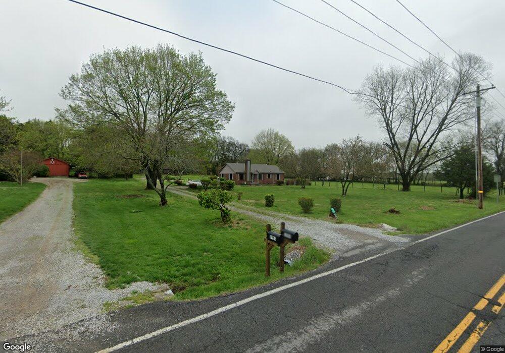
1994 Wilson Pike Franklin, TN 37067
Estimated Value: $730,000 - $1,099,683
--
Bed
1
Bath
1,376
Sq Ft
$665/Sq Ft
Est. Value
About This Home
This home is located at 1994 Wilson Pike, Franklin, TN 37067 and is currently estimated at $914,921, approximately $664 per square foot. 1994 Wilson Pike is a home located in Williamson County with nearby schools including Trinity Elementary School, Fred J. Page Middle School, and Fred J. Page High School.
Ownership History
Date
Name
Owned For
Owner Type
Purchase Details
Closed on
Dec 10, 2012
Sold by
Amis Margaret S
Bought by
Weaver Steven L and Weaver Diane M
Current Estimated Value
Home Financials for this Owner
Home Financials are based on the most recent Mortgage that was taken out on this home.
Original Mortgage
$285,000
Outstanding Balance
$198,108
Interest Rate
3.44%
Mortgage Type
New Conventional
Estimated Equity
$716,813
Purchase Details
Closed on
Jun 9, 2010
Sold by
Amis Roy C and Estate Of Martha Jamison
Bought by
Amis Roy C and Amis Margaret S
Create a Home Valuation Report for This Property
The Home Valuation Report is an in-depth analysis detailing your home's value as well as a comparison with similar homes in the area
Home Values in the Area
Average Home Value in this Area
Purchase History
| Date | Buyer | Sale Price | Title Company |
|---|---|---|---|
| Weaver Steven L | $300,000 | Southland Title & Escrow Co | |
| Amis Roy C | -- | None Available |
Source: Public Records
Mortgage History
| Date | Status | Borrower | Loan Amount |
|---|---|---|---|
| Open | Weaver Steven L | $285,000 |
Source: Public Records
Tax History Compared to Growth
Tax History
| Year | Tax Paid | Tax Assessment Tax Assessment Total Assessment is a certain percentage of the fair market value that is determined by local assessors to be the total taxable value of land and additions on the property. | Land | Improvement |
|---|---|---|---|---|
| 2024 | $2,579 | $137,200 | $123,100 | $14,100 |
| 2023 | $2,579 | $137,200 | $123,100 | $14,100 |
| 2022 | $2,579 | $137,200 | $123,100 | $14,100 |
| 2021 | $2,579 | $137,200 | $123,100 | $14,100 |
| 2020 | $1,760 | $79,300 | $64,225 | $15,075 |
| 2019 | $1,760 | $79,300 | $64,225 | $15,075 |
| 2018 | $1,705 | $79,300 | $64,225 | $15,075 |
| 2017 | $1,705 | $79,300 | $64,225 | $15,075 |
| 2016 | $0 | $79,300 | $64,225 | $15,075 |
| 2015 | -- | $63,075 | $49,400 | $13,675 |
| 2014 | -- | $63,075 | $49,400 | $13,675 |
Source: Public Records
Map
Nearby Homes
- 4160 Clovercroft Rd
- 4165 Clovercroft Rd
- 0 Lasata Unit RTC2787689
- 1820 Lanceford Ct
- 9065 Chardonnay Trace
- 1055 Amelia Park Dr
- 1068 Amelia Park Dr
- 1607 Sand Dollar Ct
- 1006 Dovecrest Way
- 1132 Amelia Park Dr
- 1407 Hanson Dr
- 109 Bayhill Cir
- 1929 Springcroft Dr
- 6060 Lookaway Cir
- 6035 Lookaway Cir
- 6001 Poplar Farms Dr
- 1422 Marrimans Ct
- 5049 Poplar Farms Dr
- 5043 Poplar Farms Dr
- 5037 Poplar Farms Dr
- 1990 Wilson Pike
- 2000 Wilson Pike
- 2005 Wilson Pike
- 1978 Wilson Pike
- 1974 Wilson Pike
- 4178 Clovercroft Rd
- 4033 Clovercroft Rd
- 2001 Wilson Pike
- 0 Clovercroft Rd
- 2008 Wilson Pike
- 1968 Wilson Pike
- 5029 Blackjack Dr
- 5029 Blackjack Dr
- 3110 Butternut Dr
- 3110 Butternut Dr
- 5024 Blackjack Dr Unit 614*
- 5024 Blackjack Dr
- 3114 Butternut Dr
- 2009 Wilson Pike
- 3114 Butternut Dr