NOT LISTED FOR SALE

1995 Mansfield Washington Rd Mansfield, OH 44903

34.55 Acres
-- Price per Acre
1,504,998 Sq Ft Lot

Last Sold January 27, 2023

Last sale price $232,450

97 Days on Market

Highlights

  • Horses Allowed On Property
  • Partially Wooded Lot
  • Gentle Sloping Lot
  • 34.55 Acre Lot
  • Pasture

About This Lot

As of January 2023

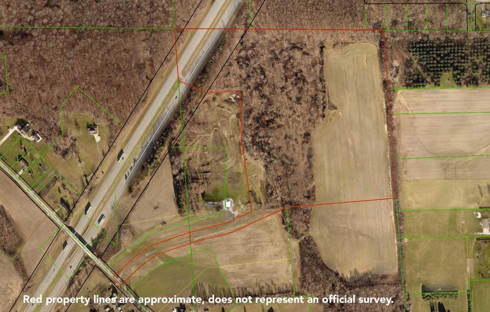
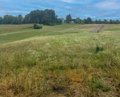
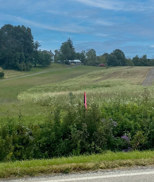
34.55 Acres of land to build your dream home. Just minutes from I-71 access. Wooded, pasture, and tillable land.

Last Agent to Sell the Property

Nate Haring

Haring Realty Inc Brokerage Phone: 4197568383 License #2016005534 Listed on: 09/28/2022

Last Buyer's Agent

Out of Board Agent

Coldwell Banker Mattox McCleery REALTORS

Property Details

Property Type

  • Land

Est. Annual Taxes

  • $502

Lot Details

  • 34.55 Acre Lot
  • Irregular Lot
  • Gentle Sloping Lot
  • Partially Wooded Lot
  • Landscaped with Trees

Farming

  • Tillable Land
  • Pasture

Horse Facilities and Amenities

  • Horses Allowed On Property

Utilities

  • No Utilities
  • Well

Listing and Financial Details

  • Tax Lot SW 1.04 AC
  • Assessor Parcel Number 0543815406000

Property Details

Property Type

Land

Est. Annual Taxes

$502

Lot Details

0

Listing Details

  • Property Sub Type: Unimproved Land
  • Prop. Type: Land
  • Horses: Yes
  • Lot Size Acres: 34.55
  • Directions: State Route 13 to E. Cook Rd. to Mansfield-Washington Rd. (just north of 1983 Mansfield Washington Rd.)
  • Attribution Contact: 4197568383
  • NAV43_Flood_Plain: No
  • NAV43_rets_property_type: Land
  • NAV43_Septic_Aprvl: No
  • Special Features: None

Interior Features

  • Possible Use: Cattle, Horses, Timber, Farm, Recreational, Construction Lot

Exterior Features

  • Lot Features: Tillable, Wooded, Irregular Lot, Pasture, Trees
  • Topography: Gently Rolling

Utilities

  • Sewer: Septic
  • Utilities: None
  • Water Source: Well

Condo/Co-op/Association

  • Association Fee Frequency: Annually

Schools

  • Junior High Dist: Madison Local School District

Lot Info

  • Lot Size Sq Ft: 1504998
  • Farm Land Area Units: Square Feet
  • Parcel #: 0543815406000

Tax Info

  • Tax Annual Amount: 502.26
  • Tax Lot: SW 1.04 AC

Range of Values:

--
Value Increase
--
Percent Increase
--
Adjusted for Inflation
Collateral Analytics

Collateral Analytics Collateral Analytics AVMs (Automated Valuation Model) employ a number of statistical approaches combined with neighborhood-specific comparable selection guarantees the most up-to-date and precise valuations.

Not Available

Collateral Analytics does not have data for the current month. Please view the chart for historical values.

ICE

ICE Mortgage Technology ICE Mortgage Technology’s AVM (Automated Valuation Model) is a state-of-the-art online residential property valuation tool that provides a quick and accurate estimate of the value of almost any home in the U.S.

Not Available

ICE Mortgage Technology does not have data for the current month. Please view the chart for historical values.

First American

First American First American Data & Analytics’ next-generation AVM combines unrivaled data assets with a blended ensemble of valuation models to produce highly accurate, reliable valuations you can trust.

Not Available

First American does not have data for the current month. Please view the chart for historical values.

Quantarium

Quantarium Quantarium’s valuation service, repeatedly proven the industry’s most accurate and comprehensive, is supercharged with a self-learning and auto-tuning AI engine that continually becomes smarter and more accurate as it processes daily inputs from the industry’s leading RE data lake.

Not Available

Quantarium does not have data for the current month. Please view the chart for historical values.

Average Value
Not Available
List Price
Sold Price
Create a Home Valuation Report for This Property
The Home Valuation Report is an in-depth analysis detailing your home's value as well as a comparison with similar homes in the area

Home Values in the Area

Source: Public Records

Average Home Value in this Area


Source: Public Records

Property History

Date Event Price List to Sale Price per Sq Ft
01/27/2023 01/27/23 Sold $232,450 -19.6% --
01/04/2023 01/04/23 Pending -- -- --
12/29/2022 12/29/22 Price Changed $289,000 0.0% --
12/29/2022 12/29/22 For Sale $289,000 +24.3% --
12/29/2022 12/29/22 Off Market $232,450 -- --
09/28/2022 09/28/22 For Sale $309,900 -- --
Source: Ashland Board of REALTORS®

Tax History Compared to Growth

Source: Public Records

Agents Affiliated with this Home

  • Section Image
See All Agents

Map

Source: Ashland Board of REALTORS®

MLS Number: 225566