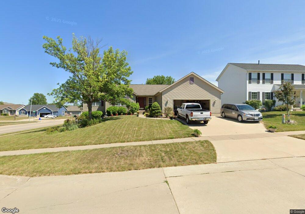
1995 Sugaridge Dr Marion, IA 52302
Estimated Value: $334,000 - $386,000
3
Beds
5
Baths
1,992
Sq Ft
$182/Sq Ft
Est. Value
About This Home
This home is located at 1995 Sugaridge Dr, Marion, IA 52302 and is currently estimated at $363,123, approximately $182 per square foot. 1995 Sugaridge Dr is a home located in Linn County with nearby schools including Wilkins Elementary School, Excelsior Middle School, and Linn-Mar High School.
Ownership History
Date
Name
Owned For
Owner Type
Purchase Details
Closed on
Sep 12, 2003
Sold by
Federal Home Loan Mortgage Corporation
Bought by
Freese Robert A and Freese Patricia K
Current Estimated Value
Purchase Details
Closed on
Sep 5, 2003
Sold by
Firstar Bank Na
Bought by
Federal Home Loan Mortgage Corporation
Purchase Details
Closed on
Feb 26, 2003
Sold by
Baca Linda Christine and Midwest Lawn Co & Overhead Doo
Bought by
Firstar Bank Na and First National Bank Iowa
Purchase Details
Closed on
Oct 3, 1997
Sold by
Midwest Development Co
Bought by
Baca Linda Christine
Home Financials for this Owner
Home Financials are based on the most recent Mortgage that was taken out on this home.
Original Mortgage
$187,200
Interest Rate
7.37%
Create a Home Valuation Report for This Property
The Home Valuation Report is an in-depth analysis detailing your home's value as well as a comparison with similar homes in the area
Home Values in the Area
Average Home Value in this Area
Purchase History
| Date | Buyer | Sale Price | Title Company |
|---|---|---|---|
| Freese Robert A | -- | -- | |
| Federal Home Loan Mortgage Corporation | -- | -- | |
| Firstar Bank Na | $234,060 | Iowa Title Company | |
| Baca Linda Christine | $208,500 | -- |
Source: Public Records
Mortgage History
| Date | Status | Borrower | Loan Amount |
|---|---|---|---|
| Previous Owner | Baca Linda Christine | $187,200 |
Source: Public Records
Tax History Compared to Growth
Tax History
| Year | Tax Paid | Tax Assessment Tax Assessment Total Assessment is a certain percentage of the fair market value that is determined by local assessors to be the total taxable value of land and additions on the property. | Land | Improvement |
|---|---|---|---|---|
| 2025 | $5,634 | $358,000 | $40,200 | $317,800 |
| 2024 | $5,872 | $317,100 | $40,200 | $276,900 |
| 2023 | $5,872 | $317,100 | $40,200 | $276,900 |
| 2022 | $5,596 | $273,500 | $40,200 | $233,300 |
| 2021 | $5,822 | $273,500 | $40,200 | $233,300 |
| 2020 | $5,822 | $267,000 | $40,200 | $226,800 |
| 2019 | $5,438 | $249,600 | $40,200 | $209,400 |
| 2018 | $5,224 | $249,600 | $40,200 | $209,400 |
| 2017 | $5,258 | $245,200 | $42,300 | $202,900 |
| 2016 | $5,292 | $245,200 | $42,300 | $202,900 |
| 2015 | $5,273 | $245,200 | $42,300 | $202,900 |
| 2014 | $5,086 | $245,200 | $42,300 | $202,900 |
| 2013 | $4,852 | $245,200 | $42,300 | $202,900 |
Source: Public Records
Map
Nearby Homes
- 1930 39th St
- 1805 Sugaridge Dr
- 2130 Rosewood Ridge Dr
- 3660 Jonquil Ct
- 4040 Willowood Ave
- 4390 Mcgowan Blvd
- 2370 Spoonbill Dr
- 4315 Snowgoose Dr
- 3480 Mcgowan Blvd
- 3605 Windemere Way
- 892 35th St
- 3490 Willowridge Rd Unit D
- 1340 38th Street Place
- 1350 44th St Unit C St
- 1370 44th St
- 1280 44th St Unit C
- 3485 Willowridge Rd Unit B
- 1300 35th St
- 1905 Charleston Dr
- 4413 Surrey Ct
- 1955 Sugaridge Dr
- 1980 41st St
- 2010 Pike Ct
- 1925 Sugaridge Dr
- 1960 41st St
- 1990 Sugaridge Dr
- 2015 Winchester Dr
- 1950 Sugaridge Dr
- 1940 41st St
- 1905 Sugaridge Dr
- 2015 Pike Ct
- 2060 Pike Ct
- 1920 Sugaridge Dr
- 1920 41st St
- 2035 Winchester Dr
- 1885 Sugaridge Dr
- 1900 Sugaridge Dr
- 2065 Pike Ct
- 1985 41st St
- 1890 41st St