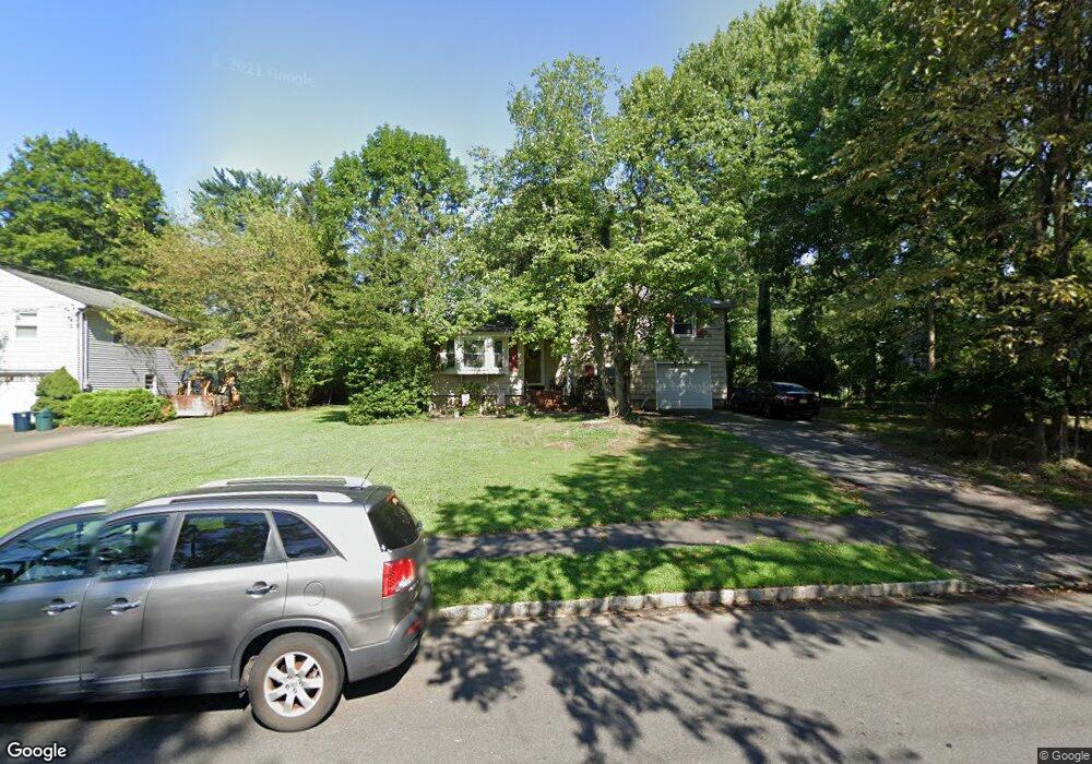
1995 W Broad St Scotch Plains, NJ 07076
Estimated Value: $562,319 - $864,000
--
Bed
--
Bath
1,565
Sq Ft
$447/Sq Ft
Est. Value
About This Home
This home is located at 1995 W Broad St, Scotch Plains, NJ 07076 and is currently estimated at $698,830, approximately $446 per square foot. 1995 W Broad St is a home located in Union County with nearby schools including William J. McGinn Elementary School, Terrill Middle School, and Scotch Plains-Fanwood High School.
Ownership History
Date
Name
Owned For
Owner Type
Purchase Details
Closed on
Nov 29, 2016
Sold by
Spies Susan
Bought by
1995 West Broad Llc
Current Estimated Value
Create a Home Valuation Report for This Property
The Home Valuation Report is an in-depth analysis detailing your home's value as well as a comparison with similar homes in the area
Home Values in the Area
Average Home Value in this Area
Purchase History
| Date | Buyer | Sale Price | Title Company |
|---|---|---|---|
| 1995 West Broad Llc | $10 | -- |
Source: Public Records
Tax History Compared to Growth
Tax History
| Year | Tax Paid | Tax Assessment Tax Assessment Total Assessment is a certain percentage of the fair market value that is determined by local assessors to be the total taxable value of land and additions on the property. | Land | Improvement |
|---|---|---|---|---|
| 2025 | $12,015 | $102,100 | $35,400 | $66,700 |
| 2024 | $11,661 | $102,100 | $35,400 | $66,700 |
| 2023 | $11,661 | $102,100 | $35,400 | $66,700 |
| 2022 | $11,522 | $102,100 | $35,400 | $66,700 |
| 2021 | $11,503 | $102,100 | $35,400 | $66,700 |
| 2020 | $11,447 | $102,100 | $35,400 | $66,700 |
| 2019 | $11,363 | $102,100 | $35,400 | $66,700 |
| 2018 | $11,172 | $102,100 | $35,400 | $66,700 |
| 2017 | $10,924 | $102,100 | $35,400 | $66,700 |
| 2016 | $10,713 | $102,100 | $35,400 | $66,700 |
| 2015 | $10,538 | $102,100 | $35,400 | $66,700 |
| 2014 | $10,191 | $102,100 | $35,400 | $66,700 |
Source: Public Records
Map
Nearby Homes
- 1933 W Broad St
- 1933 Mary Ellen Ln
- 2 Brookside Ct
- 2154 W Broad St
- 2116 Newark Ave
- 119 Lamberts Mill Rd
- 187 King St
- 1466 Lamberts Mill Rd
- 57 Rambling Dr
- 314 Highgate Ave
- 5 Robin Rd
- 2212 Shady Ln
- 120 S Martine Ave
- 2 Dutch Ln
- 345 La Grande Ave
- 2219 North Ave Unit 6
- 2314 Longfellow Ave
- 40 1st St
- 1380 Terrill Rd
- 21 Old South Ave
- 1985 W Broad St
- 2005 W Broad St
- 1990 Mary Beth Ct
- 1980 Mary Beth Ct
- 2009 W Broad St
- 1996 W Broad St
- 1975 W Broad St
- 2000 W Broad St
- 2000 Mary Beth Ct
- 2010 W Broad St
- 1988 W Broad St
- 1278 White Oak Rd
- 2015 W Broad St
- 1970 Mary Beth Ct
- 1982 W Broad St
- 1276 White Oak Rd
- 2016 W Broad St
- 2021 W Broad St
- 1995 Mary Beth Ct
- 1965 W Broad St