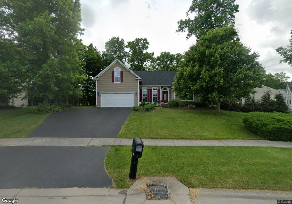
1996 Stablegate Dr Canandaigua, NY 14424
Estimated Value: $425,000 - $550,000
4
Beds
3
Baths
2,352
Sq Ft
$206/Sq Ft
Est. Value
About This Home
This home is located at 1996 Stablegate Dr, Canandaigua, NY 14424 and is currently estimated at $485,288, approximately $206 per square foot. 1996 Stablegate Dr is a home located in Ontario County with nearby schools including Canandaigua Primary-Elementary School, Canandaigua Middle School, and Canandaigua Academy.
Ownership History
Date
Name
Owned For
Owner Type
Purchase Details
Closed on
Oct 15, 2013
Sold by
Fox Donald
Bought by
Fox Bonnie Sue
Current Estimated Value
Purchase Details
Closed on
Dec 21, 2007
Sold by
Nvr Inc
Bought by
Fox Donald F
Home Financials for this Owner
Home Financials are based on the most recent Mortgage that was taken out on this home.
Original Mortgage
$194,843
Interest Rate
5.94%
Purchase Details
Closed on
Sep 21, 2007
Sold by
A & D Development Company
Bought by
Nvr Inc
Create a Home Valuation Report for This Property
The Home Valuation Report is an in-depth analysis detailing your home's value as well as a comparison with similar homes in the area
Home Values in the Area
Average Home Value in this Area
Purchase History
| Date | Buyer | Sale Price | Title Company |
|---|---|---|---|
| Fox Bonnie Sue | $40,000 | Mary Walpole-Lightsey | |
| Fox Donald F | $269,865 | -- | |
| Nvr Inc | $117,000 | Robert Vigdor |
Source: Public Records
Mortgage History
| Date | Status | Borrower | Loan Amount |
|---|---|---|---|
| Open | Fox Bonnie S | $10,550 | |
| Closed | Fox Bonnie S | $2,120 | |
| Closed | Fox Donald F | $194,843 |
Source: Public Records
Tax History Compared to Growth
Tax History
| Year | Tax Paid | Tax Assessment Tax Assessment Total Assessment is a certain percentage of the fair market value that is determined by local assessors to be the total taxable value of land and additions on the property. | Land | Improvement |
|---|---|---|---|---|
| 2024 | $9,641 | $405,000 | $44,600 | $360,400 |
| 2023 | $9,698 | $405,000 | $44,600 | $360,400 |
| 2022 | $8,443 | $286,200 | $44,600 | $241,600 |
| 2021 | $8,222 | $286,200 | $44,600 | $241,600 |
| 2020 | $7,472 | $286,200 | $44,600 | $241,600 |
| 2019 | $0 | $286,200 | $44,600 | $241,600 |
| 2018 | $7,395 | $286,200 | $44,600 | $241,600 |
| 2017 | $0 | $275,000 | $44,600 | $230,400 |
| 2016 | $7,073 | $275,000 | $44,600 | $230,400 |
| 2015 | -- | $275,000 | $44,600 | $230,400 |
| 2014 | -- | $275,000 | $44,600 | $230,400 |
Source: Public Records
Map
Nearby Homes
- 5838 Walnut Dr
- 5555 Purdy Rd
- 5780 Mountain Ash Dr
- 1727 Ackerman Way
- 1601 Clovertrail Dr
- 1612 Wheatstone Dr
- 1720 Swallowtail Dr
- 1601 Flaxen Dr
- Tupelo Plan at Farmbrook
- Hazel Plan at Farmbrook
- Dogwood Plan at Farmbrook
- Cedar Plan at Farmbrook
- 6049 Amber Dr
- 6139 Caleb Ct
- 6137 Caleb Ct
- 6127 Caleb Ct
- 6109 Caleb Ct
- 6114 Caleb Ct
- 6103 Caleb Ct
- Elite XII Plan at Fieldstone Estates North
- 1998 Stablegate Dr
- 6011 Palomino Ct
- 6017 Palomino Ct
- 2000 Stablegate Dr
- 1993 Stablegate Dr
- 2008 Stablegate Dr
- 2001 Stablegate Dr
- 6023 Palomino Ct
- 1985 Stablegate Dr
- 5988 Palomino Ct
- 2014 Stablegate Dr
- 6029 Palomino Ct
- 6000 Palomino Ct
- 5994 Palomino Ct
- 1977 Stablegate Dr
- 2017 Stablegate Dr
- 2020 Stablegate Dr
- 1980 Stablegate Dr
- 1969 Stablegate Dr
- 2025 Stablegate Dr