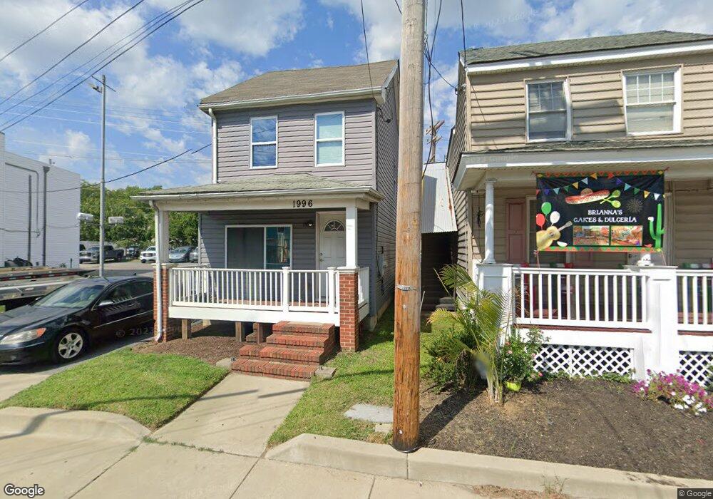
1996 West St Annapolis, MD 21401
Forest Villa NeighborhoodEstimated Value: $269,824
--
Bed
1
Bath
1,158
Sq Ft
$233/Sq Ft
Est. Value
About This Home
This home is located at 1996 West St, Annapolis, MD 21401 and is currently estimated at $269,824, approximately $233 per square foot. 1996 West St is a home located in Anne Arundel County with nearby schools including Walter S. Mills-Parole Elementary School, Annapolis Middle School, and Annapolis High School.
Ownership History
Date
Name
Owned For
Owner Type
Purchase Details
Closed on
Jan 14, 2014
Sold by
Savoy Loretta and Estate Of Lillian Burgess Scho
Bought by
Bharti Llc
Current Estimated Value
Home Financials for this Owner
Home Financials are based on the most recent Mortgage that was taken out on this home.
Original Mortgage
$127,500
Outstanding Balance
$96,550
Interest Rate
4.47%
Mortgage Type
Amount Keyed Is An Aggregate Amount
Estimated Equity
$173,274
Purchase Details
Closed on
Oct 24, 2008
Sold by
Burgess Lillian
Bought by
Savory Loretta
Purchase Details
Closed on
Apr 14, 2007
Sold by
Burgess Lillian
Bought by
Savory Loretta and Estate Of Lillian Burgess
Create a Home Valuation Report for This Property
The Home Valuation Report is an in-depth analysis detailing your home's value as well as a comparison with similar homes in the area
Home Values in the Area
Average Home Value in this Area
Purchase History
| Date | Buyer | Sale Price | Title Company |
|---|---|---|---|
| Bharti Llc | $165,000 | Eagle Title Llc | |
| Savory Loretta | -- | -- | |
| Savory Loretta | -- | -- |
Source: Public Records
Mortgage History
| Date | Status | Borrower | Loan Amount |
|---|---|---|---|
| Open | Bharti Llc | $127,500 |
Source: Public Records
Tax History Compared to Growth
Tax History
| Year | Tax Paid | Tax Assessment Tax Assessment Total Assessment is a certain percentage of the fair market value that is determined by local assessors to be the total taxable value of land and additions on the property. | Land | Improvement |
|---|---|---|---|---|
| 2025 | $5,333 | $408,167 | -- | -- |
| 2024 | $5,333 | $371,133 | $0 | $0 |
| 2023 | $4,798 | $334,100 | $333,100 | $1,000 |
| 2022 | $4,595 | $326,100 | $0 | $0 |
| 2021 | $4,372 | $318,100 | $0 | $0 |
| 2020 | $4,372 | $310,100 | $309,100 | $1,000 |
| 2019 | $4,265 | $302,233 | $0 | $0 |
| 2018 | $4,095 | $294,367 | $0 | $0 |
| 2017 | $3,739 | $286,500 | $0 | $0 |
| 2016 | -- | $270,633 | $0 | $0 |
| 2015 | -- | $254,767 | $0 | $0 |
| 2014 | -- | $238,900 | $0 | $0 |
Source: Public Records
Map
Nearby Homes
- 8 Dorsey Ave
- 14 A Dorsey Ave
- 9 Bunche St
- 25 Dorsey Ave
- 27 Dorsey Ave
- 1971 Dominoe Rd
- 201 Bowie Ave
- 1915 Towne Centre Blvd Unit 1004
- 1915 Towne Centre Blvd Unit 606
- 1915 Towne Centre Blvd Unit 1210
- 1915 Towne Centre Blvd Unit 306
- 1915 Towne Centre Blvd Unit 1001
- 1915 Towne Centre Blvd Unit 405 & 406
- 1915 Towne Centre Blvd Unit 301
- 1915 Towne Centre Blvd Unit 402
- 1915 Towne Centre Blvd Unit 807
- 1915 Towne Centre Blvd Unit 502
- 812 Francis Harris Place
- 606 James Walker Place
- 10 N Homeland Ave