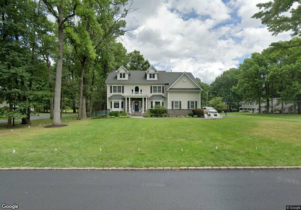
1996 Wood Rd Scotch Plains, NJ 07076
Estimated Value: $1,420,373 - $1,688,000
--
Bed
--
Bath
3,737
Sq Ft
$428/Sq Ft
Est. Value
About This Home
This home is located at 1996 Wood Rd, Scotch Plains, NJ 07076 and is currently estimated at $1,600,843, approximately $428 per square foot. 1996 Wood Rd is a home located in Union County with nearby schools including William J. McGinn Elementary School, Terrill Middle School, and Scotch Plains-Fanwood High School.
Ownership History
Date
Name
Owned For
Owner Type
Purchase Details
Closed on
Mar 31, 2011
Sold by
Mastroianni John and Mastroianni Ralph
Bought by
Atkins Gregory T and Atkins Kimberly A
Current Estimated Value
Home Financials for this Owner
Home Financials are based on the most recent Mortgage that was taken out on this home.
Original Mortgage
$963,200
Outstanding Balance
$655,123
Interest Rate
4.5%
Mortgage Type
New Conventional
Estimated Equity
$945,720
Purchase Details
Closed on
Jan 25, 2010
Sold by
Bips George J
Bought by
Mastroianni John and Mastroianni Ralph
Create a Home Valuation Report for This Property
The Home Valuation Report is an in-depth analysis detailing your home's value as well as a comparison with similar homes in the area
Home Values in the Area
Average Home Value in this Area
Purchase History
| Date | Buyer | Sale Price | Title Company |
|---|---|---|---|
| Atkins Gregory T | $1,204,000 | Chicago Title Insurance Co | |
| Mastroianni John | $460,000 | First American Title Ins Co |
Source: Public Records
Mortgage History
| Date | Status | Borrower | Loan Amount |
|---|---|---|---|
| Open | Atkins Gregory T | $963,200 |
Source: Public Records
Tax History Compared to Growth
Tax History
| Year | Tax Paid | Tax Assessment Tax Assessment Total Assessment is a certain percentage of the fair market value that is determined by local assessors to be the total taxable value of land and additions on the property. | Land | Improvement |
|---|---|---|---|---|
| 2025 | $30,067 | $255,500 | $54,000 | $201,500 |
| 2024 | $29,181 | $255,500 | $54,000 | $201,500 |
| 2023 | $29,181 | $255,500 | $54,000 | $201,500 |
| 2022 | $28,833 | $255,500 | $54,000 | $201,500 |
| 2021 | $28,785 | $255,500 | $54,000 | $201,500 |
| 2020 | $28,422 | $253,500 | $54,000 | $199,500 |
| 2019 | $28,212 | $253,500 | $54,000 | $199,500 |
| 2018 | $27,738 | $253,500 | $54,000 | $199,500 |
| 2017 | $27,122 | $253,500 | $54,000 | $199,500 |
| 2016 | $26,600 | $253,500 | $54,000 | $199,500 |
| 2015 | $26,164 | $253,500 | $54,000 | $199,500 |
| 2014 | $25,302 | $248,100 | $54,000 | $194,100 |
Source: Public Records
Map
Nearby Homes
- 2 Brookside Ct
- 1466 Lamberts Mill Rd
- 2154 W Broad St
- 119 Lamberts Mill Rd
- 314 Highgate Ave
- 1933 W Broad St
- 1933 Mary Ellen Ln
- 2 Dutch Ln
- 2116 Newark Ave
- 57 Rambling Dr
- 525 Edgar Rd
- 524 Edgar Rd
- 614 Dorian Rd
- 2 Unami Ln
- 676 Vermont St
- 2212 Shady Ln
- 187 King St
- 724 South Ave W Unit 724A
- 1840 Raritan Rd
- 1840 Lake Ave
- 2002 Wood Rd
- 2071 Oakhill Rd
- 2070 Oakhill Rd
- 2042 Parkwood Dr
- 1991 Wood Rd
- 2006 Wood Rd
- 2041 Parkwood Dr
- 2081 Oakhill Rd
- 2080 Oakhill Rd
- 2032 Parkwood Dr
- 1420 Golf St
- 1985 Wood Rd
- 1984 Wood Rd
- 2060 Brookside Dr
- 2031 Parkwood Dr
- 2091 Oakhill Rd
- 1412 Golf St
- 2042 Brookside Dr
- 1978 Wood Rd
- 1440 Golf St