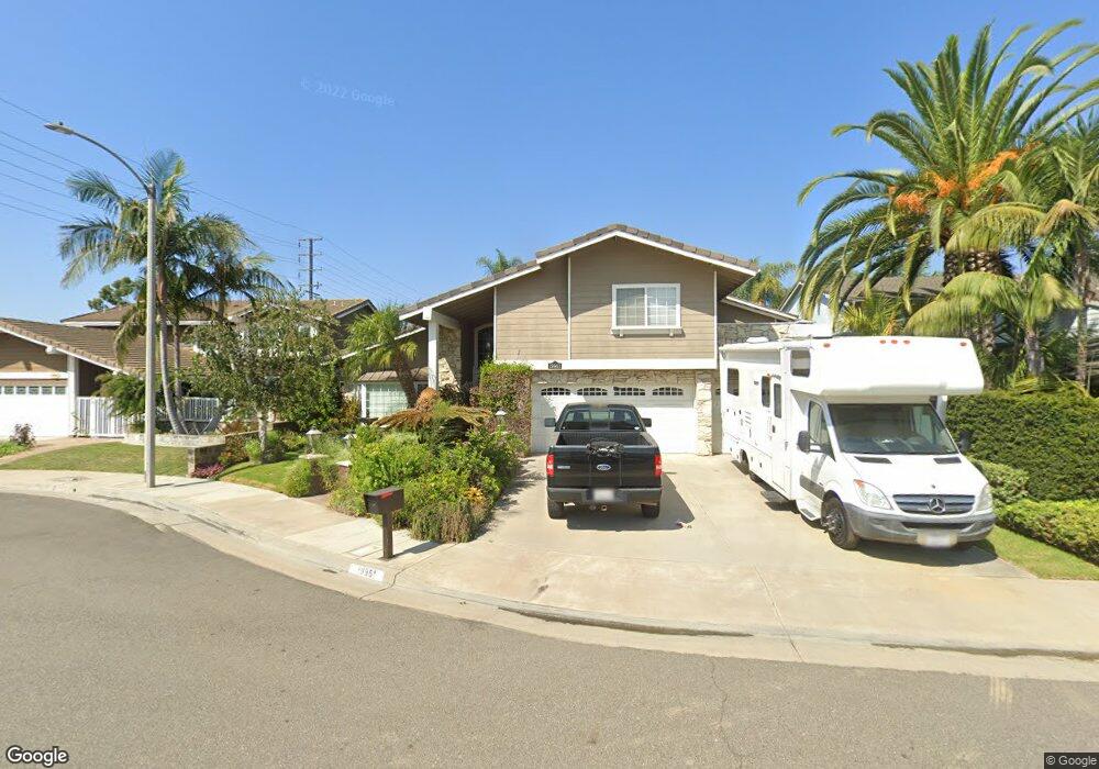
19961 Cato Cir Huntington Beach, CA 92646
Estimated Value: $1,720,000 - $1,839,000
4
Beds
3
Baths
2,072
Sq Ft
$850/Sq Ft
Est. Value
About This Home
This home is located at 19961 Cato Cir, Huntington Beach, CA 92646 and is currently estimated at $1,760,270, approximately $849 per square foot. 19961 Cato Cir is a home located in Orange County with nearby schools including John R. Peterson Elementary, Ethel Dwyer Middle, and Huntington Beach High School.
Ownership History
Date
Name
Owned For
Owner Type
Purchase Details
Closed on
Mar 23, 2004
Sold by
Ruff Ronald and Schmidt Toni
Bought by
Ruff Ronald K and Schmidt Toni
Current Estimated Value
Home Financials for this Owner
Home Financials are based on the most recent Mortgage that was taken out on this home.
Original Mortgage
$507,200
Interest Rate
5.57%
Mortgage Type
New Conventional
Purchase Details
Closed on
Mar 29, 2002
Sold by
Derobbio Joseph A
Bought by
Ruff Ronald and Schmidt Toni
Home Financials for this Owner
Home Financials are based on the most recent Mortgage that was taken out on this home.
Original Mortgage
$500,000
Interest Rate
6.87%
Purchase Details
Closed on
Mar 26, 2002
Sold by
Derobbio Joseph A and Derobbio Dolores
Bought by
Derobbio Joseph A
Home Financials for this Owner
Home Financials are based on the most recent Mortgage that was taken out on this home.
Original Mortgage
$500,000
Interest Rate
6.87%
Purchase Details
Closed on
Jul 9, 2001
Sold by
Derobbio Joseph A
Bought by
Derobbio Joseph A and Derobbio Dolores
Home Financials for this Owner
Home Financials are based on the most recent Mortgage that was taken out on this home.
Original Mortgage
$400,000
Interest Rate
7.26%
Purchase Details
Closed on
Mar 6, 2000
Sold by
Derobbio Joseph A
Bought by
Tancredi Janice
Purchase Details
Closed on
Sep 3, 1999
Sold by
Kenneth Rottner
Bought by
Derobbio Joseph A
Home Financials for this Owner
Home Financials are based on the most recent Mortgage that was taken out on this home.
Original Mortgage
$264,000
Interest Rate
7.77%
Purchase Details
Closed on
Jul 15, 1999
Sold by
Security Trust Company
Bought by
Rottner Kenneth F
Home Financials for this Owner
Home Financials are based on the most recent Mortgage that was taken out on this home.
Original Mortgage
$264,000
Interest Rate
7.77%
Purchase Details
Closed on
Sep 28, 1995
Sold by
Rottner Sue Ellen
Bought by
Rottner Kenneth F
Home Financials for this Owner
Home Financials are based on the most recent Mortgage that was taken out on this home.
Original Mortgage
$235,500
Interest Rate
7.8%
Create a Home Valuation Report for This Property
The Home Valuation Report is an in-depth analysis detailing your home's value as well as a comparison with similar homes in the area
Home Values in the Area
Average Home Value in this Area
Purchase History
| Date | Buyer | Sale Price | Title Company |
|---|---|---|---|
| Ruff Ronald K | -- | California Title Company | |
| Ruff Ronald | $625,000 | Commonwealth Land Title | |
| Derobbio Joseph A | -- | Commonwealth Land Title | |
| Derobbio Joseph A | -- | -- | |
| Derobbio Joseph A | -- | First American Title Co | |
| Tancredi Janice | -- | -- | |
| Derobbio Joseph A | $330,000 | First American Title Ins Co | |
| Rottner Kenneth F | -- | Chicago Title Co | |
| Rottner Kenneth F | -- | Southland Title Corporation |
Source: Public Records
Mortgage History
| Date | Status | Borrower | Loan Amount |
|---|---|---|---|
| Closed | Ruff Ronald K | $507,200 | |
| Closed | Ruff Ronald | $500,000 | |
| Previous Owner | Derobbio Joseph A | $400,000 | |
| Previous Owner | Derobbio Joseph A | $264,000 | |
| Previous Owner | Rottner Kenneth F | $235,500 | |
| Closed | Derobbio Joseph A | $33,000 |
Source: Public Records
Tax History Compared to Growth
Tax History
| Year | Tax Paid | Tax Assessment Tax Assessment Total Assessment is a certain percentage of the fair market value that is determined by local assessors to be the total taxable value of land and additions on the property. | Land | Improvement |
|---|---|---|---|---|
| 2025 | $10,295 | $923,306 | $714,005 | $209,301 |
| 2024 | $10,295 | $905,202 | $700,004 | $205,198 |
| 2023 | $10,065 | $887,453 | $686,278 | $201,175 |
| 2022 | $9,800 | $870,052 | $672,821 | $197,231 |
| 2021 | $9,617 | $852,993 | $659,629 | $193,364 |
| 2020 | $9,554 | $844,247 | $652,865 | $191,382 |
| 2019 | $9,439 | $827,694 | $640,064 | $187,630 |
| 2018 | $9,292 | $811,465 | $627,514 | $183,951 |
| 2017 | $9,167 | $795,554 | $615,209 | $180,345 |
| 2016 | $8,757 | $779,955 | $603,146 | $176,809 |
| 2015 | $8,673 | $768,240 | $594,086 | $174,154 |
| 2014 | $8,491 | $753,192 | $582,449 | $170,743 |
Source: Public Records
Map
Nearby Homes
- 20162 S New Britain Ln
- 8401 Dallas Cir
- 8182 Mainsail Dr Unit 203
- 20251 Cape Coral Ln Unit 315
- 8122 Seawater Dr
- 20302 Tidepool Cir Unit 204
- 8472 Norfolk Dr
- 20301 Bluffside Cir Unit D401
- 20301 Bluffside Cir Unit D312
- 20251 Lighthouse Ln
- 20331 Bluffside Cir Unit 411
- 20331 Bluffside Cir Unit A108
- 20331 Bluffside Cir Unit 222
- 20331 Bluffside Cir Unit A320
- 20331 Bluffside Cir Unit 417
- 20371 Bluffside Cir Unit B214
- 8342 Seaport Dr
- 609 Amber Dr
- 20012 Treasure Cir
- 20191 Imperial Cove Ln
- 19951 Cato Cir
- 19981 Cato Cir
- 19962 Weems Ln
- 19941 Cato Cir
- 19982 Weems Ln
- 19952 Weems Ln
- 19962 Cato Cir
- 19942 Weems Ln
- 19952 Cato Cir
- 19982 Cato Cir
- 19931 Cato Cir
- 19942 Cato Cir
- 19932 Weems Ln
- 19932 Cato Cir
- 19911 Cato Cir
- 19961 Rothert Ln
- 19981 Rothert Ln
- 19951 Rothert Ln
- 19912 Weems Ln
- 19971 Weems Ln