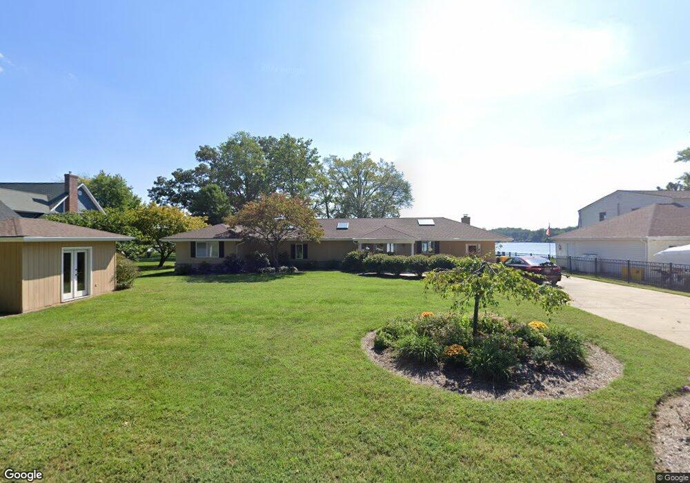
1997 Park Dr Pasadena, MD 21122
Jacobsville-Bayside Beach NeighborhoodEstimated Value: $1,125,000 - $1,298,000
Studio
2
Baths
3,540
Sq Ft
$337/Sq Ft
Est. Value
About This Home
This home is located at 1997 Park Dr, Pasadena, MD 21122 and is currently estimated at $1,192,569, approximately $336 per square foot. 1997 Park Dr is a home located in Anne Arundel County with nearby schools including Fort Smallwood Elementary School, Chesapeake Bay Middle School, and Chesapeake High School.
Ownership History
Date
Name
Owned For
Owner Type
Purchase Details
Closed on
Feb 20, 2014
Sold by
Gilligan Michael F
Bought by
Gilligan Michael F and Merino Dawn A
Current Estimated Value
Purchase Details
Closed on
Oct 11, 1991
Sold by
Vodusek Frank H
Bought by
Gilligan Michael F
Home Financials for this Owner
Home Financials are based on the most recent Mortgage that was taken out on this home.
Original Mortgage
$260,000
Interest Rate
8.82%
Create a Home Valuation Report for This Property
The Home Valuation Report is an in-depth analysis detailing your home's value as well as a comparison with similar homes in the area
Home Values in the Area
Average Home Value in this Area
Purchase History
| Date | Buyer | Sale Price | Title Company |
|---|---|---|---|
| Gilligan Michael F | -- | None Available | |
| Gilligan Michael F | $325,000 | -- |
Source: Public Records
Mortgage History
| Date | Status | Borrower | Loan Amount |
|---|---|---|---|
| Closed | Gilligan Michael F | $260,000 |
Source: Public Records
Tax History
| Year | Tax Paid | Tax Assessment Tax Assessment Total Assessment is a certain percentage of the fair market value that is determined by local assessors to be the total taxable value of land and additions on the property. | Land | Improvement |
|---|---|---|---|---|
| 2025 | $5,147 | $844,333 | -- | -- |
| 2024 | $5,147 | $765,900 | $418,100 | $347,800 |
| 2023 | $5,002 | $737,800 | $0 | $0 |
| 2022 | $4,685 | $709,700 | $0 | $0 |
| 2020 | $4,480 | $680,067 | $0 | $0 |
| 2019 | $4,418 | $678,533 | $0 | $0 |
| 2018 | $6,865 | $677,000 | $348,700 | $328,300 |
| 2017 | $4,159 | $645,400 | $0 | $0 |
| 2016 | -- | $613,800 | $0 | $0 |
| 2015 | -- | $582,200 | $0 | $0 |
| 2014 | -- | $582,200 | $0 | $0 |
Source: Public Records
Map
Nearby Homes
- 7937 E Riverside Dr
- 1930 Cedar Rd
- 8138 Forest Glen Dr
- LOT 1 Burgess Rd
- 7819 Appletree Rd
- 7821 Bodkin View Dr
- 7803 Linthicum Rd
- 7715 Paradise Beach Rd
- 7963 Oak Rd
- 2123 Beach Dr
- 0 Bush Ave
- 2053 Kurtz Ave
- 2032 Kurtz Ave
- 4785 Mountain Rd
- 1976 Yorkie Ave
- 151 Wileys Ln
- 1933 Arundel Rd
- 0 Cornfield Rd Unit MDAA2129542
- 0 Cornfield Rd Unit MDAA2129524
- 1664 Glen Dr
- 2003 Park Dr
- 1995 Park Dr
- 2005 Park Dr
- 1991 Park Dr
- 2007 Park Dr
- 1989 Park Dr
- 2009 Park Dr
- 1993 Park Dr
- 2011 Park Dr
- 2013 Park Dr
- 1985 Poplar Ridge Rd
- 2015 Park Dr
- 1983 Poplar Ridge Rd
- 2017 Poplar Ridge Rd
- 1977 Poplar Ridge Rd
- 2048 Poplar Ridge Rd
- 1975 Poplar Ridge Rd
- 2040 Poplar Ridge Rd
- 2040 Poplar Ridge Rd Unit A
- 2050 Poplar Ridge Rd
Your Personal Tour Guide
Ask me questions while you tour the home.