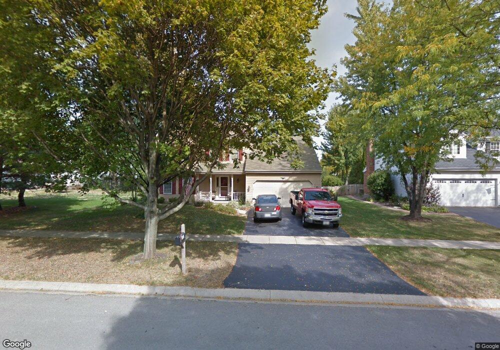
1997 Sheffield Ln Unit 2 Geneva, IL 60134
Northwest Central Geneva NeighborhoodEstimated Value: $467,000 - $517,000
4
Beds
3
Baths
2,015
Sq Ft
$244/Sq Ft
Est. Value
About This Home
This home is located at 1997 Sheffield Ln Unit 2, Geneva, IL 60134 and is currently estimated at $491,053, approximately $243 per square foot. 1997 Sheffield Ln Unit 2 is a home located in Kane County with nearby schools including Williamsburg Elementary School, Geneva Community High School, and Kensington School - Geneva.
Ownership History
Date
Name
Owned For
Owner Type
Purchase Details
Closed on
May 12, 2010
Sold by
Phillips Richard and Phillips Maureen
Bought by
Phillips Richard L and Hughes Phillips Maureen E
Current Estimated Value
Purchase Details
Closed on
Apr 27, 2000
Sold by
Mcnally Patrick P and Mcnally Maryann N
Bought by
Phillips Richard and Phillips Maureen
Home Financials for this Owner
Home Financials are based on the most recent Mortgage that was taken out on this home.
Original Mortgage
$190,000
Outstanding Balance
$66,112
Interest Rate
8.24%
Estimated Equity
$424,941
Create a Home Valuation Report for This Property
The Home Valuation Report is an in-depth analysis detailing your home's value as well as a comparison with similar homes in the area
Home Values in the Area
Average Home Value in this Area
Purchase History
| Date | Buyer | Sale Price | Title Company |
|---|---|---|---|
| Phillips Richard L | -- | Chicago Title Insurance Co | |
| Phillips Richard | $237,500 | -- |
Source: Public Records
Mortgage History
| Date | Status | Borrower | Loan Amount |
|---|---|---|---|
| Open | Phillips Richard | $190,000 |
Source: Public Records
Tax History Compared to Growth
Tax History
| Year | Tax Paid | Tax Assessment Tax Assessment Total Assessment is a certain percentage of the fair market value that is determined by local assessors to be the total taxable value of land and additions on the property. | Land | Improvement |
|---|---|---|---|---|
| 2024 | $8,914 | $132,453 | $34,159 | $98,294 |
| 2023 | $8,597 | $120,412 | $31,054 | $89,358 |
| 2022 | $8,455 | $111,886 | $28,855 | $83,031 |
| 2021 | $8,188 | $107,728 | $27,783 | $79,945 |
| 2020 | $8,084 | $106,084 | $27,359 | $78,725 |
| 2019 | $8,051 | $104,075 | $26,841 | $77,234 |
| 2018 | $7,872 | $102,147 | $26,841 | $75,306 |
| 2017 | $7,770 | $99,423 | $26,125 | $73,298 |
| 2016 | $7,333 | $92,841 | $25,772 | $67,069 |
| 2015 | -- | $88,269 | $24,503 | $63,766 |
| 2014 | -- | $88,269 | $24,503 | $63,766 |
| 2013 | -- | $88,269 | $24,503 | $63,766 |
Source: Public Records
Map
Nearby Homes
- 231 N Cambridge Dr
- 2753 Stone Cir
- 2749 Stone Cir
- 2747 Stone Cir
- 2751 Stone Cir
- 51 Burgess Rd
- 2309 Sudbury Ln
- 1736 Kaneville Rd
- 560 Renee Ct
- 1437 Cooper Ln
- 1211 James St
- 1108 S 12th St Unit 2
- 2671 Stone Cir Unit 208
- 1011 James St
- 2731 Stone Cir
- 2769 Stone Cir
- 2771 Stone Cir
- 2767 Stone Cir
- 1823 Fargo Blvd
- 2147 Fargo Blvd
- 1919 Sheffield Ln
- 325 Colonial Cir
- 327 Colonial Cir Unit 4
- 329 Colonial Cir
- 1996 Sheffield Ln
- 2000 Sheffield Ln Unit 2A
- 1916 Sheffield Ln Unit 2
- 2002 Sheffield Ln
- 331 Colonial Cir
- 1912 Sheffield Ln
- 2010 Sheffield Ln
- 2009 Sheffield Ln Unit 2A
- 1909 Sheffield Ln
- 333 Colonial Cir
- 1999 Williamsburg Ave
- 328 Colonial Cir
- 2013 Williamsburg Ave
- 2016 Sheffield Ln
- 1921 Williamsburg Ave
- 1910 Sheffield Ln Unit 2