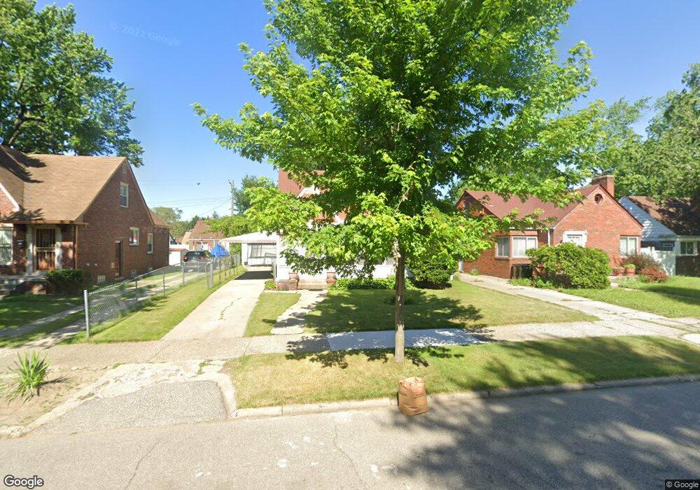
19975 Cheyenne St Detroit, MI 48235
Blackstone Park NeighborhoodEstimated Value: $126,213 - $164,000
--
Bed
2
Baths
1,459
Sq Ft
$100/Sq Ft
Est. Value
About This Home
This home is located at 19975 Cheyenne St, Detroit, MI 48235 and is currently estimated at $145,303, approximately $99 per square foot. 19975 Cheyenne St is a home located in Wayne County with nearby schools including Vernor Elementary School, Charles L. Spain Elementary-Middle School, and Edward 'Duke' Ellington Conservatory of Music and Art.
Ownership History
Date
Name
Owned For
Owner Type
Purchase Details
Closed on
Jan 27, 2022
Sold by
United Community Housing Coalition
Bought by
Carter Grace
Current Estimated Value
Purchase Details
Closed on
Jan 15, 2020
Sold by
City Of Detriot
Bought by
United Community Housing Coalition
Purchase Details
Closed on
Sep 18, 2019
Sold by
County Of Wayne
Bought by
City Of Detroit Planning And Dev Dept
Create a Home Valuation Report for This Property
The Home Valuation Report is an in-depth analysis detailing your home's value as well as a comparison with similar homes in the area
Home Values in the Area
Average Home Value in this Area
Purchase History
| Date | Buyer | Sale Price | Title Company |
|---|---|---|---|
| Carter Grace | -- | None Listed On Document | |
| United Community Housing Coalition | $188,070 | None Available | |
| City Of Detroit Planning And Dev Dept | $6,353 | None Available |
Source: Public Records
Tax History Compared to Growth
Tax History
| Year | Tax Paid | Tax Assessment Tax Assessment Total Assessment is a certain percentage of the fair market value that is determined by local assessors to be the total taxable value of land and additions on the property. | Land | Improvement |
|---|---|---|---|---|
| 2025 | $125 | $53,100 | $0 | $0 |
| 2024 | $125 | $0 | $0 | $0 |
| 2023 | $3,165 | $38,000 | $0 | $0 |
| 2022 | $0 | $0 | $0 | $0 |
| 2021 | $0 | $0 | $0 | $0 |
| 2019 | $1,334 | $17,500 | $0 | $0 |
| 2018 | $1,134 | $15,200 | $0 | $0 |
| 2017 | $298 | $15,700 | $0 | $0 |
| 2016 | $1,948 | $22,600 | $0 | $0 |
| 2015 | $2,260 | $22,600 | $0 | $0 |
| 2013 | $2,775 | $33,267 | $0 | $0 |
| 2010 | -- | $48,774 | $1,050 | $47,724 |
Source: Public Records
Map
Nearby Homes
- 20108 Cheyenne St
- 20124 Snowden St
- 20129 Ward St
- 19909 Hartwell St
- 20167 Ward St
- 19744 Littlefield St
- 19744 Snowden St
- 13517 Pembroke Ave
- 20184 Ward St
- 19719 Ward St
- 20196 Hartwell St
- 20150 Schaefer Hwy
- 19925 Schaefer Hwy
- 19978 Tracey St
- 19721 Hartwell St
- 20242 Ward St
- 19474 Cheyenne St
- 12819 Pembroke Ave
- 20123 Appoline St
- 19733 Schaefer Hwy
- 19969 Cheyenne St
- 19976 Littlefield St
- 19976 Littlefield St
- 19966 Littlefield St
- 19986 Littlefield St
- 19956 Littlefield St
- 19985 Cheyenne St
- 19985 Cheyenne St
- 19996 Littlefield St
- 19996 Littlefield St
- 19948 Littlefield St
- 19997 Cheyenne St
- 19949 Cheyenne St
- 20004 Littlefield St
- 20003 Cheyenne St
- 19938 Littlefield St
- 19939 Cheyenne St
- 19939 Cheyenne St
- 20014 Littlefield St
- 19975 Littlefield St