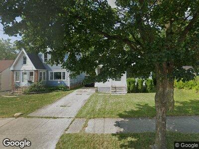
19981 Raymond St Maple Heights, OH 44137
Estimated Value: $92,748 - $138,000
4
Beds
2
Baths
1,176
Sq Ft
$99/Sq Ft
Est. Value
About This Home
This home is located at 19981 Raymond St, Maple Heights, OH 44137 and is currently estimated at $116,187, approximately $98 per square foot. 19981 Raymond St is a home located in Cuyahoga County with nearby schools including Abraham Lincoln Elementary School, Rockside/ J.F. Kennedy School, and Barack Obama School.
Ownership History
Date
Name
Owned For
Owner Type
Purchase Details
Closed on
Jun 19, 2020
Sold by
Pecnik Irene M and Pecnik Irene Marie
Bought by
Pecnik Margo
Current Estimated Value
Purchase Details
Closed on
Mar 3, 2003
Sold by
Pecnik Irene M
Bought by
Pecnik Irene M and Pecnik Margo Irene
Purchase Details
Closed on
Sep 5, 2002
Sold by
Pecnik Edward F and Pecnik Irene M
Bought by
Pecnik Irene M
Purchase Details
Closed on
Nov 26, 1982
Sold by
Pecnik Edward F and Pecnik Irene M
Bought by
Pecnik Edward F
Purchase Details
Closed on
Jan 1, 1975
Bought by
Pecnik Edward F and Pecnik Irene M
Create a Home Valuation Report for This Property
The Home Valuation Report is an in-depth analysis detailing your home's value as well as a comparison with similar homes in the area
Home Values in the Area
Average Home Value in this Area
Purchase History
| Date | Buyer | Sale Price | Title Company |
|---|---|---|---|
| Pecnik Edward F | -- | -- | |
| Pecnik Edward F | -- | -- |
Source: Public Records
Tax History Compared to Growth
Tax History
| Year | Tax Paid | Tax Assessment Tax Assessment Total Assessment is a certain percentage of the fair market value that is determined by local assessors to be the total taxable value of land and additions on the property. | Land | Improvement |
|---|---|---|---|---|
| 2024 | $3,252 | $36,120 | $5,880 | $30,240 |
| 2023 | $1,978 | $17,850 | $3,360 | $14,490 |
| 2022 | $1,971 | $17,850 | $3,360 | $14,490 |
| 2021 | $1,983 | $17,850 | $3,360 | $14,490 |
| 2020 | $762 | $13,550 | $2,560 | $10,990 |
| 2019 | $752 | $38,700 | $7,300 | $31,400 |
| 2018 | $746 | $13,550 | $2,560 | $10,990 |
| 2017 | $653 | $12,610 | $2,350 | $10,260 |
| 2016 | $628 | $12,610 | $2,350 | $10,260 |
| 2015 | $694 | $12,610 | $2,350 | $10,260 |
| 2014 | $694 | $13,860 | $2,590 | $11,270 |
Source: Public Records
Map
Nearby Homes
- 19605 Fairway Ave
- 5141 Camden Rd
- 19802 Mountville Dr
- 20503 Mountville Dr
- 20806 Watson Rd
- 19505 Preston Rd
- 20814 Raymond St
- 19816 Stockton Ave
- 19315 Libby Rd
- 20909 Kenyon Dr
- 19288 Stockton Ave
- 21011 Hansen Rd
- 5151 Erwin St
- 21417 Gardenview Dr
- 21407 Libby Rd
- 18605 Maple Heights Blvd
- 18230 Libby Rd
- 18311 Highland Dr
- 5131 Arch St
- 21880 Louis Rd
- 19981 Raymond St
- 19979 Raymond St
- 20001 Raymond St
- 20021 Raymond St
- 19941 Raymond St
- 20041 Raymond St
- 19931 Raymond St
- 19976 Raymond St
- 20002 Raymond St
- 20061 Raymond St
- 19970 Raymond St
- 20008 Raymond St
- 19925 Raymond St
- 19966 Raymond St
- 20040 Raymond St
- 20081 Raymond St
- 19900 Raymond St
- 20060 Raymond St
- 20109 Raymond St
- 19870 Raymond St