K
Seller's Agent in 2025
Kira Camarata
Cascade Hasson SIR
(541) 633-6221
8 in this area
74 Total Sales
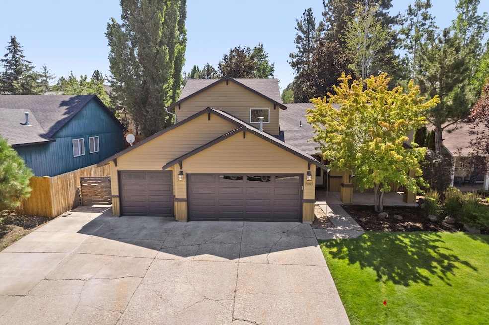
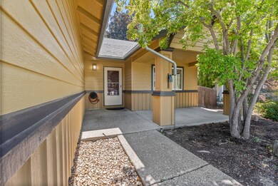
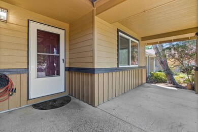
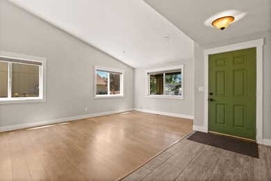
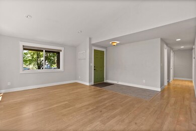
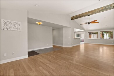
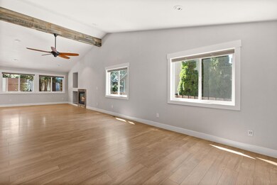
Welcome to this spacious home in one of southwest Bend's most desirable neighborhoods! Featuring an open floor plan and the Primary Bedroom on the main level, 4 bedrooms + bonus room (fully enclosed with a door and closet - ideal as a 5th bedroom, guest space, or home office) and 3 full bathrooms, with room for everyone. The three-car garage provides ample space for vehicles, gear, and storage, while the flat driveway makes access a breeze year-round. Enjoy the landscaped backyard with a deck and a hot tub perfect for relaxing or entertaining. Nearby trails leading straight to the Deschutes River for daily outdoor adventures. This lovely neighborhood is close to top-rated schools, parks, and everything Bend has to offer. Don't miss this rare blend of space, location, and lifestyle!
Last Agent to Sell the Property
Cascade Hasson SIR License #200606092 Listed on: 08/25/2025

| Date | Type | Sale Price | Title Company |
|---|---|---|---|
| Warranty Deed | $685,000 | First American Title | |
| Bargain Sale Deed | $98,000 | Bryant Lovlien & Jarvis Pc | |
| Warranty Deed | $289,900 | Western Title & Escrow Co |
| Date | Status | Loan Amount | Loan Type |
|---|---|---|---|
| Open | $548,000 | New Conventional | |
| Previous Owner | $159,400 | Fannie Mae Freddie Mac |
| Date | Event | Price | List to Sale | Price per Sq Ft |
|---|---|---|---|---|
| 10/10/2025 10/10/25 | Sold | $685,000 | -1.7% | $315 / Sq Ft |
| 09/15/2025 09/15/25 | Pending | -- | -- | -- |
| 09/10/2025 09/10/25 | Price Changed | $697,000 | -3.9% | $320 / Sq Ft |
| 08/30/2025 08/30/25 | Price Changed | $725,000 | -2.7% | $333 / Sq Ft |
| 08/25/2025 08/25/25 | For Sale | $745,000 | -- | $342 / Sq Ft |
| Year | Tax Paid | Tax Assessment Tax Assessment Total Assessment is a certain percentage of the fair market value that is determined by local assessors to be the total taxable value of land and additions on the property. | Land | Improvement |
|---|---|---|---|---|
| 2025 | $4,708 | $278,660 | -- | -- |
| 2024 | $4,530 | $270,550 | -- | -- |
| 2023 | $4,199 | $262,670 | $0 | $0 |
| 2022 | $3,918 | $247,600 | $0 | $0 |
| 2021 | $3,924 | $240,390 | $0 | $0 |
| 2020 | $3,723 | $240,390 | $0 | $0 |
| 2019 | $3,619 | $233,390 | $0 | $0 |
| 2018 | $3,517 | $226,600 | $0 | $0 |
| 2017 | $3,414 | $220,000 | $0 | $0 |
| 2016 | $3,255 | $213,600 | $0 | $0 |
| 2015 | $3,165 | $207,380 | $0 | $0 |
| 2014 | $3,072 | $201,340 | $0 | $0 |
K
Seller's Agent in 2025
Kira Camarata
Cascade Hasson SIR
(541) 633-6221
8 in this area
74 Total Sales
L
Seller Co-Listing Agent in 2025
Lisa Lamberto
Cascade Hasson SIR
(541) 610-9697
8 in this area
83 Total Sales
Buyer's Agent in 2025
Ryan Rudloff
eXp Realty, LLC
(541) 350-3993
3 in this area
29 Total Sales
Source: Oregon Datashare
MLS Number: 220208230
APN: 195144
Disclaimer: Certain information contained herein is derived from information provided by parties other than Homes.com. All information provided is deemed reliable, but is not guaranteed to be accurate and should be independently verified.
![]() © 2026 Oregon Datashare (KCAR | MLSCO | SOMLS). All rights reserved. The data relating to real estate for sale on this web site comes in part from the Internet Data Exchange Program of the Oregon Datashare. Real estate listings held by IDX Brokerage firms other than Ten-X are marked with the Internet Data Exchange logo or the Internet Data Exchange thumbnail logo and detailed information about them includes the name of the listing Brokers. Information provided is for consumers' personal, non-commercial use and may not be used for any purpose other than to identify prospective properties the viewer may be interested in purchasing. The consumer will not copy, retransmit nor redistribute any of the content from this website. Information provided is deemed reliable, but not guaranteed.
© 2026 Oregon Datashare (KCAR | MLSCO | SOMLS). All rights reserved. The data relating to real estate for sale on this web site comes in part from the Internet Data Exchange Program of the Oregon Datashare. Real estate listings held by IDX Brokerage firms other than Ten-X are marked with the Internet Data Exchange logo or the Internet Data Exchange thumbnail logo and detailed information about them includes the name of the listing Brokers. Information provided is for consumers' personal, non-commercial use and may not be used for any purpose other than to identify prospective properties the viewer may be interested in purchasing. The consumer will not copy, retransmit nor redistribute any of the content from this website. Information provided is deemed reliable, but not guaranteed.
Ask me questions while you tour the home.