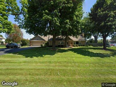
1N351 Pleasant Hill Rd Carol Stream, IL 60188
Estimated Value: $450,000 - $606,000
4
Beds
2
Baths
2,420
Sq Ft
$220/Sq Ft
Est. Value
About This Home
This home is located at 1N351 Pleasant Hill Rd, Carol Stream, IL 60188 and is currently estimated at $532,432, approximately $220 per square foot. 1N351 Pleasant Hill Rd is a home located in DuPage County with nearby schools including Pleasant Hill Elementary School, Monroe Middle School, and Wheaton North High School.
Ownership History
Date
Name
Owned For
Owner Type
Purchase Details
Closed on
Aug 4, 2009
Sold by
Hessling Tony and Estate Of Margaret Mary Hessli
Bought by
Bradford Christopher T and Bradford Melanie L
Current Estimated Value
Home Financials for this Owner
Home Financials are based on the most recent Mortgage that was taken out on this home.
Original Mortgage
$217,000
Interest Rate
5.29%
Mortgage Type
New Conventional
Purchase Details
Closed on
Apr 6, 2001
Sold by
Hessling Robert W and Hessling Margaret M
Bought by
Cassell Thomas and Cassell Joanne
Create a Home Valuation Report for This Property
The Home Valuation Report is an in-depth analysis detailing your home's value as well as a comparison with similar homes in the area
Home Values in the Area
Average Home Value in this Area
Purchase History
| Date | Buyer | Sale Price | Title Company |
|---|---|---|---|
| Bradford Christopher T | $322,500 | First American Title Ins Co | |
| Cassell Thomas | $50,000 | -- | |
| Carrington James | $20,500 | -- |
Source: Public Records
Mortgage History
| Date | Status | Borrower | Loan Amount |
|---|---|---|---|
| Open | Bradford Christopher T | $210,200 | |
| Closed | Bradford Christopher T | $234,000 | |
| Closed | Bradford Christopher T | $217,000 |
Source: Public Records
Tax History Compared to Growth
Tax History
| Year | Tax Paid | Tax Assessment Tax Assessment Total Assessment is a certain percentage of the fair market value that is determined by local assessors to be the total taxable value of land and additions on the property. | Land | Improvement |
|---|---|---|---|---|
| 2023 | $9,072 | $145,480 | $47,650 | $97,830 |
| 2022 | $8,861 | $137,480 | $45,030 | $92,450 |
| 2021 | $8,375 | $134,220 | $43,960 | $90,260 |
| 2020 | $8,247 | $132,970 | $43,550 | $89,420 |
| 2019 | $8,057 | $129,460 | $42,400 | $87,060 |
| 2018 | $8,172 | $129,890 | $39,950 | $89,940 |
| 2017 | $8,020 | $125,100 | $38,480 | $86,620 |
| 2016 | $7,901 | $120,100 | $36,940 | $83,160 |
| 2015 | $7,829 | $114,580 | $35,240 | $79,340 |
| 2014 | $7,637 | $110,170 | $37,020 | $73,150 |
| 2013 | $7,381 | $110,500 | $37,130 | $73,370 |
Source: Public Records
Map
Nearby Homes
- 25W728 Golf View Ln
- 26W231 Tuckaway Ct
- 26W199 Klein Creek Dr
- 26W116 Klein Creek Dr
- 1N100 Harriet St
- 26W331 Geneva Rd
- 0N 634 Knollwood Dr
- 25W275 Doris Ave
- 27W130 W Street Charles Rd
- Lot 2 W Street Charles Rd
- 26W441 Geneva Rd
- 26W181 Grand Ave
- Lot 11 Ellis Ave
- 0N510 Gary Ave
- 2N075 Pleasant Hill Rd Unit 3
- 0 Ellis Ave
- 26W055 Armbrust Ave
- 1N065 Papworth St
- 26W568 Lindsey Ave
- 0N301 Herrick Dr
- 1N351 Pleasant Hill Rd
- 1N220 Coventry Dr
- 1N210 Coventry Dr
- 1N221 Coventry Dr
- 1N180 Coventry Dr
- 1N211 Coventry Dr
- 26W006 Gold Finch Ct
- 181 Coventry Dr
- 26W016 Gold Finch Ct
- 1N181 Coventry Dr
- 26W003 Gold Finch Ct
- 1N170 Coventry Dr
- 25W770 Mac Arthur Ave
- 25W780 Macarthur Ave
- 1N171 Coventry Dr
- 25W790 Macarthur Ave
- 26W011 Gold Finch Ct Unit 2
- 25W688 Macarthur Ave
- 26W024 Gold Finch Ct
- 25W771 Macarthur Ave