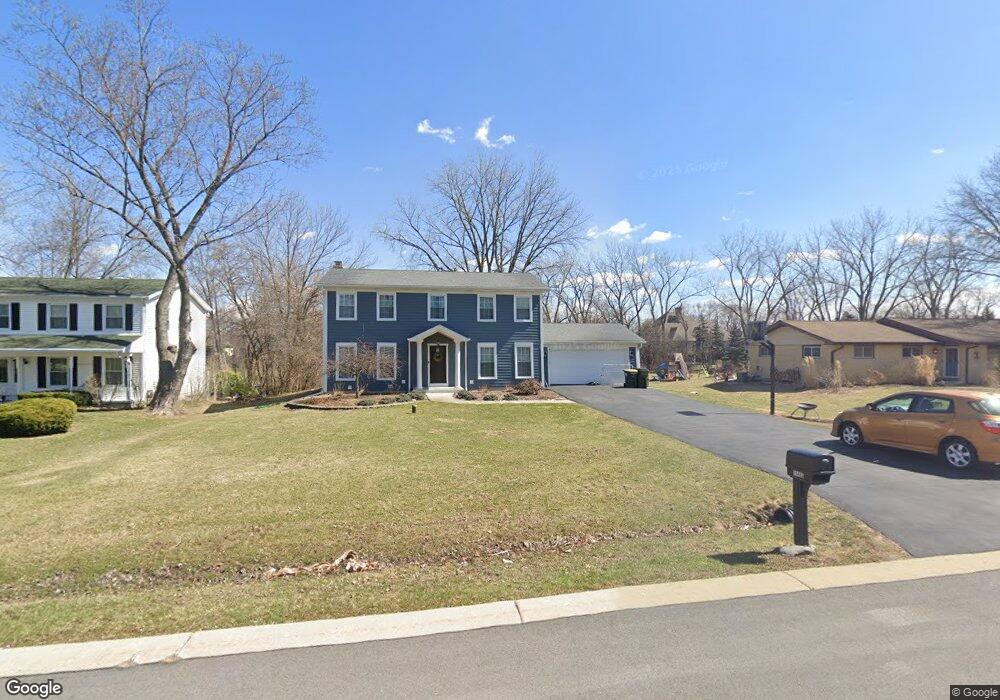
1S465 Chase Ave Lombard, IL 60148
South Lombard NeighborhoodEstimated Value: $540,883 - $625,000
--
Bed
--
Bath
2,156
Sq Ft
$268/Sq Ft
Est. Value
About This Home
This home is located at 1S465 Chase Ave, Lombard, IL 60148 and is currently estimated at $577,471, approximately $267 per square foot. 1S465 Chase Ave is a home located in DuPage County with nearby schools including Stevenson School, York Center Elementary School, and Jackson Middle School.
Ownership History
Date
Name
Owned For
Owner Type
Purchase Details
Closed on
Dec 13, 2013
Sold by
Lamontagna Robert J and Lamontagna Debra L
Bought by
Defeo Michael A and Defeo Laura A
Current Estimated Value
Home Financials for this Owner
Home Financials are based on the most recent Mortgage that was taken out on this home.
Original Mortgage
$252,000
Outstanding Balance
$190,486
Interest Rate
4.5%
Mortgage Type
New Conventional
Estimated Equity
$386,985
Purchase Details
Closed on
Jun 22, 2012
Sold by
Lamontagna Robert J and Lamontagna Debra L
Bought by
Lamontagna Robert J and Lamontagna Debra L
Purchase Details
Closed on
Jun 30, 1995
Sold by
Simenc John M and Simenc Jacqueline J
Bought by
Lamontagna Robert J and Lamontagna Debra L
Home Financials for this Owner
Home Financials are based on the most recent Mortgage that was taken out on this home.
Original Mortgage
$118,000
Interest Rate
7.79%
Create a Home Valuation Report for This Property
The Home Valuation Report is an in-depth analysis detailing your home's value as well as a comparison with similar homes in the area
Home Values in the Area
Average Home Value in this Area
Purchase History
| Date | Buyer | Sale Price | Title Company |
|---|---|---|---|
| Defeo Michael A | $315,000 | Attorneys Title Guaranty Fun | |
| Lamontagna Robert J | -- | None Available | |
| Lamontagna Robert J | $250,000 | Attorneys Title Guaranty Fun |
Source: Public Records
Mortgage History
| Date | Status | Borrower | Loan Amount |
|---|---|---|---|
| Open | Defeo Michael A | $252,000 | |
| Previous Owner | Lamontagna Robert J | $118,000 |
Source: Public Records
Tax History Compared to Growth
Tax History
| Year | Tax Paid | Tax Assessment Tax Assessment Total Assessment is a certain percentage of the fair market value that is determined by local assessors to be the total taxable value of land and additions on the property. | Land | Improvement |
|---|---|---|---|---|
| 2024 | $10,847 | $154,142 | $56,600 | $97,542 |
| 2023 | $10,205 | $142,540 | $52,340 | $90,200 |
| 2022 | $9,720 | $137,020 | $50,310 | $86,710 |
| 2021 | $9,386 | $133,610 | $49,060 | $84,550 |
| 2020 | $9,192 | $130,680 | $47,980 | $82,700 |
| 2019 | $8,691 | $124,250 | $45,620 | $78,630 |
| 2018 | $8,143 | $110,960 | $40,740 | $70,220 |
| 2017 | $7,836 | $105,730 | $38,820 | $66,910 |
| 2016 | $7,795 | $99,600 | $36,570 | $63,030 |
| 2015 | $8,546 | $103,100 | $37,860 | $65,240 |
| 2014 | $8,047 | $96,660 | $52,440 | $44,220 |
| 2013 | $7,900 | $98,020 | $53,180 | $44,840 |
Source: Public Records
Map
Nearby Homes
- 511 Graywood Dr
- Lot 1 S Meyers Rd
- Lot 11 S Meyers Rd
- Lot 7 S Meyers Rd
- Lot 8 S Meyers Rd
- Lot 6 S Meyers Rd
- Lot 9 S Meyers Rd
- Lot 5 S Meyers Rd
- Lot 10 S Meyers Rd
- Lot 2 S Meyers Rd
- 502 Rosebud Dr S
- 511 Rosebud Dr S
- 19W040 22nd St
- 396 E 17th Place
- 1618 Astor Ave
- 1S777 Westview Ave
- 2020 Saint Regis Dr Unit 509
- 2030 Saint Regis Dr
- 1520 S Fairfield Ave Unit 32C
- 855 E 22nd St Unit 416
- 1S481 Chase Ave
- 1S453 Chase Ave
- 1S491 Chase Ave
- 1S437 Chase Ave
- 1S464 Chase Ave
- 1S478 Chase Ave
- 1S452 Chase Ave
- 1S464 Fairview Ave
- 1S448 Fairview Ave
- 1S425 Chase Ave
- 1S492 Chase Ave
- 1S436 Chase Ave
- 1S514 Chase Ave
- 1S424 Chase Ave
- 1S436 Fairview Ave
- 1S527 Chase Ave
- 1S413 Chase Ave
- 1S514 Fairview Ave
- 1S424 Fairview Ave
- 1S524 Chase Ave