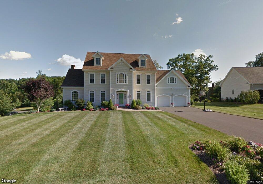
2 Abbie Rd Branford, CT 06405
Estimated Value: $860,378 - $1,095,000
4
Beds
4
Baths
3,208
Sq Ft
$304/Sq Ft
Est. Value
About This Home
This home is located at 2 Abbie Rd, Branford, CT 06405 and is currently estimated at $975,095, approximately $303 per square foot. 2 Abbie Rd is a home located in New Haven County with nearby schools including Francis Walsh Intermediate School, Branford High School, and St Mary School.
Ownership History
Date
Name
Owned For
Owner Type
Purchase Details
Closed on
Apr 25, 2003
Sold by
Apt Re Dev Llc
Bought by
Chlids Stephen M and Childs Beth A
Current Estimated Value
Home Financials for this Owner
Home Financials are based on the most recent Mortgage that was taken out on this home.
Original Mortgage
$85,000
Interest Rate
5.64%
Create a Home Valuation Report for This Property
The Home Valuation Report is an in-depth analysis detailing your home's value as well as a comparison with similar homes in the area
Home Values in the Area
Average Home Value in this Area
Purchase History
| Date | Buyer | Sale Price | Title Company |
|---|---|---|---|
| Chlids Stephen M | $447,936 | -- |
Source: Public Records
Mortgage History
| Date | Status | Borrower | Loan Amount |
|---|---|---|---|
| Closed | Chlids Stephen M | $85,000 |
Source: Public Records
Tax History Compared to Growth
Tax History
| Year | Tax Paid | Tax Assessment Tax Assessment Total Assessment is a certain percentage of the fair market value that is determined by local assessors to be the total taxable value of land and additions on the property. | Land | Improvement |
|---|---|---|---|---|
| 2025 | $10,927 | $510,600 | $107,300 | $403,300 |
| 2024 | $10,750 | $352,700 | $104,000 | $248,700 |
| 2023 | $10,542 | $352,700 | $104,000 | $248,700 |
| 2022 | $10,387 | $352,700 | $104,000 | $248,700 |
| 2021 | $10,387 | $352,700 | $104,000 | $248,700 |
| 2020 | $10,200 | $352,700 | $104,000 | $248,700 |
| 2019 | $9,887 | $340,100 | $111,300 | $228,800 |
| 2018 | $9,740 | $340,100 | $111,300 | $228,800 |
| 2017 | $9,683 | $340,100 | $111,300 | $228,800 |
| 2016 | $9,322 | $340,100 | $111,300 | $228,800 |
| 2015 | $9,159 | $340,100 | $111,300 | $228,800 |
| 2014 | $9,187 | $350,100 | $111,300 | $238,800 |
Source: Public Records
Map
Nearby Homes
- 8 Autumn Ridge Rd
- 175 Cherry Hill Rd
- 53 Brushy Plain Rd Unit 4E
- 13 Brushy Plain Rd
- 184 Cherry Hill Rd Unit Lot 4
- 180 Cherry Hill Rd Unit Lot 5
- 226 Austin Ryer Ln Unit 226
- 240 Austin Ryer Ln Unit 240
- 100 Hemlock Rd Unit 4-2
- 38 Foxbridge Village Rd
- 47 Jerimoth Dr Unit 47
- 26 Cedar Knolls Dr
- 107 Chestnut St
- 77 Chestnut St
- 60 Montoya Dr Unit 60
- 48 Montoya Dr Unit 48
- 251 N Main St
- 379 Brushy Plain Rd
- 27 Hickory Hill Ln
- 26 N Main St Unit TRLR 19
- 4 Abbie Rd
- 29 Valley Brook Rd S
- 1 Autumn Ridge Rd
- 26 Valley Brook Rd S
- 2 Autumn Ridge Rd
- 6 Abbie Rd
- 28 Valley Brook Rd S
- 23 Valley Brook Rd
- 4 Autumn Ridge Rd
- 5 Abbie Rd
- 5 Autumn Ridge Rd
- 46 Valley Brook Rd S
- 8 Abbie Rd
- 22 Valley Brook Rd
- 19 Valley Brook Rd
- 5 Wilbraham Ct
- 6 Autumn Ridge Rd
- 31 Valley Brook Rd S
- 3 Wilbraham Ct
- 7 Abbie Rd