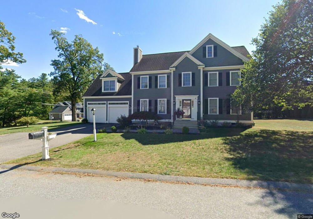
2 August Ln Shirley, MA 01464
Estimated Value: $690,093 - $788,000
4
Beds
3
Baths
2,671
Sq Ft
$282/Sq Ft
Est. Value
About This Home
This home is located at 2 August Ln, Shirley, MA 01464 and is currently estimated at $752,023, approximately $281 per square foot. 2 August Ln is a home located in Middlesex County with nearby schools including Page Hilltop School, Lura A. White Elementary School, and Ayer Shirley Regional Middle School.
Ownership History
Date
Name
Owned For
Owner Type
Purchase Details
Closed on
Jun 18, 2004
Sold by
Hayes Dev Corp
Bought by
Mansour Grace and Mansour Joseph J
Current Estimated Value
Home Financials for this Owner
Home Financials are based on the most recent Mortgage that was taken out on this home.
Original Mortgage
$393,569
Outstanding Balance
$193,938
Interest Rate
6.12%
Mortgage Type
Purchase Money Mortgage
Estimated Equity
$558,085
Create a Home Valuation Report for This Property
The Home Valuation Report is an in-depth analysis detailing your home's value as well as a comparison with similar homes in the area
Home Values in the Area
Average Home Value in this Area
Purchase History
| Date | Buyer | Sale Price | Title Company |
|---|---|---|---|
| Mansour Grace | $414,284 | -- | |
| Mansour Grace | $414,284 | -- | |
| Mansour Grace | $414,284 | -- |
Source: Public Records
Mortgage History
| Date | Status | Borrower | Loan Amount |
|---|---|---|---|
| Open | Mansour Grace | $393,569 | |
| Closed | Mansour Grace | $393,569 |
Source: Public Records
Tax History Compared to Growth
Tax History
| Year | Tax Paid | Tax Assessment Tax Assessment Total Assessment is a certain percentage of the fair market value that is determined by local assessors to be the total taxable value of land and additions on the property. | Land | Improvement |
|---|---|---|---|---|
| 2025 | $79 | $609,900 | $153,600 | $456,300 |
| 2024 | $7,822 | $576,400 | $145,900 | $430,500 |
| 2023 | $7,369 | $519,700 | $145,900 | $373,800 |
| 2022 | $6,865 | $443,500 | $130,500 | $313,000 |
| 2021 | $6,838 | $413,700 | $119,000 | $294,700 |
| 2020 | $6,579 | $408,400 | $119,000 | $289,400 |
| 2019 | $6,540 | $406,700 | $119,000 | $287,700 |
| 2018 | $6,561 | $399,600 | $116,700 | $282,900 |
| 2017 | $6,464 | $391,300 | $115,200 | $276,100 |
| 2016 | $6,102 | $369,600 | $107,500 | $262,100 |
| 2015 | $6,197 | $358,000 | $104,400 | $253,600 |
Source: Public Records
Map
Nearby Homes
- 83 Clark Rd Unit 41
- 45 Clark Rd
- 3 Ambrose Way Unit 3
- 6 Ambrose Way Unit 3
- 9 Ambrose Way Unit 9
- 1 Ambrose Way Unit 1
- 7 Ambrose Way Unit 5
- 4 Ambrose Way Unit 4
- 5 Ambrose Way Unit 5
- 13 Ambrose Way Unit 13
- 40 Ayer Rd
- 30 Ayer Rd
- 25 Front St
- 3 Mill St
- 124 Hazen Rd
- 0 Windsor Rd
- 184 W Main St Unit B2
- 49 Parker Rd
- 31 Independence Dr
- 601 Flat Hill Rd