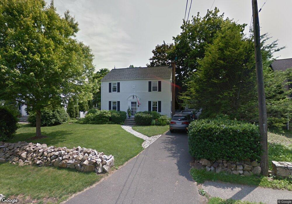
2 Benson Place Fairfield, CT 06824
Fairfield Beach NeighborhoodEstimated Value: $941,000 - $1,580,000
4
Beds
3
Baths
1,980
Sq Ft
$649/Sq Ft
Est. Value
About This Home
This home is located at 2 Benson Place, Fairfield, CT 06824 and is currently estimated at $1,285,385, approximately $649 per square foot. 2 Benson Place is a home located in Fairfield County with nearby schools including Roger Sherman Elementary School, Roger Ludlowe Middle School, and Fairfield Ludlowe High School.
Ownership History
Date
Name
Owned For
Owner Type
Purchase Details
Closed on
May 15, 1995
Sold by
Barney Timothy M and Barney Marguerite H
Bought by
Rosenthal Joel H and Rosenthal Patricia B
Current Estimated Value
Purchase Details
Closed on
May 30, 1991
Sold by
Bernhardt James H and Bernhardt Mary E
Bought by
Barney Timothy M and Barney Marguerite
Create a Home Valuation Report for This Property
The Home Valuation Report is an in-depth analysis detailing your home's value as well as a comparison with similar homes in the area
Home Values in the Area
Average Home Value in this Area
Purchase History
| Date | Buyer | Sale Price | Title Company |
|---|---|---|---|
| Rosenthal Joel H | $268,720 | -- | |
| Rosenthal Joel H | $268,720 | -- | |
| Barney Timothy M | $242,000 | -- |
Source: Public Records
Mortgage History
| Date | Status | Borrower | Loan Amount |
|---|---|---|---|
| Open | Barney Timothy M | $417,000 | |
| Closed | Barney Timothy M | $100,000 |
Source: Public Records
Tax History
| Year | Tax Paid | Tax Assessment Tax Assessment Total Assessment is a certain percentage of the fair market value that is determined by local assessors to be the total taxable value of land and additions on the property. | Land | Improvement |
|---|---|---|---|---|
| 2025 | $15,801 | $556,570 | $398,790 | $157,780 |
| 2024 | $15,528 | $556,570 | $398,790 | $157,780 |
| 2023 | $15,311 | $556,570 | $398,790 | $157,780 |
| 2022 | $15,161 | $556,570 | $398,790 | $157,780 |
| 2021 | $15,016 | $556,570 | $398,790 | $157,780 |
| 2020 | $14,444 | $539,140 | $368,270 | $170,870 |
| 2019 | $14,444 | $539,140 | $368,270 | $170,870 |
| 2018 | $14,212 | $539,140 | $368,270 | $170,870 |
| 2017 | $13,921 | $539,140 | $368,270 | $170,870 |
| 2016 | $13,721 | $539,140 | $368,270 | $170,870 |
| 2015 | $14,327 | $577,920 | $441,070 | $136,850 |
| 2014 | $14,101 | $577,920 | $441,070 | $136,850 |
Source: Public Records
Map
Nearby Homes
- 855 Riverside Dr
- 115 Fern St
- 324 Sunnieholme Dr
- 98 Cambridge St
- 361 Riverside Dr
- 2180 Kings Hwy Unit 1
- 345 Reef Rd Unit B6
- 345 Reef Rd Unit C9
- 175 Battery Park Dr
- 783 Reef Rd
- 187 Catherine Terrace
- 117 Forest Ave
- 88 Veres St
- 20 Ermine St
- 245 Unquowa Rd Unit 2
- 245 Unquowa Rd Unit 82
- 245 Unquowa Rd Unit 6
- 110 Pratt St
- 6 Lighthouse Point
- 377 Midland St
- 12 Benson Place
- 476 S Benson Rd
- 20 Benson Place
- 51 Colonial Dr
- 479 S Benson Rd
- 479 S Benson Rd Unit FL2-ID1050330P
- 479 S Benson Rd Unit ID1050330P
- 34 Benson Place
- 469 S Benson Rd
- 39 Benson Place
- 470 S Benson Rd
- 47 Colonial Dr
- 46 Benson Place
- 457 S Benson Rd
- 11 Colonial Dr
- 452 S Benson Rd
- 57 Benson Place
- 71 Colonial Dr
- 529 S Benson Rd
- 85 Colonial Dr