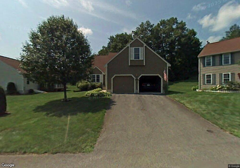
2 Brentwood Ave Unit U46 Nashua, NH 03063
Northwest Nashua NeighborhoodEstimated Value: $570,947 - $613,000
3
Beds
2
Baths
2,144
Sq Ft
$275/Sq Ft
Est. Value
About This Home
This home is located at 2 Brentwood Ave Unit U46, Nashua, NH 03063 and is currently estimated at $589,737, approximately $275 per square foot. 2 Brentwood Ave Unit U46 is a home located in Hillsborough County with nearby schools including Birch Hill Elementary School, Elm Street Middle School, and Nashua High School North.
Ownership History
Date
Name
Owned For
Owner Type
Purchase Details
Closed on
Mar 22, 2012
Sold by
Densberger Stephen J
Bought by
Densberger Cynthia A
Current Estimated Value
Purchase Details
Closed on
Aug 5, 2005
Sold by
Cox Rev Tr 1996 Donald H and Cox Rev Tr 199 Carol Wass
Bought by
Densberger Stephen J and Densberger Cynthia A
Home Financials for this Owner
Home Financials are based on the most recent Mortgage that was taken out on this home.
Original Mortgage
$150,000
Interest Rate
5.63%
Create a Home Valuation Report for This Property
The Home Valuation Report is an in-depth analysis detailing your home's value as well as a comparison with similar homes in the area
Home Values in the Area
Average Home Value in this Area
Purchase History
| Date | Buyer | Sale Price | Title Company |
|---|---|---|---|
| Densberger Cynthia A | -- | -- | |
| Densberger Stephen J | $372,000 | -- |
Source: Public Records
Mortgage History
| Date | Status | Borrower | Loan Amount |
|---|---|---|---|
| Open | Densberger Stephen J | $131,000 | |
| Previous Owner | Densberger Stephen J | $150,000 |
Source: Public Records
Tax History Compared to Growth
Tax History
| Year | Tax Paid | Tax Assessment Tax Assessment Total Assessment is a certain percentage of the fair market value that is determined by local assessors to be the total taxable value of land and additions on the property. | Land | Improvement |
|---|---|---|---|---|
| 2024 | $9,627 | $605,500 | $0 | $605,500 |
| 2023 | $8,625 | $473,100 | $0 | $473,100 |
| 2022 | $8,549 | $473,100 | $0 | $473,100 |
| 2021 | $8,169 | $351,800 | $0 | $351,800 |
| 2020 | $7,954 | $351,800 | $0 | $351,800 |
| 2019 | $7,655 | $351,800 | $0 | $351,800 |
| 2018 | $7,462 | $351,800 | $0 | $351,800 |
| 2017 | $7,716 | $299,200 | $0 | $299,200 |
| 2016 | $7,501 | $299,200 | $0 | $299,200 |
| 2015 | $7,339 | $299,200 | $0 | $299,200 |
| 2014 | $7,196 | $299,200 | $0 | $299,200 |
Source: Public Records
Map
Nearby Homes
- 36 Hampton Dr
- 4 Jared Cir Unit U21
- 5 Chatfield Dr Unit U18
- 14 Parrish Hill Dr
- 424 Broad St
- 22 Cathedral Cir
- 6 Cornwall Ln Unit 7
- 5 Meghan Dr Unit U23
- 239 Broad St
- 3 Richmond St
- 4 Nelson St
- 7 Robert Dr
- 19 Dunloggin Rd
- 334 Broad St
- 11 Inca Dr
- 8 Pilgrim Cir
- 10 Pilgrim Cir
- 199 Pine Hill Rd
- 27 Country Hill Rd Unit U90
- 76 Bartemus Trail Unit U231
- 4 Brentwood Ave Unit U47
- 1 Sugar Hill Dr Unit U45
- 3 Sugar Hill Dr Unit U44
- 3 Brentwood Ave Unit U48
- 1 Brentwood Ave Unit U49
- 5 Sugar Hill Dr Unit U43
- 6 Ivy Ln Unit U132
- 2 Myopia Ln Unit U31
- 4 Ivy Ln Unit U133
- 7 Sugar Hill Dr Unit U42
- 4 Sugar Hill Dr Unit U35
- 5 Thresher Rd Unit U135
- 5 Ivy Ln Unit U131
- 2 Ivy Ln Unit U134
- 9 Sugar Hill Dr Unit U41
- 4 Myopia Ln Unit U32
- 4 Myopia Ln Unit LNU 32
- 4 Myopia Hill Ln
- 7 Thresher Rd Unit U138
- 9 Thresher Rd Unit U51