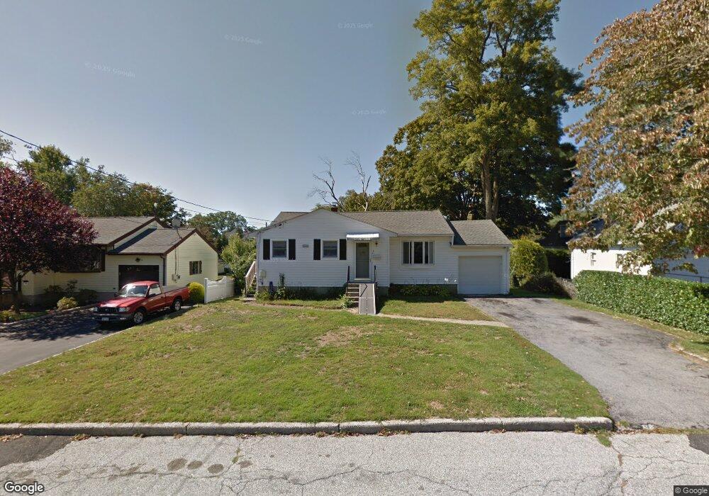
2 Briarbrook Rd Unit 20 Ossining, NY 10562
Estimated Value: $604,000 - $867,000
3
Beds
3
Baths
1,534
Sq Ft
$448/Sq Ft
Est. Value
About This Home
This home is located at 2 Briarbrook Rd Unit 20, Ossining, NY 10562 and is currently estimated at $687,353, approximately $448 per square foot. 2 Briarbrook Rd Unit 20 is a home located in Westchester County with nearby schools including Park School, Roosevelt Elementary School, and Brookside Elementary School.
Ownership History
Date
Name
Owned For
Owner Type
Purchase Details
Closed on
Jul 16, 2025
Sold by
Carella Michael and Carella Teresa
Bought by
Michael Carella Family Trust and Carella
Current Estimated Value
Purchase Details
Closed on
May 26, 2010
Sold by
Dibari John A and Di Bari Yvonne J
Bought by
Jiang Xiaobo and Mao Weiwei
Purchase Details
Closed on
Oct 27, 2005
Sold by
Carella Michael and Carella Teresa
Bought by
Carella Michael and Carella Teresa
Create a Home Valuation Report for This Property
The Home Valuation Report is an in-depth analysis detailing your home's value as well as a comparison with similar homes in the area
Home Values in the Area
Average Home Value in this Area
Purchase History
| Date | Buyer | Sale Price | Title Company |
|---|---|---|---|
| Michael Carella Family Trust | -- | None Listed On Document | |
| Jiang Xiaobo | $500,000 | Chicago Title Insurance Co | |
| Carella Michael | -- | None Available |
Source: Public Records
Tax History Compared to Growth
Tax History
| Year | Tax Paid | Tax Assessment Tax Assessment Total Assessment is a certain percentage of the fair market value that is determined by local assessors to be the total taxable value of land and additions on the property. | Land | Improvement |
|---|---|---|---|---|
| 2024 | $13,277 | $466,200 | $156,300 | $309,900 |
| 2023 | $12,912 | $439,200 | $156,300 | $282,900 |
| 2022 | $12,570 | $403,200 | $156,300 | $246,900 |
| 2021 | $10,783 | $360,000 | $156,300 | $203,700 |
| 2020 | $12,574 | $374,700 | $156,300 | $218,400 |
| 2019 | $12,428 | $346,500 | $156,300 | $190,200 |
| 2018 | $12,185 | $346,500 | $156,300 | $190,200 |
| 2017 | $1,805 | $339,800 | $156,300 | $183,500 |
| 2016 | $118,528 | $333,100 | $156,300 | $176,800 |
| 2015 | $9,707 | $18,250 | $5,300 | $12,950 |
| 2014 | $9,707 | $18,250 | $5,300 | $12,950 |
| 2013 | $9,707 | $18,250 | $5,300 | $12,950 |
Source: Public Records
Map
Nearby Homes
- 7 Birchbrook Rd
- 58 Narragansett Ave
- 24 Oakbrook Rd
- 14 Gates Ave
- 7 Grandview Ave
- 110 Pine Ave
- 33 Ryder Rd
- 42 Campwoods Grounds
- 53 Park Ave
- 200 Route 9a
- 7 Hawkes Ave
- 78 Croton Dam Rd
- 10 Mohegan Rd
- 59 Somerstown Rd
- 112 Woods Brooke Cir
- 26 Fawn Ct
- 113 Antler Ridge Unit 113
- 175 Croton Ave
- 126 Whitetail Cir
- 19 Donald Ln
- 4 Briarbrook Rd
- 8 Birchbrook Rd
- 10 Birchbrook Rd
- 6 Briarbrook Rd
- 6 Birchbrook Rd
- 8 Briarbrook Rd
- 3 Briarbrook Rd
- 5 Briarbrook Rd
- 7 Briarbrook Rd
- 3 Briarbrook Rd
- 56 Narragansett Ave
- 4 Birchbrook Rd
- 60 Narragansett Ave
- 12 Birchbrook Rd
- 9 Birchbrook Rd
- 10 Briarbrook Rd
- 11 Birchbrook Rd
- 9 Briarbrook Rd Unit NA
- 9 Briarbrook Rd
- 12 Briarbrook Rd