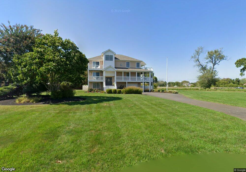
2 Bridge Ln Cape May, NJ 08204
Estimated Value: $1,218,000 - $1,635,000
--
Bed
--
Bath
2,972
Sq Ft
$472/Sq Ft
Est. Value
About This Home
This home is located at 2 Bridge Ln, Cape May, NJ 08204 and is currently estimated at $1,402,177, approximately $471 per square foot. 2 Bridge Ln is a home located in Cape May County with nearby schools including Carl T. Mitnick School, David C. Douglass Veterans Memorial School, and Maud Abrams School.
Ownership History
Date
Name
Owned For
Owner Type
Purchase Details
Closed on
Jul 8, 2008
Sold by
Beck Bernadette A M
Bought by
Gannon George M and Gannon Kimberlee Ann
Current Estimated Value
Home Financials for this Owner
Home Financials are based on the most recent Mortgage that was taken out on this home.
Original Mortgage
$417,000
Outstanding Balance
$268,062
Interest Rate
6%
Mortgage Type
Purchase Money Mortgage
Estimated Equity
$1,134,115
Purchase Details
Closed on
Feb 19, 2003
Sold by
Sullivan Brian
Bought by
Beck Bernadette A M
Create a Home Valuation Report for This Property
The Home Valuation Report is an in-depth analysis detailing your home's value as well as a comparison with similar homes in the area
Home Values in the Area
Average Home Value in this Area
Purchase History
| Date | Buyer | Sale Price | Title Company |
|---|---|---|---|
| Gannon George M | $695,000 | The Title Company Of Jersey | |
| Beck Bernadette A M | $547,000 | -- |
Source: Public Records
Mortgage History
| Date | Status | Borrower | Loan Amount |
|---|---|---|---|
| Open | Gannon George M | $417,000 |
Source: Public Records
Tax History Compared to Growth
Tax History
| Year | Tax Paid | Tax Assessment Tax Assessment Total Assessment is a certain percentage of the fair market value that is determined by local assessors to be the total taxable value of land and additions on the property. | Land | Improvement |
|---|---|---|---|---|
| 2025 | $11,704 | $577,100 | $222,000 | $355,100 |
| 2024 | $11,704 | $577,100 | $222,000 | $355,100 |
| 2023 | $11,536 | $577,100 | $222,000 | $355,100 |
| 2022 | $11,184 | $577,100 | $222,000 | $355,100 |
| 2021 | $10,849 | $577,100 | $222,000 | $355,100 |
| 2020 | $10,676 | $577,100 | $222,000 | $355,100 |
| 2019 | $10,411 | $577,100 | $222,000 | $355,100 |
| 2018 | $10,163 | $577,100 | $222,000 | $355,100 |
| 2017 | $10,174 | $577,100 | $222,000 | $355,100 |
| 2016 | $10,018 | $577,100 | $222,000 | $355,100 |
| 2015 | $9,695 | $577,100 | $222,000 | $355,100 |
| 2014 | $9,378 | $577,100 | $222,000 | $355,100 |
Source: Public Records
Map
Nearby Homes
- 1031 Seashore Rd
- 1023 Shunpike Rd
- 1024 Shunpike Rd
- 1036 Seashore Rd
- 313 Nantucket Dr
- 1062 Seashore Rd
- 3941 Bayshore Rd
- 424 Portsmouth Rd
- 753 Route 9 Unit U
- 1083 Seashore Rd
- 808 Westfield Ave
- 818 Shunpike Rd
- 3911 Bayshore Rd
- 59 Westwood Dr
- 123 Stimpson Ln
- 1204 Wilson Dr Unit 1st Floor
- 1204 Wilson Dr Unit 1st
- 1200 Wilson Dr
- 120 Victoria Dr
- 605 Bayshore Rd