Estimated Value: $1,796,000 - $1,944,000
4
Beds
4
Baths
3,809
Sq Ft
$487/Sq Ft
Est. Value
About This Home
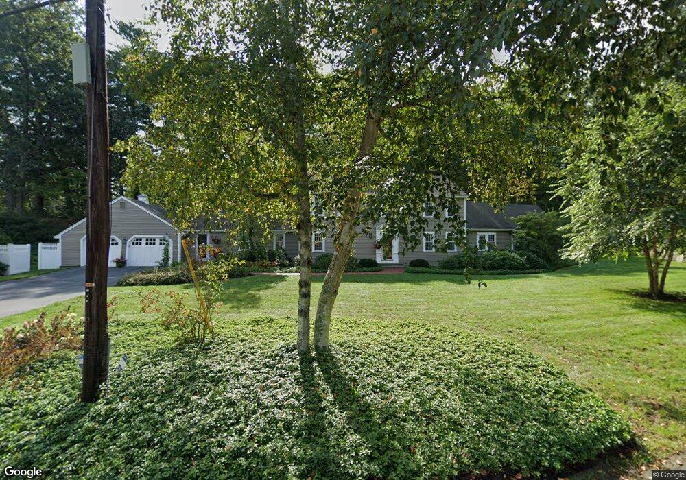
This home is located at 2 Bridle Path Cir, Dover, MA 02030 and is currently estimated at $1,854,661, approximately $486 per square foot. 2 Bridle Path Cir is a home located in Norfolk County with nearby schools including Chickering Elementary School, Dover-Sherborn Regional Middle School, and Dover-Sherborn Regional High School.
Ownership History
Date
Name
Owned For
Owner Type
Purchase Details
Closed on
Jan 11, 2021
Sold by
Roberts Nancy C
Bought by
Nancy C Roberts 2020 Ret
Current Estimated Value
Purchase Details
Closed on
Jun 30, 1976
Bought by
Roberts Francis D and Roberts Nancy C
Create a Home Valuation Report for This Property
The Home Valuation Report is an in-depth analysis detailing your home's value as well as a comparison with similar homes in the area
Home Values in the Area
Average Home Value in this Area
Purchase History
| Date | Buyer | Sale Price | Title Company |
|---|---|---|---|
| Nancy C Roberts 2020 Ret | -- | None Available | |
| Roberts Francis D | $126,000 | -- |
Source: Public Records
Mortgage History
| Date | Status | Borrower | Loan Amount |
|---|---|---|---|
| Previous Owner | Roberts Francis D | $270,000 | |
| Previous Owner | Roberts Francis D | $250,000 |
Source: Public Records
Tax History
| Year | Tax Paid | Tax Assessment Tax Assessment Total Assessment is a certain percentage of the fair market value that is determined by local assessors to be the total taxable value of land and additions on the property. | Land | Improvement |
|---|---|---|---|---|
| 2025 | $18,341 | $1,627,400 | $714,300 | $913,100 |
| 2024 | $17,208 | $1,570,100 | $714,300 | $855,800 |
| 2023 | $16,780 | $1,376,500 | $633,600 | $742,900 |
| 2022 | $16,023 | $1,290,100 | $633,600 | $656,500 |
| 2021 | $16,051 | $1,245,200 | $611,800 | $633,400 |
| 2020 | $15,436 | $1,202,200 | $611,800 | $590,400 |
| 2019 | $15,544 | $1,202,200 | $611,800 | $590,400 |
| 2018 | $15,069 | $1,173,600 | $616,100 | $557,500 |
| 2017 | $14,342 | $1,099,000 | $524,700 | $574,300 |
| 2016 | $14,155 | $1,099,000 | $524,700 | $574,300 |
| 2015 | $13,439 | $1,058,200 | $500,700 | $557,500 |
Source: Public Records
Map
Nearby Homes
- 25 Knollwood Dr
- 1 Bridle Path Cir
- 3 Bridle Path Cir
- 26 Knollwood Dr
- 8 Knollwood Dr
- 4 Bridle Path Cir
- 19 Knollwood Dr
- 28 Knollwood Dr
- 16 Knollwood Dr
- 27 Knollwood Dr
- 29 Knollwood Dr
- 30 Knollwood Dr
- 14 Knollwood Dr
- 6 Knollwood Dr
- 31 Knollwood Dr
- 93A Centre St
- 93 Centre St
- 4 Knollwood Dr
- 15 Knollwood Dr
- 33 Knollwood Dr
Your Personal Tour Guide
Ask me questions while you tour the home.