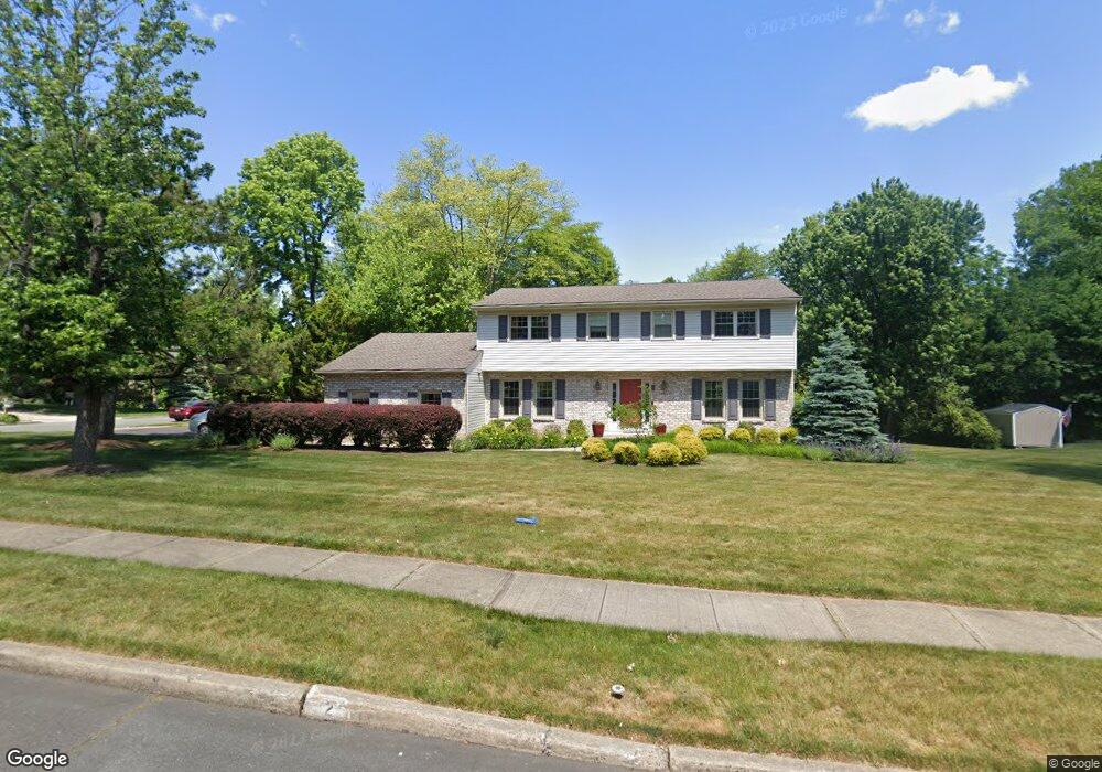
2 Brophy Dr Ewing, NJ 08638
Ewingville NeighborhoodEstimated Value: $557,516 - $693,000
Studio
--
Bath
2,318
Sq Ft
$261/Sq Ft
Est. Value
About This Home
This home is located at 2 Brophy Dr, Ewing, NJ 08638 and is currently estimated at $604,379, approximately $260 per square foot. 2 Brophy Dr is a home located in Mercer County with nearby schools including Ewing High School, Trenton Stem-To-Civics Charter School, and Guidepost Montessori at Lawrenceville.
Ownership History
Date
Name
Owned For
Owner Type
Purchase Details
Closed on
Aug 28, 2018
Sold by
Marinari Awrence T and Marinari Rosemary
Bought by
Ferenchak John and Marinari Melissa M
Current Estimated Value
Home Financials for this Owner
Home Financials are based on the most recent Mortgage that was taken out on this home.
Original Mortgage
$250,000
Interest Rate
4.6%
Mortgage Type
New Conventional
Create a Home Valuation Report for This Property
The Home Valuation Report is an in-depth analysis detailing your home's value as well as a comparison with similar homes in the area
Home Values in the Area
Average Home Value in this Area
Purchase History
| Date | Buyer | Sale Price | Title Company |
|---|---|---|---|
| Ferenchak John | $315,000 | None Available |
Source: Public Records
Mortgage History
| Date | Status | Borrower | Loan Amount |
|---|---|---|---|
| Previous Owner | Ferenchak John | $250,000 |
Source: Public Records
Tax History
| Year | Tax Paid | Tax Assessment Tax Assessment Total Assessment is a certain percentage of the fair market value that is determined by local assessors to be the total taxable value of land and additions on the property. | Land | Improvement |
|---|---|---|---|---|
| 2025 | $14,155 | $359,900 | $92,400 | $267,500 |
| 2024 | $13,306 | $359,900 | $92,400 | $267,500 |
Source: Public Records
Map
Nearby Homes
- 2 Sparrow Ct
- 19 van Saun Dr
- 2148 Pennington Rd
- 632 Timberlake Dr
- 20 Corey Dr
- 34 Lopatcong Dr
- 311 Timberlake Dr
- 89 Upper Ferry Rd
- 222 Masterson Ct
- 231 Masterson Ct
- 235 Masterson Ct
- 146 Masterson Ct
- 10 Howe Ct
- 13 Hickory Hill Dr
- 611 Masterson Ct
- 6 Van Gogh Ct
- 438 Ewingville Rd
- 200 Amberleigh Dr Unit 32H
- 51 van Duyn Dr
- 7 Diverty Rd
Your Personal Tour Guide
Ask me questions while you tour the home.