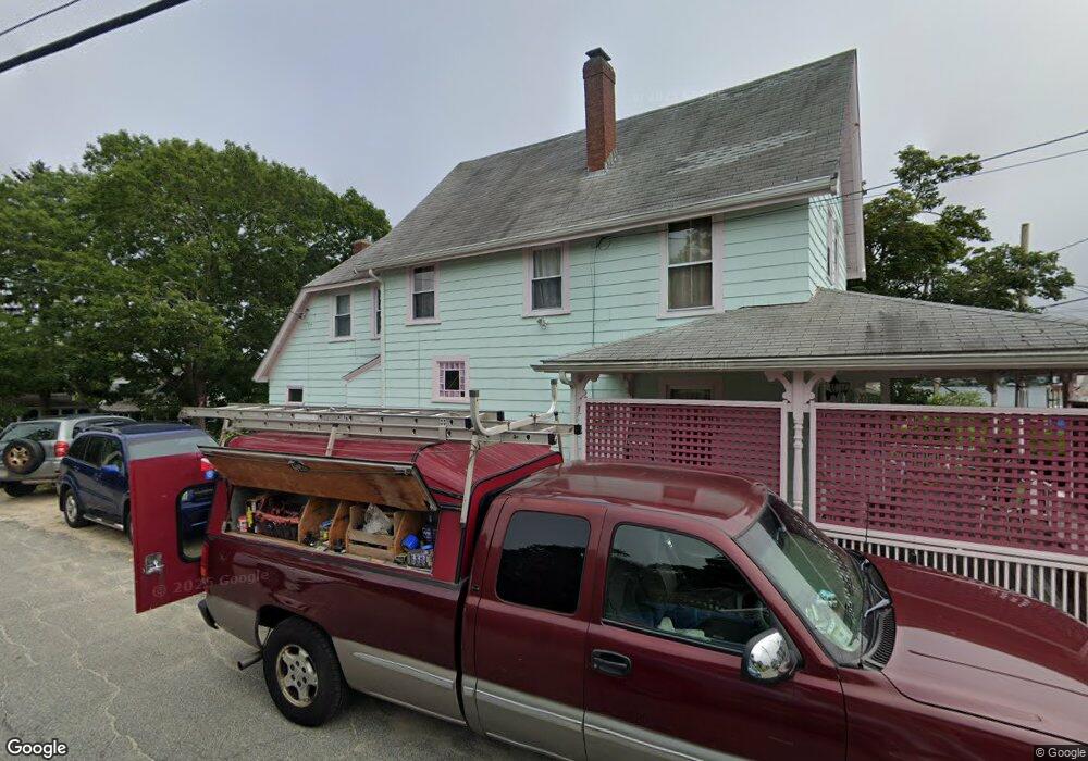
2 Captain Collis Dr Buzzards Bay, MA 02532
Estimated Value: $602,397 - $711,000
3
Beds
2
Baths
1,536
Sq Ft
$429/Sq Ft
Est. Value
About This Home
This home is located at 2 Captain Collis Dr, Buzzards Bay, MA 02532 and is currently estimated at $658,349, approximately $428 per square foot. 2 Captain Collis Dr is a home.
Ownership History
Date
Name
Owned For
Owner Type
Purchase Details
Closed on
Oct 7, 2020
Sold by
Flannery Mildred R
Bought by
Sullivan Michael J and Sullivan Georganne
Current Estimated Value
Purchase Details
Closed on
Mar 30, 1981
Bought by
Flannery Mildred R
Create a Home Valuation Report for This Property
The Home Valuation Report is an in-depth analysis detailing your home's value as well as a comparison with similar homes in the area
Purchase History
| Date | Buyer | Sale Price | Title Company |
|---|---|---|---|
| Sullivan Michael J | -- | None Available | |
| Sullivan Michael J | -- | None Available | |
| Flannery Mildred R | -- | -- |
Source: Public Records
Mortgage History
| Date | Status | Borrower | Loan Amount |
|---|---|---|---|
| Previous Owner | Flannery Mildred R | $50,000 | |
| Previous Owner | Flannery Mildred R | $25,000 | |
| Previous Owner | Flannery Mildred R | $19,000 | |
| Previous Owner | Flannery Mildred R | $55,000 |
Source: Public Records
Tax History
| Year | Tax Paid | Tax Assessment Tax Assessment Total Assessment is a certain percentage of the fair market value that is determined by local assessors to be the total taxable value of land and additions on the property. | Land | Improvement |
|---|---|---|---|---|
| 2025 | $6,177 | $562,600 | $309,200 | $253,400 |
| 2024 | $5,801 | $496,700 | $234,400 | $262,300 |
| 2023 | $5,560 | $452,000 | $213,000 | $239,000 |
| 2022 | $5,448 | $400,000 | $213,000 | $187,000 |
| 2021 | $5,235 | $373,900 | $213,000 | $160,900 |
| 2020 | $5,033 | $367,100 | $213,000 | $154,100 |
| 2019 | $4,567 | $336,800 | $208,300 | $128,500 |
| 2018 | $18,767 | $317,800 | $208,300 | $109,500 |
| 2017 | $4,240 | $303,300 | $208,300 | $95,000 |
| 2016 | $3,759 | $266,800 | $182,200 | $84,600 |
| 2015 | $3,628 | $264,800 | $182,200 | $82,600 |
| 2014 | $3,398 | $255,700 | $156,100 | $99,600 |
Source: Public Records
Map
Nearby Homes
- 3 Carleton St Unit 3
- 32 Carleton St Unit 32
- 35 Locust St
- 35 Locust St
- 36B Starboard Dr Unit 36E
- 36B Starboard Dr Unit 36G
- 36B Starboard Dr Unit 36C
- 36B Starboard Dr Unit 36A
- 36B Starboard Dr Unit 36D
- 36B Starboard Dr Unit 36B
- 36B Starboard Dr Unit 36F
- 36B Starboard Dr Unit 36H
- 0 Broad St Off Unit 72362523
- 23 Starboard Dr Unit Lot 50
- 38 Amos Way
- 12 Beacon St Unit 84
- 26 Highland Ave
- 10 Beacon St Unit 83
- 6 Beacon St Unit 79
- 8 Beacon St Unit 80
- 10 Captain Collis Dr Unit 1
- 23 Hammond St
- 4 Captain Collis Dr
- 1 Captain Collis Dr
- 28 Hammond St
- 3 Captain Collis Dr
- 24 Hammond St
- 24 Hammond
- 10 Onset Bay Ln
- 3 Pecan St
- 4 Clearwater Dr
- 7 Clearwater Dr
- 22 Hammond St
- 5 Captain Collis Dr
- 12 Onset Bay Ln
- 32 Hammond St
- 16 Onset Bay Ln
- 8 Clearwater Dr
- 5 Great Rock Rd Unit 1
- 7 Captain Collis Dr
Your Personal Tour Guide
Ask me questions while you tour the home.