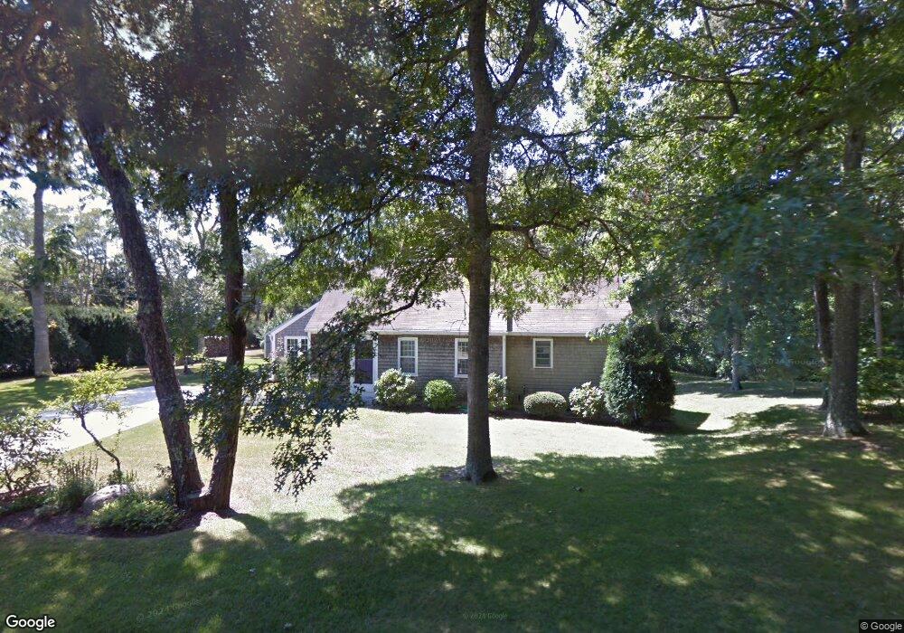
2 Captain Curtis Way Orleans, MA 02653
Estimated Value: $879,503 - $1,100,000
3
Beds
4
Baths
1,712
Sq Ft
$584/Sq Ft
Est. Value
About This Home
This home is located at 2 Captain Curtis Way, Orleans, MA 02653 and is currently estimated at $1,000,126, approximately $584 per square foot. 2 Captain Curtis Way is a home located in Barnstable County with nearby schools including Orleans Elementary School, Nauset Regional Middle School, and Nauset Regional High School.
Ownership History
Date
Name
Owned For
Owner Type
Purchase Details
Closed on
Oct 25, 1988
Sold by
Kohr Robert B
Bought by
Munsey Michelle A
Current Estimated Value
Home Financials for this Owner
Home Financials are based on the most recent Mortgage that was taken out on this home.
Original Mortgage
$135,600
Interest Rate
10.48%
Mortgage Type
Purchase Money Mortgage
Create a Home Valuation Report for This Property
The Home Valuation Report is an in-depth analysis detailing your home's value as well as a comparison with similar homes in the area
Home Values in the Area
Average Home Value in this Area
Purchase History
| Date | Buyer | Sale Price | Title Company |
|---|---|---|---|
| Munsey Michelle A | $169,500 | -- |
Source: Public Records
Mortgage History
| Date | Status | Borrower | Loan Amount |
|---|---|---|---|
| Closed | Munsey Michelle A | $135,600 |
Source: Public Records
Tax History Compared to Growth
Tax History
| Year | Tax Paid | Tax Assessment Tax Assessment Total Assessment is a certain percentage of the fair market value that is determined by local assessors to be the total taxable value of land and additions on the property. | Land | Improvement |
|---|---|---|---|---|
| 2025 | $4,395 | $704,400 | $292,700 | $411,700 |
| 2024 | $4,369 | $681,600 | $287,000 | $394,600 |
| 2023 | $3,932 | $631,100 | $265,700 | $365,400 |
| 2022 | $3,596 | $499,400 | $241,600 | $257,800 |
| 2021 | $3,489 | $445,000 | $234,100 | $210,900 |
| 2020 | $3,416 | $451,800 | $244,800 | $207,000 |
| 2019 | $3,109 | $420,200 | $217,200 | $203,000 |
| 2018 | $4,813 | $402,800 | $213,100 | $189,700 |
| 2017 | $4,530 | $394,300 | $213,100 | $181,200 |
| 2016 | $2,512 | $388,900 | $211,300 | $177,600 |
| 2015 | $2,387 | $371,800 | $197,300 | $174,500 |
Source: Public Records
Map
Nearby Homes
- 6 Hathorne Ln
- 53 Great Oak Rd
- 18 Cole Place
- 216 Main St
- 3 Bramblewood Ln
- 2 Seaview Rd
- 110 Beach Rd
- 320 State Hwy
- 6 Snow Way
- 150 Old State Hwy Unit Compound
- 46 Freeman Ln
- 20 Kittiwake Ln
- 66 Tides End Ln
- 25 Pleasant View Dr
- 13 S Orleans Rd Unit 28
- 44 Tonset Rd
- 785 State Hwy Unit 9
- 25 Twin Rocks Dr
- 6 Apple Way
- 6 Captain Curtis Way
- 114 Hopkins Ln
- 119 Hopkins Ln
- 124 Hopkins Ln
- 123 Hopkins Ln
- 10 Captain Curtis Way
- 117 Hopkins Ln
- 5 Chickadee Ln
- 110 Hopkins Ln
- 90 Capt Curtis Way
- 90 Captain Curtis Way
- 125 Hopkins Ln
- 130 Hopkins Ln
- 14 Captain Curtis Way
- 108 Hopkins Ln
- 10 Chickadee Ln
- 87 Captain Curtis Way
- 85 Captain Curtis Way
- 11 Chickadee Ln
- 86 Captain Curtis Way