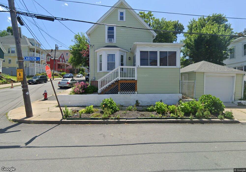
2 Carlton St Lynn, MA 01902
Agganis AC NeighborhoodEstimated Value: $427,000 - $535,000
3
Beds
1
Bath
1,104
Sq Ft
$450/Sq Ft
Est. Value
About This Home
This home is located at 2 Carlton St, Lynn, MA 01902 and is currently estimated at $497,208, approximately $450 per square foot. 2 Carlton St is a home located in Essex County with nearby schools including Robert L. Ford Elementary School, William R. Fallon School, and Pickering Middle School.
Ownership History
Date
Name
Owned For
Owner Type
Purchase Details
Closed on
Oct 19, 2005
Sold by
Connor John R
Bought by
Cardova Cesar R and Cordova Cecilia
Current Estimated Value
Home Financials for this Owner
Home Financials are based on the most recent Mortgage that was taken out on this home.
Original Mortgage
$285,421
Interest Rate
5.72%
Mortgage Type
Purchase Money Mortgage
Purchase Details
Closed on
Jul 21, 2004
Sold by
Sene Mor N
Bought by
Connor John
Purchase Details
Closed on
Aug 31, 1995
Sold by
Oleary Kathryn and Oleary Edward
Bought by
Sene Mor
Create a Home Valuation Report for This Property
The Home Valuation Report is an in-depth analysis detailing your home's value as well as a comparison with similar homes in the area
Home Values in the Area
Average Home Value in this Area
Purchase History
| Date | Buyer | Sale Price | Title Company |
|---|---|---|---|
| Cardova Cesar R | $289,900 | -- | |
| Connor John | $183,000 | -- | |
| Sene Mor | $66,500 | -- |
Source: Public Records
Mortgage History
| Date | Status | Borrower | Loan Amount |
|---|---|---|---|
| Open | Sene Mor | $254,400 | |
| Closed | Sene Mor | $63,600 | |
| Closed | Sene Mor | $285,421 |
Source: Public Records
Tax History
| Year | Tax Paid | Tax Assessment Tax Assessment Total Assessment is a certain percentage of the fair market value that is determined by local assessors to be the total taxable value of land and additions on the property. | Land | Improvement |
|---|---|---|---|---|
| 2025 | $4,795 | $462,800 | $187,700 | $275,100 |
| 2024 | $4,526 | $429,800 | $169,400 | $260,400 |
| 2023 | $4,437 | $397,900 | $169,400 | $228,500 |
| 2022 | $4,270 | $343,500 | $138,600 | $204,900 |
| 2021 | $4,128 | $316,800 | $126,400 | $190,400 |
| 2020 | $3,677 | $274,400 | $98,700 | $175,700 |
| 2019 | $3,745 | $261,900 | $96,300 | $165,600 |
| 2018 | $3,516 | $232,100 | $93,000 | $139,100 |
| 2017 | $3,209 | $205,700 | $72,300 | $133,400 |
| 2016 | $3,027 | $187,100 | $60,900 | $126,200 |
| 2015 | $2,950 | $176,100 | $65,400 | $110,700 |
Source: Public Records
Map
Nearby Homes
- 70 Grant St
- 5 Rockingham St
- 325 Western Ave
- 135 Allen Ave
- 49 Eade St
- 345 Western Ave
- 69 Hollingsworth St Unit 69A
- 12 Eade St
- 67 Beacon Hill Ave
- 31 Jefferson St
- 15 Nichols Ave
- 199 Allen Ave
- 102 Rockaway St
- 6-8 Beede Ave
- 12 W Colony Rd
- 7 Ward St
- 131 Adams St
- 102 Henry Ave
- 200 Locust St Unit 706
- 10 Valley Ave
- 67 Grant St
- 6 Carlton St Unit 1
- 68 Carlton St
- 49 Grant St
- 69 Grant St
- 57 Carlton St
- 62 Grant St Unit 64
- 6 Hawthorne St
- 2 Hawthorne St
- 2 Hawthorne St Unit 3
- 4 Hawthorne St Unit 3
- 73 Grant St
- 70 Grant St Unit 16a
- 70 Grant St Unit 22b
- 70 Grant St Unit 33c
- 70 Grant St Unit 36b
- 70 Grant St Unit 26b
- 52 Grant St
- 45 Grant St Unit 47
- 45-47 Grant St
Your Personal Tour Guide
Ask me questions while you tour the home.